Where is the deepest lake located? What is the deepest and cleanest lake on earth
The wonders of nature are relentless, especially when it comes to lakes and reservoirs. In their vicinity, you can really see the most spectacular natural phenomena. The lakes below are known for their picturesque places hidden in the bosom of nature.
The untouched purity of their waters, as well as a wide variety of flora and fauna, can surprise any person. Some of these lakes are popular destinations for tourists, while others receive a rare influx of travelers due to their remoteness.
We bring to your attention an overview of the 7 deepest lakes in the world.
1. Lake Baikal
Location
- located in the southern part of Siberia, between the Irkutsk region in the northwest and the Republic of Buryatia in the southeast of Russia.
Area and depth - Its area is 31,722 km (12,248 sq mi) and its maximum depth is 1,642 m (5,387 ft).
Lake Baikal is the deepest lake in the world and the oldest freshwater lake (formed 20-25 million years ago). It was listed world heritage UNESCO in 1996 - having the largest amount of fresh water: one fifth of all fresh water in the world is located in Lake Baikal. It is also considered one of the brightest lakes - on a sunny day, you can see crystal clear water up to 40 meters deep.
The second name of the lake is “Pearl of Siberia”. Baikal is rich in biological diversity - about 1000 plants and 2500 animal species are represented in the region of this incredible lake. One of the brightest representatives of the fauna is the famous Baikal seal, which is one of the three species of freshwater seals in the world.
Lake Baikal is located in a remote location and is covered with ice for five months every year. Therefore, it boasts a large influx of tourists.
2. Lake Tanganyika

Location
- the lake is divided between four countries - Tanzania, the Democratic Republic of the Congo (DRC), Burgundy and Zambia, Africa.
Area and depth – the surface area of the lake is 32,900 km (12,700 sq mi), and average depth 1,470 m (4,820 ft).
Lake Tanganyika is the longest freshwater lake and the second deepest lake in the world. The waters of the lake flow into the Atlantic Ocean, and the main source of water is the Congo River.
Tanganyika was first discovered by British explorers back in 1858, when they were conducting an expedition in search of the source of the Nile. In the local language, it translates as "larger lake spread like a plain."
Tanganyika is famous for its rich aquatic life, with over 250 different fish species, as well as a huge number of invertebrate species such as mollusks and crustaceans. Most of the population in this region (about 1 million people) survives only thanks to fish caught from the lake.
Tanganyika annually receives thousands of tourists who kayak, dive and even organize sport fishing competitions in its waters.
3. Lake Vostok

Location
- Antarctica.
Area and depth - its area is 12,500 km 2 (4,830 sq mi), and its maximum depth is from 510 m (1,700 ft) to 900 m (3,000 ft).
The mainland Antarctica has 400 subglacial lakes and Vostok is the largest of them. Interestingly, the water in the lake is under ice, which is about 2 miles thick.
Lake Vostok got its name from the Russian research station of the same name. By the way, what is noteworthy is that the lowest temperature in the world was recorded at this station, which was -89.2 degrees Celsius, and at that moment the lake was right under it.
4. Lake San Martin/O'Higgins

Location
- Chile and Argentina, South America.
Area and depth – The area of the lake is about 1,013 km, the length of the coastline is 525 km, and the maximum depth is 836 meters (2,742 feet).
This lake is known as O'Higgins in Chile and San Martin in Argentina. It has a very unusual shape, consisting of eight branches. It is mainly fed by the waters of the Mayer River, and flows into the Pacific Ocean through the Pasqua River.
Lake San Martin/O'Higgins is the deepest lake in South America and has a unique milky light blue water color. It is quite inaccessible and is in one of the least populated areas continent. Until the 1990s, apart from some rare animal and plant species, no one else lived on Lake San Martin/O'Higgins. Only recently people began to settle near its waters.
5. Lake Malawi

Location
- the lake is located between the states of Malawi, Mozambique and Tanzania, Africa.
Area and depth – the area of the lake is 29,600 km 2 (11,400 square miles), the maximum depth is 706 m (2316 feet).
Lake Malawi is the ninth largest lake in the world and the second deepest in Africa. This is a meromictic lake, that is, a lake that has layers of water that do not mix with each other.
It was first discovered by Portuguese traders in 1846. Lake Malawi is home to a huge variety of fish, which are the source of food for most of the inhabitants of the regions adjacent to it. Malawi is also called the "Lake of Stars" because of the light from the lanterns of thousands of fishermen, which resemble stars from above.
Every year, many tourists gather on the shores of Lake Malawi, who enjoy all the nature of water beauty. They go kayaking or water skiing, go scuba diving. Sailing is also very popular in this region.
6. Lake Issyk-Kul

Location
- Mountains of the Northern Tien - Shan in the east of Kyrgyzstan.
Area and depth - The surface area of the lake is 6236 square kilometers (2408 square miles) and its maximum depth is 702 meters (2192 feet).
Issyk-Kul is the tenth largest lake in the world. It is considered endorheic (with an indoor pool) and is filled with salt water. Issyk-Kul in Kyrgyz language is translated as " warm lake»: this lake never freezes, although it is surrounded by snow-capped mountains.
The Issyk-Kul State Reserve was established in 1948 to protect the unique natural landscapes and waterfowl on the lake. The mountains around the lake are home to rare animal species. The shores of Lake Issyk-Kul are known for their sanatoriums and rest houses.
7. Lake Quesnel

Location
— British Columbia, Canada.
Area and depth
– The surface area of the lake is 266 square kilometers, and the maximum depth is 610 meters.
Quesnel is a glacial lake (fjord). This lake is considered the deepest in the world among all glacial lakes. It is located in the heart of the Caribou Mountains.
Quesnel boasts an impressive ecosystem. Tourists and visitors are very fond of this lake because of the stunning landscapes that open up around it, as well as the unique tranquility that winds around the ancient cedar forest.
The waters of Lake Quesnel are home to more fish species, including rainbow trout, chinook salmon, char and many more. Tourists who visit these places have the opportunity to kayak, retire to the beaches along the coastline or go hiking in the surrounding mountains.
We are glad to welcome all inquisitive users to the vastness of our resource. The topic of our conversation: the deepest lakes in the world. First of all, it is worth noting that about 68 percent of the Earth's fresh water is concentrated in lakes. At the same time, these reservoirs are the habitat of hundreds of thousands of living organisms. At the same time, the quiet waters of the lakes are a charge of vivacity and health for a person. By relaxing on the shores of lakes, we can relax from technogenic stress and have a wonderful time with loved ones. Well, now let's move on to the rating of the deepest fresh water bodies on the planet.
TOP 10 Deepest Lakes on Earth
10
590 meters
The last place in the ranking of the deepest lakes on Earth is occupied by Matano. We are talking about a large body of water located on the territory of the island of Sulawesi (Indonesia). The depth of this lake reaches 590 meters. At the same time, the reservoir is known for the presence of clean water and rich wildlife. Among the unique organisms that live in the Indonesian reservoir, many pearls and nutritious fish should be distinguished. Due to the presence of expensive corals, divers from all over the world visit the lake every year.
594 meters

This body of water is located in the United States, namely in the Oreton National Park. It's about very picturesque place, which is surrounded by cliffs stretching above the ground to a height of 600 meters or more. There are two small islands in this reservoir. In addition, there are amazing fish. At the deepest point, an indicator of 594 meters was recorded. This depth is due to melting glaciers. In the summer, the water rises strongly. At the same time, it is crystal clear and beneficial for the body.
614 meters

Another deepest lake on Earth is the Great Slave Lake, located in North America. The area of the reservoir is 28,500 kilometers. And this amazing body of water is located in northwestern Canada. This is the deepest lake (614 meters) in America. It's hard to believe, but for almost 8 months the water of such a deep reservoir is ice-bound. They are beyond the 60th parallel. However, in summer period time in the reservoir reigns a rich marine world, full of rare fish.
668 meters

Pearl Central Asia- a lake familiar to all of us, the depth of which reaches 668 meters. It is located in the north of the Tien Shan mountains. The average depth of the reservoir, which is located in Kyrgyzstan, is 305 meters. It is worth noting that there are many amazing legends regarding this place. They were probably invented to attract foreign tourists, but this does not prevent them from being interesting. According to one of the myths, earlier on the site of this lake there was a huge kingdom. Once the ruler decided to drown the kingdom so that no one would know about his weakness in front of the mermaids.
706 meters

Another deep lake located in Malawi. In Africa, this is the second largest and deepest lake, which in some areas reaches 706 meters. It should be added that over the past 100,000 years, the depth of this unique reservoir has decreased significantly. Previously, it was 100 meters deeper. Most likely, such changes are due to the desertification of local lands. Coastal areas have become less suitable for crop production. However, the land adjacent to the lake is fruitful to this day. The reservoir itself is rich in minerals and fish. There are always a lot of fishermen and tourists.
836 meters

San Martin should also be attributed to the deepest lake on the planet. In America, you will not find a more amazing fresh water reservoir. And we are talking not only about the depth, but also the area of the lake. At the deepest point of the reservoir, a mark of 836 meters was registered. It is worth noting that such a figure is registered only in one place. The average depth is only 450 meters. Lake San Martin contains many amazing fish and corals.
900 meters

No one has yet seen the surface of this reservoir with their own eyes. This is due to the presence of a four-layer arctic ice. However, modern equipment allows us to find out that the maximum depth of the reservoir is 900 meters. The maximum temperature at the same time reaches only 3 degrees above zero. There is no doubt that this body of water is the cleanest on our planet. This is due, of course, to the presence of glaciers. The lake was first discovered in 1996. Prior to this, the reservoir was sealed with 500,000-year-old ice.
1025 meters

Top 3 deepest lakes in the world opens Caspian Sea. The depth is 1025 meters. This is a remnant of the Tethys Sea. The fauna of this reservoir is rich in various species of fish. This is due not only to the area, but also to the salinity of the reservoir. in the waters unique lake there are many representatives of endemic animals, including sturgeon, salmon, white fish and roach. In addition, bream can be found in the depths of the Caspian Sea. The lake is also rich in carbon resources.
Deep lakes are found on all continents. The border zone of Argentina and Chile is especially rich in such reservoirs, given the area of the countries, they will be among the leaders. As for the origin of deep-sea lakes, there is a complete variety: glacial, volcanic, tectonic. Approximately the same picture for temperature regimes.
But reservoirs with great depth often have differences from shallow ones. Some have atypical mineral composition or inhabitants that you will not find anywhere else. Wealth in fish is typical for most of the representatives of the list, although there are exceptions. The tourism industry is also not developed everywhere, but the potential is there and visible to the naked eye.
The deepest lakes on earth
1. Baikal
This is the deepest lake in the world. It is also the largest reservoir of fresh water not only in Russia, but on the entire planet. Angara flows out of it, and many rivers flow into it. The distribution area of many species of animals and plants is limited. There are many natural monuments in the district: Cape Ludar, Ushkany Islands, Chersky Peak, etc. In winter, the surface is almost completely covered with a thick layer of ice. Although the lake is protected, there are environmental problems.
Depth - 1642 meters.
2. Tanganyika
It is the longest of the freshwater lakes, with an area of 32,900 km². It is located in Central Africa, while it belongs to four countries at once. The hot climate affects the changes in water levels at different times of the year. When the inflowing rivers partially dry up, the lake follows suit. There are special problems with the ecology in the north of the lake, as there was a dumping of waste from enterprises, and fishing was put on stream.
Depth - 1470 meters.

3. East
Location features - the lake is located in Antarctica - could not but affect the characteristics. There is no larger (15790 km²) of subglacial lakes in the world. At the same time, the water warms up to + 10 ° C due to geothermal sources. A Russian research station of the same name is based in the immediate vicinity. The study of microorganisms living in the local waters has not yet been completed.
Depth - 1200 meters.

4. Caspian Sea
It falls into the zone of control of five states, including Russia. The economic activity associated with the use of the water area of the lake, which has an area of 371,000 km², is diverse: there are oil deposits, fisheries are being conducted, there are ports and places for recreation on the coast. Is an . In terms of tourism, the reliance is on nearby mineral springs, popular and mud treatment. However, there are infrastructure problems.
Depth - 1025 meters.

5. San Martin
Located in South America, the lake has an area of 1058 km². Particularly noteworthy is the shape of the reservoir: it is divided into wide, uneven arms. The specificity of the name is connected with this: those parts of the processes that belong to Chile have a different name for the locals - O'Higgins. The lake is fed by small streams flowing into it, as well as the larger Mayer.
Depth - 836 meters.

6. Nyasa
Also called Malawi, it covers an area of 29,600 km². It belongs to three East African countries, which makes it difficult to agree on the environmental protection of the territory. It is elongated in shape, has practically no sharp bends. It is used for fishing, but the coastal zone is sparsely populated. The area is picturesque, as there are different types of relief, many species rare plants and fauna representatives.
Depth - 706 meters.

7. Issyk-Kul
It is located in Kyrgyzstan and has an area of 6236 km². It is drainless, fed by 80 tributaries. 4 picturesque bays are used for crafts, tourism and as ports. Travelers are attracted in many ways by the combination of the spirit of climate types: mountain and sea. There are places for camping, as well as full-fledged resort areas. The beach season is short, from mid-June to late August.
Depth - 702 meters.

8. Great Slave
A feature of the Canadian lake, which has an area of 28568 km², is an ice crust that covers the surface for 8 months. The thickness of the cover allows you to use the reservoir in winter as a full-fledged road for trucks. The vegetation on the opposite coasts is different: in the west - dense forests, and in the east - tundra. Mines are operating in the district and diamonds are being searched for.
Depth - 614 meters.

9. Crater
It is located in the United States on the territory of the national park of the same name. The area is 53.2 km², the shape is rounded, to which the reservoir owes its volcanic origin. A local landmark is the "Lake Old Man" - a log that has been floating in the lake in an upright position for a hundred years. Its safety is ensured by low temperatures. Hydrothermal activity persists, so eruptions are still possible.
Depth - 594 meters.

10. Matana
The Indonesian lake with an area of 164.1 km² is of tectonic origin. Its shores are rich in nickel ore deposits. This caused a number of controversies: the reservoir is an important source of drinking water for the region, and the development of deposits has led to pollution. The composition of water at depth is unique: the oxygen content tends to zero, but iron compounds prevail over other elements.
Depth - 590 meters.

11. Buenos Aires
Located on the borders of Argentina and Chile. It occupies an area of 1850 km² and is of glacial origin. At the end of the 19th century, the course of one of the tributaries was artificially changed, which affected the water level in the lake, albeit slightly. The western and eastern parts of the reservoir are very different in appearance and vegetation. One of the attractions is the marble grottoes.
Depth - 586 meters.

12. Hornindalsvatnet
Norwegian Lake with an area of 50.42 km². There is a contradiction between the official data regarding the depth, and those indicators that were obtained when laying the cable along the bottom of the reservoir. The telephone company announced that the lowest point of the lake is 612 meters from its surface. In the middle of summer, a mass marathon is held along the coast. It is considered the cleanest of the lakes in Scandinavia.
Depth - 514 meters.

13. Quesnel
It is located in Canada, has a glacial origin and an area of 266 km². The shape is oblong, there are three clearly marked sleeves. The researchers measured that the water in the lake is completely renewed in 10 years. Popular tourist destination: someone comes for picturesque views, someone for fishing, for example, for rainbow trout. Small piers have been built along the banks, and water transport runs regularly.
Depth - 506 meters.

14. Sarez
It is located on the territory of Tajikistan and covers an area of 80 km². It was formed due to the blockage of the channel and basin of the mountain river Bartang. The water level fluctuates. In theory, it is dangerous for settlements downstream, as it can, in the event of a breakthrough of natural barriers, bring down huge volumes of water on them. There are many species of flowering plants on the banks, but there are few fish in the reservoir.
Depth - 505 meters.

15. Toba
Formed in the caldera of the volcano of the same name. Belongs to Indonesia and has an area of 1103 km². The tourism industry is based on the interest of travelers in the ethnic culture of these places, especially in the Batak people. Another area popular with foreigners is ecotourism. The influx of guests occurs once a year: in May, when the weather becomes warmest, and on the Chinese New Year in February.
Depth - 505 meters.

16. Tahoe
Located in the USA, is one of the popular places recreation, especially domestic tourism. Area - 495 km², coastline - 114 km. There is one island - Fannett. It is small in size, but rises above the water, due to its mountainous shape and is clearly visible from many points. There are dense forests around, and there are few settlements on the coast itself, although they are oriented, among other things, to visitors.
Depth - 501 meters.

17. Lago Argentino (500 m)
The area of the Argentine freshwater lake is 1415 km². The largest in the country, mapped in the 80s of the XVIII century. Belongs to the territory of the national park. Food is provided by melting glaciers and rivers that carry melt water to the lake. Tourists come here for fishing, and also because of the unusual species found nowhere else in South America.
Depth - 500 meters.

18. Kivu
It is located in Central Africa and belongs to two countries at once. Refers to the list of the Great African Lakes. Connected to Lake Tanganyika via the Ruzizi River. The area is 2700 km². The most famous story related to the reservoir occurred in 1948. A volcano nearby became active for a long time, and the water in the Kivu boiled, and all the fish boiled.
Depth - 480 meters.

19. Salsvannet
There are discrepancies about the depth of this Norwegian lake. Perhaps the official sources underestimate it somewhat. The area is 44.77 km². At depth, there is practically no oxygen in the water. In addition, there is higher salinity, which affects the density of water. The reasons for such deviations from the norm can be hidden both in the origin of the reservoir and in factors that have not yet been discovered. Research continues to this day.
Depth - 464 meters.

20. Nahuel Huapi
The name is translated from the local dialect as "island of the jaguar". It belongs to the territory of Argentina and covers an area of 530 km². The shape is elongated, there are branch sleeves. The largest of the lakes in the local national park. Tourism is widely developed. There are many hotels in the cities along the coast. Visitors are attracted by ethnic groups, history, and ecological features. There are several types of travel programs.
Depth - 464 meters.

21. Hauroko
Located in New Zealand, the southernmost in the country, belongs to the territory of the national park. The area is 63 km². The shape is very curved and resembles the letter "S". There are many camping sites nearby, but there are no hotels or shops. mass tourism absent, although the lake is often used as a transit point for long journeys.
Depth - 462 meters.

22. Puerredon
It has another name - Cochrane. It belongs to the territory of Chile and Argentina and has an area of 270 km². Nearby are the southern Andes, the reservoir is fed by a glacier. The coasts are predominantly high, mountainous or hilly. There are small patches of land on the surface of the water, but they are too small to be called islands. The vegetation is often low, there are many fish, although there is no permanent fishing.
Depth - 460 meters.

23. Tinsyo
It is located in Norway and has an area of 51.43 km². The reservoir was used by the Nazis during the occupation of the country. Local waters with atypical composition were to be used for nuclear research. Already in the 90s, one of their sunken ferries was discovered. In addition, previously unknown species of fish were found. The study of the features of the lake continues to this day.
Depth - 460 meters.

24. Adams Lake
Located in Canada and belongs to the glacial type of education. The area is approximately 137 km². The lake is elongated and narrow. The curves of the coastline are quite smooth and gradually narrow to extreme points. Popular as an object of domestic tourism: locals come here to fish. The main commercial fish species is rainbow trout.
Depth - 457 meters.

25. Chelan
Located in the United States, from the language of the Indians its name is translated as "deep water". The area is 135 km², the largest in the state of Washington. The river of the same name flows out, and the Stkhekin flows into it. It belongs to the Northern Cascades National Park. A boarding house was built on the coast, working all year round. There are several settlements, including the city of the same name in the southeast.
Depth - 453 meters.

26. Van
The endorheic Turkish lake with salt water is located on an area of 3574 km². It is the largest soda lake in the world. The name can be translated as "inhabited place". Surrounded by several mountain systems, which affects the climate and air saturation. There are several islands in the reservoir. On some, Armenian sights have been preserved: monasteries, churches, and so on.
Depth - 451 meters.

27. Poso
The Indonesian lake has an area of 323.2 km². The lake attracts tourists with its nature. Particularly noteworthy are the species of shrimp and snails that live here. Also, local coastal settlements are ready to offer guests a lot of interesting experiences: national color is adjacent to developed infrastructure and services. There are sandy beaches and hotels for almost every budget.
Depth - 450 meters.

28. Fagnano
Refers to the possessions of Chile and Argentina. It bears the name of a Catholic missionary who visited these parts at the end of the 19th century. The largest (593 km²) of the lakes of Tierra del Fuego. It is the source of the Asopardo River. Included on the Argentine side of the national park. Jeep trips are popular among tourists. Local operators offer this service to everyone.
Depth - 449 meters.

29. Big Bear
Location - north arctic circle, belongs to Canada and covers an area of 31153 km². There is a uranium deposit, but it is abandoned due to the unprofitability of mining. The lake is navigable, but only a small part of the year, since most of the time the surface of the reservoir is covered with a crust of ice. There is only one settlement on the coast, which once served as a fort.
Depth - 446 meters.

30. Manapouri
Belongs to the territory of the New Zealand National Park. The area is 142 km², the origin is glacial. The name translates as "lake of the sad heart." The locals have several more names for it, including: Roto-au and Moturau. There are more than 30 islands in the water area of the reservoir, they are mostly covered with forest. Europeans brought red deer here more than a hundred years ago.
Depth - 444 meters.

Many are interested in the question - which lake is the deepest in the world? Baikal- the deepest lake in the world. It is located in the southeastern part of Russia and occupies a vast territory of the central part of the Asian continent. Due to its greatness, the deepest lake in the world, Baikal, has several more beautiful names. A body of water is called a deep or clear eye, sacred lake, the mighty sea. Locals usually call it the Baikal Sea.
This lake contains the largest fresh water reserves on the planet, which have a unique composition. The water is not only clean and transparent, it can be compared with distilled water in terms of the content of mineral salts.
In terms of area, the deepest lake in the world, Baikal, is almost equal to Holland. It has several dozen islands. Its length is 635 km, the largest width in the center is 80 km, and the narrowest part is located in the Selenga region and is 27 km. The lake is located at an altitude of more than 450 km relative to sea level, and the length of its coast is approximately 2000 km. More than half of this coastal territory is protected by the state.
More than 300 rivers fill the deepest lake in the world, Baikal, with their waters, at least half of this volume falls on the Selenga River, and only the Angara flows out of it. Lake Baikal is surrounded by mountain ranges and numerous hills. On the West Coast, the terrain is more rocky and precipitous than on the east.

Some tourists are actively interested in where is the deepest lake in the world? These places are famous for their picturesque landscapes and the unique diversity of the animal world, which makes them interesting for tourists. The region has the status of a protected area of world importance. In terms of the number of rare plants growing only in these parts, it surpasses even the flora of Madagascar and the Galapogos Islands. There are numerous resorts here. best time to visit the world's deepest lake Baikal, the period from late April to late October is considered. During the summer months, tourists can make various excursions and hikes, fish, dive, hunt, relax on the beach, and in winter time skiing, ice fishing and boating are popular.
You can get to these places by plane or by train. There are direct flights to Ulan-Ude and Irkutsk. The journey there from Moscow by plane will take 6 hours, and by train it will take about 4 days. Now you know where the deepest lake in the world is located.

The question of the origin of Lake Baikal has long been a subject of heated debate in the scientific world and creates the basis for a variety of, sometimes fantastic, conjectures and hypotheses. How was this lake formed with crystal clear water, surrounded by picturesque mountains and unique nature?
The Buryat legend tells of the Great Fire that consumed the earth and contributed to the origin of Lake Baikal. From the resulting void came the sea. The legend did not find scientific confirmation, and for a long time scientists investigated this problem.
In the distant eighteenth century, the Germans Palass and Georgi formulated a scientifically based assumption on this topic. They participated in the Siberian expedition, which was organized by the St. Petersburg Academy around 1970. Scientists argued that the reason for the emergence of Baikal was the collapse of the land caused by a natural disaster. Most likely it was an earthquake. They believed that before the events described there flowed big river, flowing into the Yenisei. It took into its channel all the waters that today flow into Lake Baikal. A century later, the Pole Yanchevsky proposed his hypothesis, basing it on data obtained during a trip in the Baikal region. He believed that this reservoir was formed due to a natural disaster, after which the earth's crust began to slowly shrink.
There were many scientists who offered their theories, but often they echoed each other and their guesses about the origin of Lake Baikal differed only in details. Vladimir Obruchev came closest to the modern understanding of the process by which the Baikal Basin was formed. He suggested that everything began after the formation mountain system Siberia. The depression was formed after the subsidence of a large area of land on both sides of the gap.
In the second half of the 20th century, thanks to scientific advances, scientists have made significant progress in the study of this problem. Some clarity was introduced by the global fault system or the world rift theory discovered at that time. According to this discovery, Baikal arose as a result of processes on a planetary scale and that there are several similar formations on the surface of the earth. Tanganyika and the Red Sea are among them.
At the end of the 20th century, scientists from many countries dealt with this problem. The basin of Lake Baikal is considered one of the central links of the Baikal rift. It stretches for more than 2.5 thousand km and is located on the very border of the Eurasian and Indonesian-Australian lithospheric plates. At first, it was believed that the rift appeared due to a collision of plates, but after a detailed study of new data, it was found out that the anomalous heating of the mantle became the reason for everything.
The lava that floated up and spread in different directions formed massifs of mountain ranges that surround the lake. This spreading over a plane heated to very high temperatures of magma caused the appearance of large faults. As a result, this caused the formation of a depression, which later became Lake Baikal.
As new knowledge emerged and geophysical methods developed, interesting details and a scientifically confirmed chronological sequence of the formation of this unique lake appeared.

In addition to numerous large and small streams, almost 300 rivers and streams flow into it. In addition to the three navigable rivers, the Upper Angara, Barguzin and Selenga, there are several more that are especially distinguished by their size: Turka, Snezhnaya, Barguzin, Buguldeyka. And only the only Angara carries its waters to the northwest, flowing out of the mighty lake.

Only it takes all the power of its waters from Lake Baikal and carries them hundreds of kilometers through the center of Russia. Its width at the source is about 2 km. In this place stands a giant rock, called the Shaman-stone by the locals. As the legend says, Baikal-father threw this block at his daughter, who was running away from him. She decided to rush off to the handsome Yenisei, although her father wanted to marry her off to a hero named Irkut.
The Angara, like other rivers of Lake Baikal, is a beautiful and clean river. Its length is about 1800 kilometers.

The Selenga, like the river of Lake Baikal, is the largest of all the rivers that flow into the lake. The source of the river is in Mongolia, then it flows through Russian land, ending its journey by splitting in the delta of the lake itself. It carries to Baikal almost half of all water entering it.

The Upper Angara is a fast mountain river with a large number of rapids. Even when it finds itself on a plain, it continues to wriggle and separates, so that later it can unite in a single channel. Near Baikal, like other rivers of Lake Baikal, it pacifies its waters and becomes calmer.

Another river of Lake Baikal flows in Buryatia, descending along a mountain range, after which it carries its restless waters along rocky rapids. In the upper reaches there is a large nature reserve. It passes through taiga valleys, gorges and mountain ranges.
This place is very attractive for lovers of rafting on mountain rapids. The sections intended for this do not even have a minimum category of difficulty, which means that they can be passed without much risk to life. Although the river also has sections with a dangerous bottom, sharp rocks and waterfalls.
The deepest lake is an amazing, mysterious and not fully understood miracle of nature. It is fed by the same unique rivers that carry their waters along the most beautiful regions and protected places, while maintaining its originality. Every effort must be made to preserve this rich supply of crystal clear water and its rare ecosystem.

There are many unusual territories on earth that combine several features that distinguish them from other places. Baikal is one of such regions. Exactly this clear lake in Russia, with perfectly clear water, which contains practically no mineral impurities. And yet it has a huge depth - the largest among all the lakes in the world.
Thanks to special geographical features, this corner of nature attracts the attention of people from different parts of the world. The maximum recorded depth of the lake is 1640 meters. With this indicator, Baikal is ahead of all lakes the globe. The next after the Russian leader, Tanganyika is inferior to him very much. Its largest depth mark does not exceed 160 meters. In combination with the huge area of Baikal, which is equal to Holland, these gigantic scales are simply impossible to imagine.
One of the reasons for such a great depth of Lake Baikal and its area is the presence of many rivers that flow into it. The approximate number of tributaries is approximately 300. With such a significant replenishment, Baikal continues in just one river - the Angara. It should be noted that the reservoir is considered the largest natural reservoir on the planet, with perfectly clean fresh water. In these parameters, even the Great Lakes in North America taken together cannot be compared with it. Its waters reach a volume of 23,600 m3.
Highly great depth Lake Baikal, combined with the impressive area of this lake, explains the fact that the locals call it the sea. This ancient reservoir on the surface of the Earth appeared as a result of complex processes occurring in the earth's crust. Approximately 25 million years have passed since its formation began. It continues even now. Scientists believe that Baikal may be the beginning of the emergence of a new ocean, which, of course, should not appear tomorrow, but its occurrence in the future is recognized by the scientific world as a proven fact.
Due to the maximum depth of Lake Baikal and high level coastline, which is 455 meters larger than the surface of the ocean, the basin of the reservoir is deservedly defined as the most deep depression on the ground.

The water of Lake Baikal is unusually clean and transparent. With the help of the Secchi disk, a test was carried out, according to which the transparency of the lake was 40 meters, and, for example, in the Caspian Sea, there is not even 25 meters. Known for their purity, the Alpine reservoirs are inferior to Baikal in these parameters. The transparency of the reservoir may vary depending on several factors. The river mouth and shallow water give way to areas with great depth. Seasonal changes in the vital activity of microflora also affect.
The water of Lake Baikal meets all the criteria for quality drinking water. Its purity and unique properties are explained by the influence of microorganisms and vegetation. Small crustaceans epishura, living in the lake in large numbers, act as a biofilter. An armada of such crustaceans is capable of cleaning the upper layers 3-4 times a year. There are almost no organic impurities and dissolved substances in the reservoir.
The mineral composition of the water is very poor, does not even reach 100 mg/liter, and includes silicon, calcium and magnesium. Other reservoirs have concentrations of such substances starting from 400 mg/litre. There is no hydrogen sulfide in Baikal, but oxygen is present in large quantities both in the upper layers and at the very depths. Its water has excellent qualities. Its purity can only be surpassed by water from Crater Lake in the United States, which is considered a natural analogue of distillate.
Nowadays, only Baikal in the world is an open reservoir, with water suitable for drinking, which does not require additional treatment. The ideal water of Lake Baikal is now bottled on an industrial scale. It is taken at a depth of about 410 meters. The top layers protect it from any surface contamination.
The temperature in the lake is different. It is influenced not only by climatic conditions, but also by the anomalous depth of the lake. The highest water temperature is 15 degrees. As the depth increases, the temperature decreases. At around 25 meters it is only 10 degrees, and at a depth of 250 meters and below, the temperature is 3-5 degrees. Shallow water sometimes manages to warm up to 24 degrees.

Lake Baikal and its surrounding areas are one of the most unique and rich in natural treasures in the region. There are sanctuaries, nature reserves, national parks and protected natural monuments. Together, there are about two hundred such territories. Almost the entire Baikal region is under state protection. Only in a few industrialized areas: Baikalsk, Slyudyanka, Severobaikalsk, Kultuk and Babushkino, due to the developed industrial complex, there are no serious restrictions on the work of local enterprises.
The protection of Lake Baikal is carried out not only in Russian Federation as these areas are considered a UNESCO World Heritage Site. In Russia, there is Federal Law No. 94 FZ, “On the Protection of Lake Baikal”. He determined the status of protected areas, the regime of protection, the possibility of using natural resources the edges. Since part of the unique territory around Lake Baikal is part of China and Mongolia, there is a problem with organizing the protection of the entire complex, due to the difficulties associated with the need to coordinate actions with foreign partners. The disunity of environmental services and bodies that oversee this area also has a negative effect.
The main thing that needs to be done to protect Lake Baikal is to preserve the unique natural complex in its original purity, which is almost never found in the world. Amazingly beautiful places with unique climatic, geological, biospheric and other conditions in which wildlife can exist will have to be preserved. Some territories will have to remain free from many types of economic activity due to their remoteness from civilization. They are located in hard-to-reach areas where transport connection often missing. Provide security assistance environment and to prevent the hunting of rare animals and birds, illegal fishing and the destruction of plants, the forces of law enforcement agencies and the huntsman service should.

The uniqueness of Lake Baikal lies in its record depth, unusual geographical location, ideal purity of water and, of course, in its vast territory. The lake is located in Russia, in the east of Siberia and is the natural border of two regions of the Russian Federation. With a maximum depth of 1640 m, the area of Lake Baikal is 31 thousand km 2. It exceeds the size of the territories of such states as Holland or Belgium. In the world rankings of the most extensive lakes, it is in 6th place.
The area of Lake Baikal in the center of Asia is 365 km long and not less than 80 km wide. All this territory is surrounded by rows of mountain ranges and is located in a wide basin. It could fit the waters of 92 seas, such as the Sea of Azov. It contains almost 20% of the world's fresh water.
Among the coastal areas there are numerous hills. In the west, the coasts are rocky and steep, while on the east coast the relief is not so steep. In some places, mountain ranges are located at a distance of tens of kilometers from the coast.
Baikal did not suffer the fate of other ancient lakes, and it did not turn into a swamp. On the contrary, every year its area only increases, and scientists predict that the area of Lake Baikal will expand to a gigantic size and become a new ocean.

The nature of Lake Baikal is amazing and unusual. Such a variety of animals and flora nowhere on the planet. In these parts, there are the rarest specimens of flora and fauna.
Vegetable world
There are few places on earth that can cause so much surprise and delight in a botanist as the Baikal region. Currently, science identifies about 1 thousand different plant species that grow in the vicinity of this wonderful lake. Most of them are endemic. This means that they grow only in these parts. Diverse natural conditions and the multi-million-year history of these territories have preserved the local ecosystem in its original form. They determined the appearance of this magnificent nature reserve, where many relic plants are preserved that have long disappeared in other parts of our planet.
Pine, spruce, fir and cedar trees are located along the banks - traditional Siberian trees, and only the southern shore of the lake is decorated with blue fir trees. The origin of this species is still a mystery. Olkhon Island is located in the middle of Lake Baikal and has relict thickets. Basically, this is a spruce forest that has retained its original appearance since the Paleolithic. In the west of the lake there is a tundra-steppe, with relict plants preserved since the end of the Ice Age. The combination of special tundra plants with steppe species is not found anywhere else on the planet.
The nature of Lake Baikal pleases with a bright green carpet of herbs and flowers, forest slopes are covered, where you can often find rare berries and fragrant wild rosemary in abundance.
Animal world
Scientists believe that the fauna of the deepest lake is ancient, and consists of a large number of different animals, including very rare ones. More than 2.5 thousand species of animals live here, more than half of which are endemic. First of all, it is worth noting microscopic crustaceans, called epishura endemic, which are a biological filter. Their presence is one of the main factors affecting the crystal clearness of lake water.
The deepest lake is inhabited by 54 species of fish, and 15 of them are considered commercial. The most famous of them is omul. He lives for about 25 years. It should be noted an amazing, almost transparent fish, called golomyanka. She gives birth to live larvae. Not a single fish in the world reproduces in this way.
The seal lives here - the only seal that lives in reservoirs with fresh water. Also in the lake there are many sturgeons, pikes, whitefish, taimen.
In the forest areas and on the hills of the Baikal region, there are a wide variety of animals and birds. They live in the forests a large number of deer, martens, sable. AT mountainous areas sheep are found, and marmots and ground squirrels are found in the steppes. A huge number of ducks settle in these parts. Seagulls and cormorants nest here. Geese, herons, swans, loons are less common. There are 7 species of eagles here.
The nature of Lake Baikal is diverse and unique. Every effort must be made to preserve this rare land for posterity.

Some are interested in the question of which lake is the largest in the world. And oddly enough, this, which, despite its name, is the largest lake in the world. This reservoir separates the land of Europe and Asia.
What is special about it?
The lake does not have any current, but it is customary to call it the sea. The presence of the second name of the reservoir is determined by the following factors:
- dimensions
- depth
- lodge features
After the formation of the largest lake in the world, numerous studies were carried out, thanks to which it was possible to find out the basic information and understand what a reservoir is, what important differences it has.
The Caspian Sea is a lake whose shape resembles the Latin letter S. The surface area of the reservoir is 371 thousand square meters, the width is four hundred and fifteen thousand square meters. Such dimensions lead to the fact that many countries border the Caspian Sea.
An important advantage of the reservoir is a surprisingly rich underwater world, and many of its inhabitants have acquired resistance to constant changes in the reservoir.
The reservoir includes several bays. At the same time, the largest is Kara-Bogaz-Gol (separation took place in 1980 with the help of a deep dam, and four years after an important event, the result was secured by a culvert).
In addition, the lake includes the following large bays:
- Komsomolets
- Turkmen
- Mangyshlak
- Kazakh
- Krasnovodsky
- Agrakhansky
- Kizlyarsky
The water area of the Caspian Sea includes 50 islands that differ in size. However, some islands have an area of more than 350 square meters. Some are combined into island archipelagos, known as the Apsheron and Baku.
The Caspian Sea appeared due to oceanic processes. This is proved by the features of the bed, which consists of the earth's crust of the oceanic type. At the same time, the creation process dates back to distant times, because the age of the lake is already 13,000,000 years. It was then that the Alps mountains appeared, which separated the Sarmatian and Mediterranean Seas from each other. The Akchagyl Sea existed for a long period. But after that, numerous transformations of the reservoir began:
1. The Pontic Sea dried up, as a result of which only Lake Balakhani remained from it ( southern part Caspian);
2. The Akchagyl Sea turned into the Absheron Sea;
The main changes associated with the reservoir took place approximately 17,000 - 13,100 years ago. The changes were due to transgression.
At present, after numerous transformations, there is the Caspian Sea, which is actually a lake.
Such changes led to the need for a thorough study of the region. As it turned out, the southern coast includes numerous caves. At the same time, scientists note that people lived in these parts about 75,000 years ago.
The first mention of the reservoir and the Massagetae tribe that inhabited the region can be found in Herodotus. At the same time, it was established that other tribes also lived in the region: Saks, Talysh.
Handwritten documents testify that the Russians have been making sailing operations to the Caspian Sea since the 9th-10th centuries. The presence of such official information indicates that the lake has attracted increased attention from the very beginning.

- This is the largest lake on planet Earth. A distinctive feature of the reservoir is the instability of the hydrological regime, which is due to specific influences:
- climatic
- geological
- hydrological
On the territory of the Caspian basin, special processes are taking place that are gradually changing the lake. Scientists note that the water balance changes quite often, and changes occur in different periods of time (tens, hundreds, thousands of years).
Changes include:
- level with maximum value
- temperature regime
At the same time, researchers describe the current state of the Caspian Sea, allowing the inhabitants of the planet to understand how the largest lake in the world differs from many other reservoirs.
Water temperature
The temperature regime fluctuates in the following ranges:
- Winter. In the southern part - +10 - +13 degrees Celsius, in the northern part - below 0 degrees Celsius
- Summer. During this season, the temperature can rise to +25 - +28 degrees Celsius
At depth, the water temperature is about +5 degrees Celsius.
In fact, the water temperature undergoes significant latitudinal changes, which, first of all, manifest themselves in the cold season. The difference is about +10 degrees, which is a significant indicator. In fact, these figures do not become prohibitive: shallow water areas, where the depth is less than 25 meters, the annual difference can reach even twenty-five degrees Celsius.
At the same time, we can note the average differences:
West Coast usually warmer by a couple of Celsius than east;
Open and closed parts also differ in their temperature regime. At the same time, external influences lead to warming up to four degrees Celsius.
The researchers note that over time, the temperature regime of the reservoir may change.
Features of the climate of the Caspian Sea basin
The climate of the region in which the Caspian Sea is located captures 3 directions at once, which causes a significant difference in temperature regime at different times of the year.
In winter, the air temperature varies from minus 8 degrees Celsius in the north to plus 10 degrees Celsius in the south. Thus, the maximum difference can reach 22 degrees.
At the same time, in the summer, the temperature ranges from +24 to +27 degrees Celsius, as a result of which a difference of a couple of tens is excluded. Over the entire history of observations, the maximum air temperature of +44 degrees was noted, and this an important event took place on the east coast.
On average, 200 millimeters of precipitation falls per year, but the figures for different parts regions vary considerably.
The eastern part is always characterized by dry weather. As a result, the indicator does not exceed millimeters;
The southwestern region boasts 1700 millimeters.
It should be noted that water can evaporate quite actively from the surface of the lake. This has a positive effect on the climate of the region. Successful evaporation of the water ensures proper water circulation, which prevents large fluctuations in humidity levels.
The average annual wind speed in the region is from three to seven meters per second. At the same time, the predominant northern direction. It should be noted that in the cold months of the year, wind gusts sometimes reach up to forty meters per second.
The most windy areas are traditionally considered:
- Absheron Peninsula
- Makhachkala
- Derbent
It is in this area that the highest rates of windiness can be recorded. The climate features of the region are largely determined by the influence of the Caspian Sea.
currents
The Northern Caspian plays the most important role in shaping the region's climate. In this case, the main direction of the flow occurs from the northern side of the reservoir.
Salinity of water
Salinity is from 0.3% (the lowest). This characteristic is fixed near the mouth of the Volga. The salinity index allows us to state that the Northern Caspian is a desalinated sea basin. At the same time, in the southeast, the salinity index reaches 13%. The maximum rate is recorded in the Kara-Bogaz-Gol Bay, where it already reaches 300%.
Lake relief
The Caspian Sea has a specific bottom relief, which is divided into three varieties:
Shelf;
Continental slope;
Deep sea trenches.
How were all the above types of relief distributed?
The shelf starts from the coastline and stretches to a depth of 100 meters. At the same time, a continental slope begins below its border, the depth of which, depending on the region of the lake, ranges from 500 to 750 meters;
The coast is characterized by low relief. At the same time, the banks have canopies and indented places;
The Middle Caspian includes a mountainous coast, which has practically no indented shape;
The eastern part is elevated;
The South Caspian has mountainous areas. At the same time, the coastline is more indented.
The Caspian Sea and its relief belong to the zone of high seismicity. It should be noted that in the region in which the lake is located, mud volcanoes often erupt, located in southern point reservoir.
Characteristics of the reservoir
Historians and scientists testify that the area and volume of water can vary significantly. Both factors are seriously affected by water level fluctuations.
What examples can be given? For example, when a reservoir rises, it can account for up to 78 and a half thousand cubic kilometers. Moreover, in this case, the volume indicator reaches about 44% of all lake water reserves.
The maximum depth is 1025 meters. This indicator was recorded in the South Caspian depression. It should be noted that the Caspian Sea ranks third in depth. The leader is Baikal with an indicator of 1620 meters, as well as Tanganyika with 1435 meters. It is important to note that the northern part is a shallow section of the reservoir, because the maximum depth never exceeds twenty-five meters.
Fluctuating water in a pond
Historical studies confirm that the water level in the lake can fluctuate significantly. At the same time, scientists and historians record the features of changes in the water level.
Throughout the history of the reservoir, frequent changes in its characteristics are noted. It should be noted that in the Middle Ages, the highest indicators were noted regarding the height of the water. Despite this, the process is continuous, the tendency to lower and increase the water level in the lake constantly replaces each other, which indicates the circulation and preservation of the water balance. Any recorded indicator cannot be final.
Measurements have been taken on a regular basis since 1837, with researchers using special instruments for regular checks. Scientists note that the downward trend - the rise in the total water level changed many times, and these changes occurred at different intervals.
Serious fluctuations are due to a whole chain of factors that are divided into the following areas. The researchers note that in the future fluctuations in the water of the Caspian Sea should be preserved, but the safety of the reservoir is guaranteed.
Features of water balance cycles
Surface currents define complex cyclones that follow each other. Significant differences are noted in each part of the Caspian. It should be noted that the lake belongs to restless water bodies. For example, changes in atmospheric pressure and direction, wind speed always lead to fluctuations in water levels. Changes in characteristics are most clearly manifested in the shallow part of the reservoir, because surges during stormy weather can reach even four meters.
The instability of the lake leads to the fact that the climatic picture is also subject to serious changes.
The water balance is always determined by the characteristics of the flow and atmospheric influences, the volume of evaporating liquid from the surface of the reservoir. At the same time, the Kara-Bogaz-Gol Bay belongs to the consumable part of the reservoir. The most important role is played by the flow of the Volga, which belongs to the incoming part. The flow of the Volga can reach about 80% of the inflow of river waters to form the Caspian.
Water composition
The Caspian Sea is distinguished by its closed structure and unique composition. At the same time, serious differences in proportions are noted for the waters of areas that are under the influence of continental runoff.
Constant fluctuations in water and changes in water balance do not allow chloride levels to rise.
This provides for a regular increase in the following components:
- Carbonates
- Calcium
- sulfates
The above three components occupy an important place in any river waters. The composition of water also changes under the influence of complex cyclic factors.

The largest lake is usually called the Caspian Sea and many are interested in the question: where is the largest lake in the world? This body of water is located in the part of the world where Europe and Asia meet. Thus, the lake belongs to Eurasia.
The water area is divided into three large parts, which have the characteristics of the climatic region, the unique characteristics of the reservoir and its water balance:
- Northern Caspian occupies 25% of the territory
- The Middle Caspian has 36%
- The South Caspian has 39% of the total installed area
It is important to note that the reservoir is characterized by serious fluctuations in depth. For example, up to 22 meters fall on the northern part, and up to 1025 meters on the southern part. Moreover, a depth of less than one meter is recorded in 20% of the Northern Caspian. Despite such fluctuations, the Caspian still occupies the third position in the world in terms of depth.
The large size of the Caspian Sea determines that as many as five countries belonging to Eurasia are in contact along the borders with the lake:
- Russia
- Azerbaijan
- Kazakhstan
- Turkmenistan
This information proves that the lake actually occupies an important place on the world map.
Caspian Basin
Four more states are included in the Caspian basin: Armenia, Georgia, Turkey, Uzbekistan. Each country has a direct access to the Caspian Sea.
The basin includes more than one hundred and thirty rivers, the largest being the Volga. It is the Volga River that connects the Caspian Sea and the World Ocean. The Volga and all its river tributaries are regulated by operating reservoirs, which are formed by hydroelectric dams.
The Caspian basin also includes additional rivers that guarantee the maintenance of the water balance of the world's largest lake. At the same time, the Volga, which flows through Europe, remains the most important.
It should be noted that East Coast The Caspian can no longer boast of a developed hydrographic network. The rivers Emba and Ural flow into the territory of Kazakhstan. In Turkmenistan, there is one watercourse that is not permanent, but it still needs to be noted: the Atrek River. Iran is distinguished by the connection of the Caspian Sea and several rivers. Even though connections still exist in eastbound, their total length is much smaller.
Cities of the Caspian Sea
The biggest seaport, located on the Caspian Sea, is the capital of Azerbaijan, Baku. The city is located in the south of the Absheron Peninsula. It should be noted that in 2010, 2,500,000 people lived in Baku.
The following are also associated with the Caspian Sea big cities:
Sumgayit, Lankaran (Azerbaijan);
Turkmenbashi (Turkmenistan);
Aktau, Atyrau (Kazakhstan);
Kaspiysk, Makhachkala, Astrakhan (Russia).
Such geographical position, and, accordingly, the relationship with rivers, countries and cities, indicates that the Caspian Sea is actually the largest lake in the world.
Features of the development of the Caspian Sea
The economic development of the Caspian Sea has been of interest to society since ancient times. This is evidenced by historical information. At present, people have managed to achieve good results.
Story Features
For the first time, studies of the reservoir began in 285 BC. At the same time, the corresponding measures were carried out by the Greeks. After the first attempt, the work was postponed for a long time.
Nowadays, they began to try thanks to Peter the Great, who organized the expedition in 1714 for almost a whole year. Then hydrographic studies were carried out in the 1720s with the help of Russian and foreign researchers.
At the beginning of the 19th century, there was already an opportunity for instrumental photography, thanks to which it was possible to carefully analyze the features of the geography of the reservoir and the region.
In 1866, 50 years of research began. The main objective was to enrich knowledge regarding hydrobiology and hydrology.
The most active research began in the late 1890s. At the same time, Soviet geologists made every effort to understand the fluctuations in the level of the reservoir, study the water balance and find oil.
Numerous expeditions made it possible to start using the Caspian Sea for the benefit of the entire world society.
Development results
How can the Caspian Sea be used for the benefit of the people?
Gas and oil production. Numerous deposits with a special purpose are being developed on the territory of the Caspian Sea. To date, the resources of oil and gas condensate amount to about twenty billion tons, and half of this volume is oil. Mining of valuable minerals has been carried out since the 1820s, but it was possible to reach the industrial level only in the second half of the 19th century.
The Caspian shelf, which is included in the water basin, is used for the extraction of salt, stone, sand, clay, limestone.
A developed network allows the use of the Caspian Sea for navigation.
The lake is rich water world. This is used for the active development of fisheries. It should be noted that more than 90% of sturgeons can be caught in this region. To date, fishing and the extraction of valuable caviar have been successfully developed. At the same time, the seal fishery is also developing at a rapid pace.
Recreational resources are another advantage associated with the Caspian region. A special water composition and a unique balance, a beneficial climate allow the successful development of a number of resorts, but at the same time, the economic, political and religious characteristics of the eastern states do not allow the recreational resources of the Caspian region to be fully used, due to the unique characteristics of the sea-lake.
The Caspian Sea is the largest and most important lake in the world, which justifies its position and increased attention to itself.
TOP 10 deepest lakes in the world

If you did not know which lake is the deepest in the world and where the deepest lake in the world is located, then you should familiarize yourself with the TOP 10. Baikal is a legendary lake. It is written about in various sources, the reservoir is unusually loved by travelers and researchers. Every year, amazing discoveries are made on Baikal, expeditions are carried out, and studies are carried out. This lake holds an impressive number of different world records.
The deepest lake is considered one of the oldest on the planet, and it is also the deepest in the world. The average depth is 730 meters, and the maximum mark is 1637 meters. Since 1996 Baikal has been on the UNESCO World Heritage List.
The origin of the lake is disputed even today. Scientists have not come to a consensus regarding the age of the reservoir, which is estimated at about 25-35 million years. That is why Baikal is considered a unique reservoir, because other glacial lakes "live" on average 10-15 thousand years, gradually becoming waterlogged.
A distinctive feature of the deepest lake in the world is the fact that it contains about 19% of the world's fresh water reserves. This is an impressive amount that is not found in any other body of water in the world. The transparency of the lake attracts attention. Inhabitants or various objects can be seen at a depth of up to 40 meters. At the same time, the water contains the minimum amount of mineral salts, on average, the value reaches 100 mg per liter. All this makes it possible to use Baikal water as distilled water.
In total, there are about 2630 species of inhabitants of both plants and animals. However, most of them are endemic. In other words, you can only meet them here. The abundance of living organisms can be explained by the impressive oxygen content in the water column. Among all animals, golomyanka is distinguished. This fish contains less than 30% fat. The epishura crustacean, which contains over 300 species, also becomes an amazing inhabitant. Among the mammals, it is worth highlighting the seal, which is called the Baikal seal.
Interestingly, the water reserves in Baikal are so impressive that they could provide all the inhabitants of the world for a long 40 years. Scientists are still studying Baikal ice, which is fraught with many mysteries. A distinctive feature is an extraordinary shape. It can be found exclusively on Baikal. If you see the lake from space, you can see the dark rings in the pictures. Their origin in this moment are not known, although scientists are building a lot of conjectures. Answering the question which lake is the deepest in the world, there is no doubt that this is Baikal.

All the deepest lakes in the world are of interest, and Tanganyika is special lake, which has personal status in Africa. Its location is known to locals throughout the mainland. A distinctive feature of Lake Tanganyika is the amazing fauna and flora, as well as impressive dimensions. The waters of the lake are located in the East African Rift, which is a narrow valley with an impressive length. The crescent shape and proximity to the mountains make the area surprisingly picturesque.
Lake Tanganyika feeds great river Congo. This is carried out through the Lukuga River. However, Tanganyika does not belong to the Congo Basin. The lake holds one of the world records as the longest freshwater body of water. At the same time, it is located above the sea at an altitude of 773 meters. The total length reaches 673 kilometers, and the width at its largest point is 72 kilometers. The depth of the reservoir is quite impressive and is 1470 meters, which makes the lake the second deepest in the world. On the territory of the entire reservoir, the average depth reaches 570 meters.
The volume of water in Lake Tanganyika is 18.9 thousand cubic meters, which also brings the lake to the second place in the world ranking. The total area exceeds 32 thousand square kilometers. Coastline has an impressive length and is 1828 kilometers. The reservoir basin also includes streams and rivers. In general, Lake Tanganyika is often referred to as the "African pearl", because it holds a huge number of world records.
It is surrounded on different sides by four countries at once. These are Zambia, Democratic Republic of the Congo, Burundi, Tanzania. Communication with Atlantic Ocean also available through the Congo and Lukuga rivers. Interestingly, Tanganyika has an impressive age of 10-12 million years. For the entire impressive period of history, the lake has never dried up. As a result of this, an unusual underwater world was formed, which is not similar in any corner of the planet.
There is no full circulation of water in the lake, the reason is the impressive depth, as well as the absence of bottom currents. As a result, a high amount of hydrogen sulfide is concentrated in the lower layers of the water. Already at a depth of 200 meters, the so-called "dead zone" begins. There is no life here due to lack of oxygen. Near the surface of the water there is an impressive variety of fish species. In particular, there are a lot of cichlids here. They are present in the amount of 250 species, among which about 98% live exclusively in this lake.

Answering the question which lake is the largest in the world or where is the largest lake in the world, you will be somewhat surprised. The Caspian Sea is an unusual body of water with a non-standard name. In fact, this sea has no connection with the World Ocean, it is located at a considerable distance from it. In the north and east, the sea borders on a desert area, the southern coast is lowland, and the western coast is mountain ranges Greater Caucasus. On all sides, the reservoir is surrounded by land, which is why it is called the "sea-lake".
A distinctive feature is the different topography of the bottom. Shallow water is observed in the northern part, depressions and an underwater threshold are observed in the central and southern parts. An interesting feature It can also be said that the Caspian Sea is located in more than one climatic zone. The northern part of the sea is represented by a continental climate, the western part is temperate, the eastern part is desert, and the southwestern part is subtropical humid.
Such a climatic feature leads to the fact that the sea “behaves” differently at different times of the year. In winter, strong winds and low temperatures prevail here, reaching a maximum of 8-10 degrees below zero in the air. In spring, northwest winds reign here. In summer, the air masses circulate slightly; near the coast, the wind can increase. Temperatures in summer can rise to a maximum of 27-28 degrees above zero. It can be concluded that winters in the Caspian Sea are cold and windy, and summers are windy and hot.
The volume of river runoff varies significantly throughout the year. It reaches its maximum in spring and also in early summer. There may be spring floods. To date water resources lakes are actively used by people, reservoirs, hydroelectric power stations are being built. All this has led to the fact that the water level in the Caspian Sea has dropped somewhat today.
The main food of the lake is river. Among the rivers that flow into the Caspian Sea, the Ural, Volga and Terek are distinguished. It is these three rivers that bring about 90% of the river runoff. About 9% of the rivers flow from the western side and only 1% from the rivers of the Iranian coast. There are also tidal waves in the lake, which are significantly noticeable especially in November and December. It is during this period of time that the sea level can increase by an average of 2-3 meters. In summer, the sea level practically does not change.
There is an impressive number of fish species here. As a result, fishing and fisheries are actively developing here. In particular, there is a lot of sturgeon fish, and oil has recently been discovered in the Caspian Sea.

San Martin- a reservoir that is located in the state of Santa Cruz in Argentina. San Martin, like other deepest lakes in the world, impresses with its impressive dimensions, which makes it one of the largest in the world. On the Continent South America it is also the deepest. The lake occupies the territory between Chile and Argentina, located right on the border. Interestingly, the reservoir also has another name for its Argentine part. He was given a "name" in honor of José de San Martin, who is a national hero.
The area of the reservoir reaches 1010 square meters, and the maximum depth is 836 meters. The shape of the lake is uneven and “torn”, it is additionally represented by eight branches. The Mayer River becomes the main tributary, flows into Lake San Martin and the Chico and O'Higgins glaciers, and there are also small streams. Only one Pascua River flows out of the reservoir.
Around the lake are scenic views pampas, and also hit the snowy peaks. The flora and fauna of the area is rich, especially many species of birds and animals. A huge number of trout live here, so sport fishing competitions are often held. Lake San Martin is amazingly clear, the water in it can change its hue from green to deep blue.
Nearby there is the town of El Chalten, which is called the tourist center of the region. Everything here is arranged so that it is convenient for travelers to relax and explore the lake. The town has information centers, travel agencies, souvenir shops, as well as camping-type hotels. Additionally, you can choose a walking tour along the coast of San Martin. Boat trips, extreme trips to the snowy peaks of the nearest Andes mountains are also offered.
There are full-fledged attractions on the coast of Lake San Martin. These include the luxurious estate of Nahuel Huapi. Guests of the lake can take time to explore the estate. For this, horseback riding tours are offered, which give incredible pleasure from the trip.
Lake San Martin reaches 1058 square kilometers. The reservoir is located above sea level, at an altitude of 250 meters. The coastline is quite impressive and reaches 525 kilometers in length. The lake is considered the deepest in America. Here you can always meet tourists and locals, photographers and artists who come here to admire the beauty and magnificent views of the territory.

One of the largest African reservoirs and the deepest lakes in the world is called Nyasa. It is located in East Africa in the Great rift valley. The lake is 560 kilometers long and up to 80 kilometers wide. The depth is quite impressive and reaches 704 meters. This allows us to bring Lake Nyasa to fifth place in the world ranking of the deepest reservoirs. The reservoir was discovered in 1616 by Bucarra travelers from Portugal.
The name of the reservoir is quite standard. It was picked up in the Yao language, and in translation it means "lake". Nyasa is located on the territory of several countries at once - Mozambique, Malawi, Tanzania, occupying their borders. A distinctive feature is the relief of the coast, which is represented by spatial beaches and steep banks. The plains from the northwestern part of Lake Nyasa have special expanses, where the plains amaze with their picturesqueness.
In the same place, the Songwe River flows into the lake. In addition, the reservoir feeds 14 rivers, among which are Bua, Ruhuhu, Lilongwe, Rukuru. The only river that flows out of the reservoir is the river with the sonorous name Shire. The water of Lake Nyasa has different temperatures, ranging from warm to cool. The lake impresses with rich fauna, so fishing is actively practiced here. In total, it contributes about 4% of Malawi's GDP. A huge number of different species of fish live in Nyasa, as well as crocodiles, whooper eagles. All this emphasizes the originality of the lake. Crocodiles and whooper eagles prey on fish.
Lake Nyasa is a natural landmark that amazes with its picturesqueness and eccentricity. This is what attracts the attention of travelers from all over the world. The reservoir itself ranks third in Africa and is one of the five deepest in the world. Today, shipping is developed here, among the main ports are Karonga, Chipoka, Monkey Bay, Nkota-Kota, Bandawe, Mwaya, Metangula.
The Lake Nyasa basin is sparsely populated. The bulk of the people live near the southern coast of Nyasa. The western and northern coasts have a very sparse population with little economic activity. There is a hydroelectric power plant on the outflowing Shire River. It becomes the main source of electricity. Very often, the energy of the country suffers due to the volatility of the lake. The greatest shortage was observed in 1997, when the lake level was at its lowest.

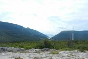
Kyrgyzstan- a surprisingly picturesque country that abounds in luxurious territories. Lake Issyk-Kul attracts the attention in particular. This reservoir is considered one of the largest in the world. Interestingly, in terms of water transparency, this reservoir is in the second position in the world ranking, second only to Baikal. Issyk-Kul is considered the pearl of both Kyrgyzstan itself and Central Asia. The lake is salty and mild winters do not allow the reservoir to freeze even in winter. A distinctive feature is the amazing surrounding beauty, which attracts the attention of tourists from all over the world.
Lake Issyk-Kul is located in the Northern Tien Shan, occupying the territory between two ridges. Them maximum height is 5200 meters high. Spruce forests are located on their slopes on the northern side, and steppe vegetation on the southern side. The lake is fed by rivers, which in total flow into about 80 pieces. Among the main ones are Zhuuku, Zhyr-galan, Tyup, Ak-Terek, Tong and some others. Most rivers are fed by glaciers.
Interestingly, the appearance of the river looks unexpected from space. The astronauts themselves claim this. Along with the Great Wall of China and the pyramids of Cheops, Lake Issyk-Kul is distinguished. From space at such an impressive height, it resembles a human eye.
Not a single river flows out of the reservoir. This leads to the fact that the water in the river is salty, as mineral substances are collected. However, in terms of salinity, the reservoir is significantly inferior to sea water, on average, five and a half times. However, the type of mineralization is considered quite valuable, which belongs to the chloride-sulfate-sodium-magnesium type.
The water is permeated with oxygen, which makes it light and transparent. It unusually resembles an ocean or sea. Many different legends are associated with this lake. One of them says that there are ruins at the bottom of the reservoir ancient city, which had a beautiful appearance. The color of the water is extraordinary. It can change shades from pale blue to dark blue.
Lake Issyk-Kul has an impressive history. The first mention dates back to the chronicles of the second century BC. In them, the reservoir is called Zhe-Hai, which in Chinese means “warm sea”. Most likely this name was given due to the fact that the lake does not freeze. The scientific study of the flora and fauna of the reservoir, as well as the composition of the water, began in the 19th century. Many scientists were so interested in the nature of this place that they bequeathed to bury themselves on its coast.

The Great Slave Lake is an amazing body of water that amazes with its spaciousness and picturesqueness. The name Slave is of unknown origin and most experts are inclined to believe that it was not given to him by chance. The reservoir itself is located on the territory of Canada and in terms of its dimensions it can easily compete with the largest lakes in the world, including the Great American Lakes.
The depth of the large Slave Lake is about 614 meters. For the North American continent, this figure is considered the maximum. In the world ranking, the reservoir ranks seventh. Slave Lake is navigable in the summer, but under ice in the winter. It is so strong that cars can safely drive on it. Until recently, the road on frozen ice was the only one until a full-fledged highway was built.
The Great Slave Lake is completely covered with ice for seven to eight months of the year, from November to June. Interestingly, the lake itself appeared during global cooling. For most of the year, it reminds of this time. A distinctive feature is the scenic beauty of the surrounding area, which attracts the attention of tourists. The shores are adorned with dense tundra forests. The seething streams of water that can be seen between the rocks look spectacular.
Gold diggers are usually attracted northern shores reservoirs. It will be of interest to adventure lovers who dream of learning about the formation of the city of Yellowknife. It originated during the gold rush. Prior to that, only Indians lived on the coast of the lake, namely, the slave tribe. Interestingly, the name of the tribe, translated into Russian, means "slave" or "slave".
It is from this tribe that the name of the lake appeared, according to most researchers. However, after a long study of this fact, it was found that the slave tribe has nothing to do with slaves. The representatives of the tribe are brave, courageous and strong people. To date, the composition of the tribe is about ten thousand people. All of them live on the coast of this reservoir.
In length, the Great Slave Lake reaches 480 kilometers, and the width of the reservoir reaches from 19 to 225 kilometers. Several rivers flow into the lake, in particular the Slave, Snowdrift, Hay, Tolson, Yellowknife. Only one river flows out of the lake - this is the Mackenzie. In terms of area, the reservoir reaches 28.5 thousand square kilometers with a volume of over 1,500 cubic meters.

one of the most amazing natural objects peace. The formation of this reservoir occurred after the eruption of Mount Mazama volcano. It happened over seven thousand years ago. A distinctive feature of the lake is the deep blue hue and the incredible beauty of the surrounding landscape. This place is considered one of the most picturesque in the world. Not every lake causes such a storm of emotions as Crater.
The depth of Crater Lake reaches 594 meters. This explains its rich dark blue hue. Attracts and cleanliness of the surrounding area, its environmental friendliness. Here you can often meet tourists who come to admire the beauty. You can also see photographers and artists who are trying to capture the picturesque.
The history of the lake began about twelve thousand years ago. It was then that for the first time people began to live here, who saw the volcanic eruption. The result was Crater Lake. For a long time it was not known to Europeans. It was first found by John Fremont, who led the expedition of 1843-1846. Gradually, the lake began to be explored, a lake was found here. It changed its name several times. The modern one was fixed only by 1869.
Many researchers wonder why the water turned out at the top of the mountain. Most experts are inclined to believe that this has been happening for centuries. This happened gradually by filling the lake with snow and rain. The lake is a bowl of a volcano.
Interestingly, the lake has many different attractions. One of them is a ghost ship. This is an island that reaches 48 meters in height. It is formed from the lava of a volcano and resembles a ship in its silhouette. Another attraction is Halman Peak. This is a volcanic cone, whose age exceeds 70 thousand years. It was named so in honor of the explorer who first discovered this lake.
It is also worth highlighting the island of the Sorcerer, located on the island. His name is given to him in honor of the sorcerer's hat, which he resembles. It is extraordinarily beautiful and reaches 233 meters in height. The pointed peaks of the Pinnacles are also distinguished, which were the result of volcanic gases and erosion. Crater Lake is today part of the park. Everything has been created here for the convenience of tourists, to provide them with a comfortable viewing of the picturesque territory.

Lakes are extremely important for our planet, as they contain an impressive amount of fresh water. Lake Buenos Aires and Matano are called one of the interesting and attracting attention. Matano is a lake located in Indonesia. In its country, it is an important source of fresh water. The lake is located in the south of the island of Sulawesi. The area of the reservoir is impressive and reaches 164 square kilometers, and the depth is 590 meters.
A distinctive feature of Lake Buenos Aires and Matano is the crystal clear water. Those who have been here claim that one can easily see everything that happens at a depth of 20-25 meters. An interesting feature is called the unique flora. It is here that an impressive number of fish are found, whose ancestors swam here several millennia ago.
The scenic area around the lake also attracts. It is represented by mountains and tropical forests. For the convenience of vacationers, beaches with white sand are organized here. Diving is also offered on the lake. A huge number of divers gather here who dream of admiring the beauty underwater world. An extraordinary feature of Matano can be called the presence of two levels of the water column. The first has a high percentage of oxygen, and the second lacks sulfates, there is an excess of iron. Many scientists compare this composition with the oceanic one, which is quite atypical for lakes.
Lake Buenos Aires and Matano is located on the border of Chile and Argentina. It has the same depth as Matano, reaching 590 meters. The total area of the reservoir is 1850 square kilometers. The origin and nutrition of the lake is glacial, and it is located directly in the Patagonian Andes. On the territory of South America, Buenos Aires is considered the deepest body of water, and in the world ranking it occupies the ninth position.
The main feature is excellent ecology and crystal clear water. Also, Lake Buenos Aires and Matano, notable for the presence marble caves. They have amazing beautiful view which attracts tourists from all over the world. The color of the water, which consists of shades of turquoise and emerald, also looks interesting.
Near the lake there is an impressive number of cities and towns. This is due to the excellent climate and scenic beauty of the area. Excursions are often made here so that tourists have the opportunity to admire the magnificent appearance of the marble caves. You can only see the beauty live, as photographs are not able to convey it.

- an amazing reservoir that attracts attention. It has not yet been fully studied, so the official parameters have not been established. To date, it is believed that the depth of the lake reaches 514 meters, but this is not an accurate indicator. However, it also allows Hornindalsvatnet to be the deepest lake in both Norway and all of Europe. In the world ranking, the lake occupies the tenth position.
In the 90s of the 20th century, the Telenor company took up the study of the lake. Previously, it was the country's official telephone company. Telenor planned to lay the fibers directly on the bottom of Lake Hornindalsvatnet. At that moment, a depth of 612 meters was declared. If this indicator is officially confirmed, the lake will take the seventh position in the world ranking.
Lake Hornindalsvatnet has no other outstanding characteristics. Its volume of water reaches 12 cubic meters with a total surface area of 50 square meters. These are rather modest dimensions even for Norway. In the country, in terms of volume and area, the lake ranks 19th.
Of interest is the location of the lake. It is located in the Norwegian province in the west of Norway. This is the coast of the Atlantic in the county of Sogn ok Fjordane. Hornindalsvatnet is located above the sea at an altitude of 53 meters, and Hornindal is located on its shore. It is the administrative center of the commune. The town is quite small and has only a few hotels.
Crystal clear water becomes a distinctive feature of the lake. On the territory of all Scandinavia, it is Lake Hornindalsvatnet that is considered the cleanest lake. This is explained by the fact that the feeding of the reservoir is not connected with the rivers. The main source of food is glaciers. Here everyone can go fishing, because the fauna of the reservoir is really unique. You can find quite rare varieties of fish that are not found in other water bodies in Norway. However, their fishing is not prohibited.
The landscape is also remarkable, which is distinguished by its beauty and picturesqueness. Many consider this place to be the pearl of the country, so excursions are often organized here. Also on the lake every year in the middle of summer a Marathon is held, in which an impressive number of people take part. This is a race for an impressive distance, reaching 42 kilometers and 195 meters. If you wish, you can just relax, swim and sunbathe on the beach. You can also try your hand at rowing, which is developed on Hornindalsvatnet.
Article Rating
5 General5 TOP5 interesting5 Popular5 design
Olkhon Island on Baikal (Jason Rogers / flickr.com) Lake Tanganyika, Central Africa Lake Vostok, Antarctica Caspian Sea, Baku Lake San Martin (OʹHiggins) Lake Malawi - the deepest in Africa (706 meters) Lake Matano 590 meters deep
As you know, 70% of the earth's surface is water. Therefore, it would probably be more logical to call our planet the Planet of Water.
The water resources of the Earth are represented by the following categories: oceans, seas, rivers, lakes, small rivers, ponds, springs and springs - we are all accustomed to this sequence of dimensional gradation since childhood. Meanwhile, in each category, there may be an example that, in terms of its characteristics, will surpass the leading category.
Some lake storms are in no way inferior to sea unrest, and the depth of others is many times greater than the greatness of the deep sea. It is precisely with these water giants that it is worth getting acquainted in more detail. So, let me present the ranking of the 10 deepest lakes in the world.
Let's start with the most famous and deepest lake in the world - Baikal.
Baikal is a unique body of water. It is the largest natural reservoir of fresh water. Baikal is also considered the most ancient lake on our planet; according to scientists, its age is about 15,000 years.
The reservoir strikes with the uniqueness of flora and fauna, the species diversity of which is 1,700 specimens, and many of them are endemic.
The lake is an object national treasure Russian Federation and is included in the list of UNESCO World Heritage Sites.
Baikal is rightly called the sea by the people. Its depth in some areas reaches 1,642 meters.
Olkhon Island on Lake Baikal (Jason Rogers / flickr.com) Olkhon Island, Baikal (Jason Rogers / flickr.com) Olkhon Island (Jason Rogers / flickr.com) Jason Rogers / flickr.com Sergey Gabdurakhmanov / flickr.com Martin Lopatka / flickr .com Konstantin Malanchev / flickr.com Lake Baikal (Konstantin Malanchev / flickr.com) Sergey Gabdurakhmanov / flickr.com Khoboy Cape, Olkhon (Konstantin Malanchev / flickr.com) Konstantin Malanchev / flickr.com White Sturgeon (Heaven Ice Day / flickr.com) Heaven Ice Day / flickr.com LA638 / flickr.com miquitos / flickr.com Cape Burkhan (Shaman Rock), Olkhon. (Konstantin Malanchev / flickr.com) Baikal seal (Sergey Gabdurakhmanov / flickr.com) Shamanka rock. View from Olkhon island. Baikal (Tanya Legkobyt / flickr.com) Olkhon Island, Baikal (alexey_nitsa / flickr.com) Sergey Gabdurakhmanov / flickr.com Klas Š. / flickr.com Klas S. / flickr.com Konstantin Malanchev / flickr.com Sergey Gabdurakhmanov / flickr.com Baikal seal (Sergey Gabdurakhmanov / flickr.com) Sergey Gabdurakhmanov / flickr.com Konstantin Malanchev / flickr.com Klas Š. / flickr.com Konstantin Malanchev / flickr.com Konstantin Malanchev / flickr.com Olkhon, Baikal (Konstantin Malanchev / flickr.com) Oleg Gant / flickr.com Sunset in Siberia, Northern Baikal, Russia (Yuri Samoilov / flickr.com) Sergey Gabdurakhmanov / flickr.com Yuri Samoilov / flickr.com Vera & Jean-Christophe / flickr.com Délirante bestiole / flickr.com Vladislav Bezrukov / flickr.com fennU2 / flickr.com -5m / flickr.com Vladislav Bezrukov / flickr.com Voyages Lambert / flickr.com Vera & Jean-Christophe / flickr.com Sergey Gabdurakhmanov / flickr.com Kyle Taylor / flickr.com Baikal seal (Sergey Gabdurakhmanov / flickr.com) Thomas Depenbusch / flickr.com Sergey Gabdurakhmanov / flickr.com Kyle Taylor / flickr.com Sergey Gabdurakhmanov / flickr.com seseg_h / flickr.com Richard Thomas / flickr.com Daniel Beilinson / flickr.com NASA's Earth Observatory / flickr.com Clay Gilliland / flickr.com Aleksandr Zykov / flickr.com Aleksandr Zykov / flickr.com Aleksand r Zykov / flickr.com
TOP 2: Lake Tanganyika (1470 meters)
Another lake giant is located on the distant African continent - this is Lake Tanganyika. Its waters are 1,470 m deep. It is called the second deepest lake in the world.
Tanganyika is also unique in that it is the only lake in the world whose shores are shared by four countries - Tanzania, Congo, Burgundy and Zambia. It is from the waters of Tanganyika that the longest and deepest river in the world, the Nile, begins its source.
Lake Tanganyika, Central Africa
TOP-3: Lake "Vostok" in the ice of Antarctica (1200 meters)
Are you used to the fact that a lake is necessarily an open body of water with fresh water? It turns out that it happens otherwise.
"Vostok", the same lake that is located in the ice of Antarctica. The existence of the reservoir became known relatively recently, in 1996, and it is still full of mysteries.
Currently, active work is underway to study the "deep-sea northerner", perhaps it will help to open a picture of the past of our planet.
Lake Vostok, Antarctica
The reservoir got its name from the Russian polar station Vostok, near which it was discovered.
TOP 4: Caspian Sea (1025 meters)
The 4th place and the most controversial lake in our rating is the Caspian. We are all used to the name of the Caspian Sea, however, this is not so. It refers to the seas very conditionally: the Caspian is located on the basis of the earth's crust of oceanic origin, hence its second name - the Caspian Sea.
The reservoir is located between two continents, European and Asian, and its water resources belong to five states - Russia, Iran, Kazakhstan, Azerbaijan and Turkmenistan.
Caspian Sea, Baku
The deepest point of the lake-sea is 1025 meters. The waters of the lake will be filled by 130 freshwater rivers, but the chemical composition of the lake is saturated with salts. The Caspian has no drains.
TOP 5: San Martin - the deepest lake of the South American continent
The reservoir is a natural dividing line of two South American states - Argentina and Chile.
The lake has another name - OʹHiggins, as the Chileans called it, giving the name of their national hero who fought for the independence of South America. By the way, the Argentine name of the lake - San Martin - is also given by the name of the hero-liberator.
Lake San Martin (OʹHiggins)
San Martin is famous for its unusual milky blue hue. A similar color is given by particles of stone deposits flowing into the lake along with the melt waters of glaciers.
TOP 6: Malawi - the deepest lake in Africa (706 meters)
Although the black continent is considered the driest, it is here that another lake "giant" is located, the second deepest lake in Africa - Malawi.
Lake resources belong to three states - Mozambique, Malawi and Tanzania. Malawi is a champion in fish species diversity. At present, the reservoir is rapidly shrinking, the main reasons for the loss of hydro resources are the natural process of evaporation and the Shire River, which takes its source from here.
Lake Malawi is the deepest in Africa (706 meters) Children play on the shore of Lake Malawi A fisherman on the water surface of Malawi
The depth of Malawi is 706 meters and the lake ranks 6th in the ranking.
TOP 7: Issyk-Kul - the deepest lake in Central Asia (702 meters)
In seventh place is the deepest lake in Central Asia - Issyk-Kul, the depth of which is 702 m. It is located in the north of the Tien Shan Mountains of Kyrgyzstan.
Issyk-Kul gained world fame thanks to beautiful legends. According to legend, it is here, in the depths of the water, that the ancient Armenian church, and along the shores of the lake, the soldiers of Tamerlane once laid down their barrows.
From 2006 to mountain lake scientific interest has also become aggravated, in connection with the remains of an ancient civilization found at its bottom.
Its name, and in the Kyrgyz language it literally means "hot lake", the reservoir received due to the fact that its salty waters do not freeze even in the most severe frosts.
TOP 8: Great Slave Lake in Canada (614 meters)
The eighth deepest lake in the world and the reservoir with the strongest ice is the Great Slave Lake. Geographically, it is located in Canada.
The depth of the Great Slave Lake is 614 meters and it ranks 8th in the ranking.
For almost eight months a year, the waters of the lake are a giant skating rink - its ice is so strong that it can withstand the weight of several multi-ton trucks.