As the Sea of Azov used to be called. Rivers flowing into the Sea of \u200b\u200bAzov: names
In ancient times, the Sea of \u200b\u200bAzov was called among the Greeks Meotian Lake (Greek Μαιῶτις), among the Romans Palus Maeotis, among the Scythians Kargaluk, among the Meotians Temerinda (significant mother of the sea); further among the Arabs Nitschlakh or Baral-Azov, among the Turks Baryal-Assak or Bahr-Assak (Dark Blue Sea; in modern Turkish Azakdenizi), among the Genoese and Venetians Mare delle Zabacche (Mare Tane). The extreme points of the Sea of Azov lie between 45°12′30″ and 47°17′30″ N. latitude and between 33°38′ (Sivash) and 39°18′ east. longitude. Its greatest length is 343 km, the greatest width is 231 km; coastline length 1472 km; surface area - 37605 km². (this area does not include islands and spits, occupying 107.9 sq. km).
According to morphological features, it belongs to flat seas and is a shallow water reservoir with low coastal slopes.
In terms of distance from the ocean to the mainland, the Sea of \u200b\u200bAzov is the most continental sea on the planet. The underwater relief of the sea is relatively simple. With distance from the coast, the depths slowly and smoothly increase, reaching 14.4 m in the central part of the sea. The main area of the bottom is characterized by depths of 5-13 m. The location of the isobaths, which is close to symmetrical, is disturbed by their slight elongation in the northeast towards the Taganrog Bay. The 5 m isobath is located about 2 km from the coast, moving away from it near the Taganrog Bay and in the bay itself near the mouth of the Don. In the Taganrog Bay, the depths increase from the mouth of the Don (2–3 m) towards the open part of the sea, reaching 8–9 m at the boundary of the bay with the sea. western (Sea and Arabat banks) coasts, the depths over which decrease from 8–9 to 3–5 m. The underwater coastal slope of the northern coast is characterized by wide shallow water (20–30 km) with depths of 6–7 m, underwater slope to depths of 11-12 m.
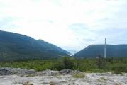
The catchment area of the Sea of Azov Basin is 586,000 km². The sea shores are mostly flat and sandy, only on the southern coast there are hills of volcanic origin, which in some places turn into steep frontal mountains.
Sea currents are dependent on the very strong northeast and southwest winds blowing here and therefore change direction very often. The main current is a circular current along the shores of the Sea of Azov counterclockwise. In terms of biological productivity, the Sea of Azov ranks first in the world. The most developed are phytoplankton and benthos. Phytoplankton consists (in%) of: diatoms - 55, peridinium - 41.2, and blue-green algae - 2.2. Among the biomass of benthos, mollusks occupy a dominant position. Their skeletal remains, represented by calcium carbonate, have a significant share in the formation of modern bottom sediments and accumulative surface bodies.
The hydrochemical features of the Sea of Azov are formed primarily under the influence of an abundant inflow of river waters (up to 12% of the water volume) and difficult water exchange with the Black Sea.
The salinity of the sea before the regulation of the Don was three times less than the average salinity of the ocean. Its value on the surface varied from 1 ppm at the mouth of the Don to 10.5 ppm in the central part of the sea and 11.5 ppm near the Kerch Strait. After the creation of the Tsimlyansk hydroelectric complex, the salinity of the sea began to increase (up to 13 ppm in the central part). Average seasonal fluctuations in salinity rarely reach 1%. Water contains very little salt. For this reason, the sea freezes easily, and therefore, before the advent of icebreakers, it was unnavigable from December to mid-April.
During the 20th century, almost all more or less large rivers flowing into the Sea of \u200b\u200bAzov were blocked by dams to create reservoirs. This has led to a significant reduction in the discharge of fresh water and silt into the sea.
The Sea of Azov is a truly unique gift of nature, which we must appreciate. It is unique in its appearance, depth, size, composition of flora and fauna and plays a very important role in the ecosystem of the region.
Brief historical background. In ancient times, the Sea of Azov did not exist! The full-flowing Don River flowed into the ancient Black Sea (approximately in the area of \u200b\u200bthe modern Kerch Strait).
There is a theory that around 5600 BC there was a very strong rise in the water level of the Black Sea, which was caused by a major earthquake. (Perhaps it was this event that gave rise to the legends of the Flood).
Sea of Azov - Origin of the name. This area has always been at the crossroads of the historical paths of different peoples and, therefore, has managed to change a large number of names. The ancient Greeks living on these shores affectionately called him Meotida (Nurse - translated from Greek). The ancient Romans jokingly called it for its shallow water - Palus Maeotis (Meotian swamp). The Scythians called it - Kargulak (Sea rich in fish). The Meotian tribes called him - Temerinda (meaning the Mother of the Sea). The Turks called it Barh el-Assak (Dark Blue Sea). The Horde conquerors called it - Balyk-dengiz (Fish Sea).
The main theory of the origin of the original name - Azov came from the Turkic adjective "azak" (meaning the mouth of the river, a low place). Subsequently, the word "Azak" was transformed into the modern one - Azov.
The Sea of Azov is an inland sea in the eastern part of Europe. By its distance from the world ocean, the Sea of Azov is considered a continental sea. The Sea of Azov is connected to the Atlantic Ocean through a very long chain of seas and straits. (Black Sea, Sea of Marmara, Aegean Sea, Mediterranean Sea).
On the world map, it is "indicated by a small blue speck" and is the shallowest sea in the world. The greatest depth of the Sea of Azov does not exceed thirteen and a half meters, and the average depth is not more than seven meters. Such rivers as Don, Kuban, Mius, Berda, etc. flow into it.
Scientists attribute the Sea of Azov to the so-called "flat seas", shallow water bodies with low shores, the bottom is replete with sand and shell deposits. The coast of the sea is mostly sandy and only in the southern part there are sometimes small hills of volcanic origin. The coast of the Sea of Azov is indented with bays. The coastline is a popular resort and recreation area, as well as nature reserves and national parks. An excellent example of a protected area are the Priazovsky National Park and the Biryuchy Island Spit.
Sand and shell spits have advanced into the open sea for many kilometers and are a real decoration of the Azov coast. The most famous spits of the Sea of Azov: Berdyansk Spit, Fedotova Spit, Spit Peresyp, Stepanovskaya Spit, Obitochnaya, Curve, Long, Belosaraiskaya. It is here that sanatoriums, boarding houses and popular recreation centers are located.

Temperature regime of the Sea of Azov.
The water temperature of the Sea of Azov is variable, which is quite normal for shallow water bodies. The minimum temperature is usually fixed at the end of January or February and is close to the freezing point. Only near the Kerch Strait is the water temperature in the Sea of Azov on the surface always positive. The average annual temperature on the surface is about +11 degrees Celsius.
In summer, a fairly uniform temperature is established on the surface of the Sea of \u200b\u200bAzov. The warmest water is in July and reaches +28 ... +28.5 degrees Celsius. In the period from March to August, the water temperature drops from the surface to the bottom by about 1 degree. The temperature distribution may change after the first big storm.

Salinity of the Sea of Azov
Due to the difficult water exchange with the Black Sea and the abundant inflow of fresh river water (up to 12% of the volume of water), the salinity of the Sea of \u200b\u200bAzov is not uniform. The salinity of the water in the northern part in the area of the Taganrog Bay and the salinity of the water in the area of the Kerch Strait may differ by several ppm. The average salinity is kept at 11% and seasonal fluctuations in the salinity of the Sea of Azov usually do not exceed 1%.
In winter, the Sea of \u200b\u200bAzov freezes quite easily due to the lower salinity of the water in the northern part of the water area from December to March. The southern part freezes quite rarely, and the ice is carried into the Black Sea through the Kerch Strait.
The ionic composition of water is quite different from the salt composition of the ocean and has a different set of sodium and chloride ions. At the same time, there is an increased content of carbonates, sulfates and calcium.
Water transparency in the Sea of Azov
It should be noted that the water transparency of the Sea of Azov is quite low. Moreover, water transparency is uneven at different times of the year and ranges from 0.5 to 8 meters. The color of the water in the Sea of Azov can also vary from greenish-blue to yellowish.
To uninitiated people, it may even seem quite “dirty”. Actually it is not. The transparency is affected by the abundant inflow of river waters, the presence of plankton in sea water, and the rapid resuspension of bottom silts during storm winds. In late autumn and in winter, the water of the Sea of \u200b\u200bAzov is more turbid. During the Summer period, transparency improves significantly, with the exception of the “sea bloom” period, when many plant microorganisms develop in the upper layers of the water. The best time to relax on the Sea of Azov is June, July and early August.
The relief of the bottom of the Sea of Azov.
The bottom of the Sea of \u200b\u200bAzov has a fairly uniform relief. The bottom depth increases smoothly, there are practically no holes and significant differences in depth. Moreover, near the shore, small “splash pools” are often washed up in which children love to frolic. This is not surprising, there is usually a shallow depth and even warmer water. It is this feature that parents who have small children really like. Indeed, on the one hand, you can not be afraid that the kids will go too deep, and on the other hand, a comfortable depth for swimming adults begins after 15-20 meters from the shore. In the northern part of the water area there is shallow water (20 kilometers with depths of no more than 6 meters). The maximum depth of the Sea of Azov is 13.5 meters.
Ecology of the Sea of Azov.
Ecologists record quite severe pollution of coastal waters near large industrial cities on the coast. So, the most polluted area of the Sea of Azov is the area in the area of Taganrog and Mariupol. At the same time, the section from Berdyansk to Genichesk is environmentally friendly, as it does not have large settlements and industrial enterprises. Sea water should not be drunk (during bathing) or used to gargle for small children. This can cause intestinal upset and fever.
The true pearl of the coast of the Sea of \u200b\u200bAzov is, which has an exclusively recreational and resort direction and access to the Milk Estuary. On the other side of the Milk Estuary, the Priazovsky National Park begins and a small village is located -.
Currents in the Sea of Azov.
The currents are often affected by blowing winds and the direction of the currents change quite often. The south-east and north-east winds have the strongest attention. Most often, a circular current is recorded along the coast of the sea (counterclockwise).
Flora and Fauna of the Sea of Azov
It is difficult to find a more diverse inland sea in the world in terms of the number of animal and plant organisms. In terms of productivity, the Sea of Azov is 160 times greater than the Mediterranean Sea, forty times greater than the Black Sea and six times greater than the Caspian Sea. This is really an amazing property, considering that the area of the Black Sea exceeds the area of the Sea of Azov ten times!

Phytoplankton and benthos abound in the waters of the Sea of Azov. Mollusks occupy a dominant place and their remains just form the bottom sediment.
The ichthyofauna is represented by 103 species of fish (both marine and freshwater). Anadromous species of fish are in the sea until puberty, and only for spawning enters rivers or estuaries. The breeding period in most cases does not exceed 2 months. Among migratory fish in the Sea of Azov, the following are most valued: Beluga, Sturgeon, Severyuga, Herring.

Semi-anadromous fish species enter rivers to breed, but they can remain there much longer than anadromous fish species. Sometimes they can stay in the rivers for up to one year, and the young in most cases remain in the rivers for the winter period. The most popular semi-anadromous fish species in the Sea of Azov are Taran, Pike perch, Bream, Chekhon.
 goby
goby
Marine fish species (permanently remaining in sea water) are divided into those permanently living in the Sea of Azov and entering from the Black Sea. We refer to the permanently living species of fish: All types of gobies, pelengas, flounder, kalkan, tyulka, needle fish, gloss. To the group of fish entering the Sea of Azov, we include: Azov and Black Sea anchovy, Black Sea herring, red mullet, striped mullet, Black Sea kalkan, mackerel, horse mackerel, sharp nose, etc.

Freshwater fish constantly lives in one area of the reservoir, without moving over long distances. These species of fish inhabit the coastal waters of the sea containing minimal salinity. This is silver carp, pike, ide, sterlet, bleak.
Sea of Azov. Minerals.
The bowels of the Sea of Azov abound in minerals. Geologists have discovered zircon, rutile and ilmenite here. Under the bottom of the Sea of \u200b\u200bAzov, if you search well, you can find almost half of the entire periodic table. Significant reserves of natural gas were found in the bowels.

The main thing for the inhabitants of the coast of the Sea of Azov is to preserve this priceless gift of nature and pass it on to the next generations.
The Sea of Azov is located in the south of the European part of Russia. It is connected by a narrow (up to 4 km) and shallow (4–3 m) Kerch Strait with.
The Sea of Azov is the shallowest and one of the smallest seas in the world. Its area is 39 thousand km2, the volume of water is 290 km3, the average depth is 7 m, and the maximum depth is 15 m.
The sea has a relatively simple outline. The northern coast is flat, steep, with alluvial sand spits. In the west, it separates from the sea a bay, which is connected to the sea by the Genik Strait. In the southeast, the delta of the Kuban River stretches for 100 km with extensive floodplains and numerous channels. The Kuban River flows into the Temryuk Bay. In the northeast, the largest bay of the sea, Taganrog, juts out into the land for 140 km, the top of which is the delta of the Don River.
Shallow shores of the sea pass into a flat flat bottom. Depths gradually increase with distance from the coast. The greatest depths are in the central part of the sea, the depths in the Taganrog Bay are from 2 to 9 m. Mud volcanoes are known in the Temryuk Bay.
Almost all river runoff into the sea (more than 90%) comes from the Don and Kuban rivers. The vast majority of runoff falls on the spring-summer season.
The main exchange of the waters of the Sea of \u200b\u200bAzov occurs through the Kerch Strait with. According to long-term average data, about 49 km3 of water annually flows out of the Sea of Azov as surface runoff. The resulting runoff of water from the Sea of Azov to the Black Sea is about 15 km3/year.
The climate of the Sea of Azov, deeply penetrating into the land, is continental. It is characterized by cold winters, dry and hot summers. In the autumn-winter season, the weather is determined by the influence of the spur of the Siberian anticyclone with a predominance of east and northeast winds at a speed of 4–7 m/s. Strengthening the impact of this spur causes strong winds (up to 15 m/s) and is accompanied by cold air intrusions. The average monthly temperature in January is –1…–5°С, during northeastern storms it drops to –25…–27°С.
Warm, clear weather with light winds prevails in spring and summer. In July, the average monthly temperature throughout the sea is 23–25°С, and the maximum temperature is over 30°С. During this season, especially in spring, Mediterranean cyclones quite often pass over the sea, accompanied by western and southwestern winds at a speed of 4–6 m/s, and sometimes squalls.

The main types of bottom sediments common in the Sea of Azov are silts, silts, sands, shell rocks and mixed sediments.
Silts accumulate in the deepest parts, in a hydrodynamically calm environment and occupy the maximum areas of distribution. Silts are transitional varieties bordering the central part of the reservoir and accumulating at a slight distance from the shore and in the apex of the Taganrog Bay. Sands and shell rocks are most widespread on accumulative forms, sand and shell banks, as well as spits and beaches.
The small size and shallow depths of the sea contribute to the rapid development of wind waves. A few hours after the start of the wind, the wave reaches a steady state and just as quickly fades when the wind stops. The waves are short, steep, in the open sea they reach a height of 1–2 m, sometimes up to 3 m.
Interannual fluctuations in sea level, determined by long-term changes in the components of the water balance, are several centimeters. Seasonal level changes mainly depend on the regime. The annual course of the level is characterized by its increase in the spring-summer months and decrease in autumn and winter, the range of fluctuations is on average 20 cm.


The winds prevailing over the sea cause significant surge fluctuations in the level. The most significant level rises were noted in Taganrog - up to 6 m.
With sharp changes and wind in the Sea of Azov, seiches can occur - free standing fluctuations in the level. In the water areas of ports, seiches are excited with periods of several hours.
Currents in the sea are excited mainly by the wind. The slope of the level, created as a result of the action of the wind, causes compensatory currents. In the pre-estuary areas of the Don and Kuban rivers, runoff currents are traced.


Under the action of the western and south-western winds, a clockwise circulation of waters is formed in the sea. Cyclonic circulation is also excited by easterly and northeasterly winds, which are stronger in the northern part of the sea. With the same winds, but stronger in the southern part of the sea, the currents have an anticyclonic character. With weak winds and calm, slight currents of variable directions are noted.
Since weak and moderate winds prevail over the sea, currents with speeds up to 10 cm/s have the highest frequency. At strong winds (15–20 m/s), the current velocities are 60–70 cm/s.
In the Kerch Strait, with northern winds, a current from the Sea of Azov is observed, and with winds with a southern component, Black Sea water enters the sea. The prevailing current velocities in the strait increase from 10–20 to 30–40 cm/s in its narrowest part. After strong winds, compensatory currents develop in the strait.


Ice forms annually on the Sea of Azov, and the ice coverage strongly depends on the nature of winter. In moderate winters, by the beginning of December, ice forms in the Taganrog Bay. During December, fast ice is established along the northern coast of the sea, and a little later - along the other coasts. The width of the fast ice strip is from 1.5 km in the south to 6 km in the north. In the central part of the sea, only at the end of January - beginning of February, floating ice appears, which then freezes into ice fields of high density (9–10 points). The ice cover reaches its maximum development in the first half of February, when its thickness is 30–40 cm, in the Taganrog Bay - 60–80 cm.
Ice conditions during the winter are unstable. When changing cold and warm air masses and wind fields over the sea, ice fields repeatedly break and drift, and hummocks form. In mild winters, the central part of the sea is usually free of ice; ice is observed only along the coast, in bays and estuaries.
Clearing of the sea from ice in moderate winters occurs during March, first in the southern regions and estuaries, then in the north and, last of all, in the Taganrog Bay. The average duration of the ice period is 4.5 months.
In winter, almost throughout the entire water area, the water temperature on the surface is negative or close to zero, only near the Kerch Strait it rises to 1–3°C. In summer, throughout the sea, the temperature on the surface is uniform - 24–25 ° С. The maximum values in July-August in the open sea reach 28°C, and near the coast they can exceed 30°C.
The shallowness of the sea contributes to the rapid spread of wind and convective mixing to the bottom, which leads to the alignment of the vertical temperature distribution: its difference in most cases does not exceed 1°C. However, in summer, when there is calm, a layer of temperature jump is formed, which limits the exchange with the bottom layers.
The spatial distribution of salinity under the conditions of natural inflow of river waters was rather uniform, horizontal gradients were observed only in the Taganrog Bay, at the outlet of which the salinity of 6–8‰ prevailed. In the water area of the open sea, salinity was within 10–11‰. Vertical gradients were observed sporadically in almost all areas, mainly due to the inflow of Black Sea waters. Seasonal changes did not exceed 1‰, only in the Taganrog Bay they increased under the influence of the intra-annual runoff distribution.


Hydrocarbon fields of the Sea of Azov
Two areas are distinguished in the Sea of Azov: the oil and gas Indolo-Kuban, which corresponds to the trough of the same name in the structure of the basement and sedimentary cover, and the gas-bearing West Ciscaucasian, which includes almost the entire rest of the water area, with the exception of the eastern part of the Taganrog Bay. The latter is assigned to the Central Ciscaucasian gas-bearing region.
The oil and gas potential of the Sea of Azov is associated with a wide range of deposits. It includes pre-Cretaceous (Triassic) deposits of the transitional (intermediate) complex and Cretaceous-Cenozoic sequences of the sedimentary cover of the Scythian plate. According to the data of deep exploratory drilling and well testing, five oil and gas bearing and promising complexes have been identified in the water area: pre-Cretaceous, Lower Cretaceous, Upper Cretaceous-Eocene, Maikop and Middle Miocene-Pliocene. At the same time, industrial productivity was established only in the deposits of the Maikop series and the Middle-Upper Miocene, in which gas deposits were discovered.

In the West Ciscaucasian region, in the zone of the Azov swell, Maikop deposits are productive in the Morskaya, Small, West Beisugskaya, Beisugskaya and Strelkova areas. The gas content of the Middle-Upper Miocene deposits was established in the Obruchevskaya, Signalnaya, Zapadno-Beisugskaya and Oktyabrskaya areas. It should be noted that in the Beisugskaya area, which is, as it were, the boundary between the local uplifts of the Azov and Kanevsko-Berezansky swells, the main gas reserves are associated with the Eocene sandy-clayey formations of the Tikhoretskaya and Cherkasskaya formations; Lower Cretaceous deposits are also productive, although their gas reserves are insignificant.
In the offshore part of the Indolo-Kuban region, industrial gas content has been established in the Middle Miocene clay-carbonate formations in the Severo-, Severo-Bulganak, Severo- and Vostochno- and Seismic exploration areas.
All gas deposits identified in the water area are located in the depth interval of 300–1500 m, reservoir pressures in them are close to hydrostatic, initial well flow rates are small and amount to a few tens of thousands of m3/day.
The volume of predicted hydrocarbon resources in the Sea of Azov, estimated in 2002, amounted to about 1.5 billion tons of standard fuel (CF), including 757.4 million tons of fuel equivalent in the Russian sector of the Sea of Azov. Of these, in the Indolo-Kuban trough - 35.7 million tons of coal fuel, at the Timashovskaya step - 372.8 million tons of coal fuel, on the Azov swell - 342.1 million tons of coal fuel and in the North Azov trough - 6.9 million tons of coal fuel.

Until recently, the Sea of Azov was the most productive fishing reservoir in the world. The ichthyofauna of the Sea of Azov has a complex genesis and includes representatives of various faunal complexes - Mediterranean, Ponto-Caspian, Boreal-Atlantic and freshwater. Currently, it includes 103 species and subspecies of fish. Of these, 14 species are rare, endangered and vulnerable - 7. The number of marine species is 39, freshwater - 8, anadromous and catadromous migrants - 14, brackish water - 42. The average catch per unit of its water area was 70–80 kg/ha. In the second half of the 1930s, the annual catches of “white” and “red” fish, together with herring, reached 140–170 thousand tons.
This was mainly determined by exceptionally favorable physical-geographical and, in particular, hydrometeorological conditions, which include:
- the inland location of the Sea of Azov in temperate latitudes on the southern margin of the Russian Plain;
- temperate continental climate;
- a large influx of total solar radiation (from 4.9 to 5.3 thousand MJ / m2), positive for the year, causing a relatively high average annual and summer (11.5 ° С and 24–25 ° С, respectively);
- the character that determines, in particular, the intense wind mixing of waters;
- a large, relative to the volume of the sea, inflow of river waters enriched with nutrients, which leads to a positive freshwater balance;
- reduced, approximately three times, in comparison with the waters of the ocean, salinity;
- high concentrations of biogenic salts in its waters (total nitrogen on average 1000 mg/m3, including mineral - 120 mg/m3; total phosphorus - 65 mg/m3, including mineral - 9 mg/m3; silicon - 570 mg/m3; m3).
To a large extent, the high fish productivity of the Sea of Azov was associated with the presence of huge areas (most of which are now lost as a result of hydraulic engineering), floodplain and estuary spawning grounds for anadromous and semi-anadromous fish, whose reproduction was ensured by a high and long spring (55% of the annual volume in the natural period and 29% in modern) or spring-summer flood.
Characterized by low inertia and rapid response to the variability of river runoff and processes that determine the large spatial and temporal variability of not only hydrophysical and parameters, but also biological characteristics.
At present, due to the impact of economic activity (mainly irrational fishing), commercial catches in the Azov Sea basin do not exceed 40 thousand tons, and the basis of the catches are only low-value fish species: sprat, anchovy, gobies, as well as an acclimatized species - pilengas. Such valuable fish species as sturgeon, herring, fish, shemaya, bream, carp, etc., which in the recent past formed the basis of fishing, have now almost completely lost their commercial value.
The regulation of the Don River in 1952 (the creation of the Tsimlyansk Reservoir), the reduction in runoff by 13–15 km3 per year, and other consequences of economic activity in the sea basin caused serious negative changes in the sea ecosystem.
The decrease in the annual runoff of the Don River by 30%, a significant reduction in the volume of floods caused a decrease in the area of spawning grounds, violated the conditions for the reproduction of freshwater species.

The amount and composition of biogenic substances entering the sea and their distribution throughout the year have changed greatly. Most of the suspended matter settles in the Tsimlyansk reservoir; their quantity introduced into the sea in spring and early summer has significantly decreased; the supply of mineral forms of phosphorus and nitrogen was reduced, and the number of organic forms, which are more difficult to assimilate by organisms, increased sharply. Nutrients reaching the sea are mainly consumed in the Taganrog Bay and are carried out to the open sea in small quantities.
The pollution of river and sea waters has increased with various harmful chemicals - phenols, in some areas of the sea - with oil products. The greatest pollution is observed in the mouth areas of the Don and Kuban rivers and in the water areas adjacent to large ports. These environmental changes have led to a sharp drop in the biological productivity of the sea. The forage base of fish has decreased several times, and the total catches, mainly of valuable fish species, have decreased.
The water management situation in the sea basin is very tense. Currently, an average of about 28 km3 of river water per year enters the sea. With such a volume of runoff, it is possible to maintain its salinity within 13–14‰. A further increase in water consumption in the basin of the reservoir is unacceptable, as this will cause an irreversible increase in salinity to the level of the Black Sea and will lead to a deterioration in the conditions for the habitat of the most valuable marine organisms.


The Sea of Azov, especially its Russian part, is a zone favorable for the accumulation of various pollutants, primarily because the bottom of this basin is almost entirely covered with silts of various compositions that accumulate various pollutants. At the same time, most of the main sources of these pollutants are concentrated in the Russian part of this basin. These are, first of all, the large rivers Don and Kuban, as well as a number of port cities, among which there is such a large center as Rostov-on-Don. Almost all such sources are located in the Taganrog Bay, and Mariupol, which is one of the main polluters, is located on the territory, its influence is also felt in the Russian part of the bay. In addition, the Taganrog Bay has the largest length of abrasion shores in the Sea of Azov, many sections of which are subject to catastrophic erosion. Thus, the Taganrog Bay and its shores are the least ecologically stable in the entire Sea of Azov. Smaller pollution zones associated with the removal of pollutants from land are outlined on the pre-estuary seashore of the Kuban and at the mouth of its Ponura channel, where water comes from rice paddies.
An important place in the Sea of Azov in terms of the nature of pollution is occupied by a special strip of water area - the route of passage of ships from the Kerch Strait to the Taganrog Bay. The zone of Kuban floodplains from Primorsko-Akhtarsk to Temryuk is a special area in the sense of ecological danger on the Russian coast of the Sea of Azov. Over the past 100 years, this entire area has twice been subjected to catastrophic flooding during storm surges from the northwest.

Recreational resources
The total length of the Sea of Azov (within Russia) is about 1000 km and covers a vast territory within the Rostov Region and the Krasnodar Territory. The coastal zone of the sea has favorable natural and climatic conditions for the development of recreational economy. The recreational resources of the flat territory and the Eastern Sea of Azov, of course, lose to the popular resorts of the Black Sea, but upon closer examination, they can make a certain contribution to solving the problems of treatment and active recreation of the population. At present, it is expedient to use the territory for the creation of recreational types of systems proper (that is, only for recreation), the organization of medical resort areas is possible only on the basis of deposits of mineral waters and therapeutic mud. Favorable natural conditions (sunshine, warm sea, sandy beaches, the presence of balneological sources) create a relatively favorable combination for organizing recreation, tourism and, possibly, treatment, designed to meet the needs of various population groups. To improve the recreational qualities of the territory, it is necessary to resume work on the preparation of a regional program for recreational nature management, the creation of a network of medical and recreational enterprises that use the local natural potential and are designed primarily for the local resident, as well as measures to develop norms and recommendations for the rational use of the coastal zone.
I would be grateful if you share this article on social networks:
The Inland Sea of Azov is located in the south of European Russia. It is connected by a narrow (up to 4 km), shallow (4-5 m) Kerch Strait to the Black Sea. The border between the seas runs along the line of Cape Takil - Cape Panagia.
The Sea of Azov is the shallowest and one of the smallest seas in the world. Its area is 39 thousand km 2, the volume of water is 290 km 3, the average depth is 7 m, the greatest depth is 13 m.
Sea of Azov
The sea has a relatively simple outline. The northern coast is flat, steep, with alluvial sand spits. Arabatskaya spit in the west
The arrow separates the Sivash Bay from the sea, which is connected to the sea by the Genik Strait. In the southeast, the Kuban delta stretches for 100 km with extensive floodplains and numerous channels. The Kuban flows into the top of the open Temryuk Bay. In the northeast, the largest bay of the sea, Taganrog, juts out into the land for 140 km, the top of which is the Don delta.
Hydrology
Almost all river runoff into the sea (more than 90%) comes from the Don and Kuban. The vast majority of runoff falls on the spring-summer season.
The main exchange of the waters of the Sea of \u200b\u200bAzov occurs through the Kerch Strait with the Black Sea. According to long-term average data, about 49 km 3 of water annually flows out of the Sea of Azov with a surface stream, and about 34 km 3 of the Black Sea water enters it in the lower course. The resulting runoff of water from the Sea of Azov to the Black Sea is approximately 15 km 3 /year.
Climate
The climate of the Sea of Azov, deeply penetrating into the land, is continental. It is characterized by cold winters, dry and hot summers. In the autumn-winter season, the weather is determined by the influence of the spur of the Siberian anticyclone with a predominance of east and northeast winds at a speed of 4-7 m/s. Strengthening the impact of this spur causes strong winds (up to 15 m/s) and is accompanied by cold air intrusions. The average monthly temperature in January is -1-5°, during northeastern storms it drops to -25-27°.
Warm, clear weather with light winds prevails in spring and summer. In July, the average monthly temperature throughout the sea is 23-25°, and the maximum is over 30°. During this season, especially in spring, Mediterranean cyclones quite often pass over the sea, accompanied by western and southwestern winds at a speed of 4-6 m/s, and sometimes squalls.
The amount of atmospheric precipitation on the eastern coast of the sea is 500 mm per year, on the western coast - about 300 mm.
The small size and shallow depths of the sea contribute to the rapid development of wind waves. A few hours after the start of the wind, the wave reaches a steady state and just as quickly fades when the wind stops. The waves are short, steep, in the open sea they reach a height of 1-2 m, sometimes up to 3 m.
Interannual fluctuations in sea level, determined by long-term changes in the components of the water balance, are several centimeters. Seasonal level changes mainly depend on the regime of river flow. The annual course of the level is characterized by its increase in the spring-summer months and decrease in autumn and winter, the range of fluctuations is on average 20 cm.
The winds prevailing over the sea cause significant surge fluctuations in the level. The most significant level rises were noted in Taganrog - up to 6 m. In other points surges of 2-4 m are possible (Genichesk, Yeysk, Mariupol), in the Kerch Strait - about 1 m.
With sharp changes in atmospheric pressure and wind in the Sea of \u200b\u200bAzov, seiches can occur - free standing fluctuations in the level. In the water areas of ports, seiches are excited with periods from several minutes to several hours. In the sea, seiches are observed with a daily period of 20-50 cm.
Bottom relief
Shallow shores of the sea pass into a flat flat bottom. Depths gradually increase with distance from the coast. The greatest depths are in the central part of the sea, the depths in the Taganrog Bay are from 2 to 9 m. Mud volcanoes are known in the Temryuk Bay.

Bottom relief and currents of the Sea of Azov
currents
Currents in the sea are excited mainly by the wind. The slope of the level, created as a result of the action of the wind, causes compensatory currents. In the pre-estuary areas of the Don and Kuban, runoff currents are traced.
Under the action of the western and south-western winds, the circulation of waters counterclockwise is formed in the sea. Cyclonic circulation is also excited by easterly and northeasterly winds, which are stronger in the northern part of the sea. With the same winds, but stronger in the southern part of the sea, the currents have an anticyclonic character. With weak winds and calm, slight currents of variable directions are noted.
Since weak and moderate winds prevail over the sea, currents with speeds up to 10 cm/s have the highest frequency. With strong winds (15-20 m/s), the current velocities are 60-70 cm/s.
In the Kerch Strait, with northern winds, a current from the Sea of Azov is observed, and with winds with a southern component, Black Sea water enters the sea. The prevailing current velocities in the strait increase from 10-20 to 30-40 cm/s in its narrowest part. After strong winds, compensatory currents develop in the strait.
ice coverage
Ice forms annually on the Sea of Azov, and the ice cover (the area occupied by ice) strongly depends on the nature of the winter (severe, moderate, mild). In moderate winters, by the beginning of December, ice forms in the Taganrog Bay. During December, fast ice is established along the northern coast of the sea, and a little later - along the other coasts. The width of the fast ice strip is from 1.5 km in the south to 6 - 7 km in the north. In the central part of the sea, only at the end of January - beginning of February, floating ice appears, which then freezes into ice fields of high concentration (9-10 points). The ice cover reaches its maximum development in the first half of February, when its thickness is 30-40 cm, in the Taganrog Bay - 60-80 cm.
Ice conditions during the winter are unstable. When changing cold and warm air masses and wind fields over the sea, ice fields repeatedly break and drift, and hummocks form. In the open sea, the height of hummocks does not exceed 1 m, and near the Arabatskaya Strelka it can reach up to 5 m. In mild winters, the central part of the sea, as a rule, is free of ice, it is observed only along the coast, in bays and estuaries.
Clearing of the sea from ice in moderate winters occurs during March, first in the southern regions and estuaries, then in the north, and finally in the Taganrog Bay. The average duration of the ice period is 4.5 months. In abnormally warm and severe winters, the periods of ice formation and melting can be shifted by 1-2 months or even more.
Water temperature and salinity
In winter, almost throughout the entire water area, the water temperature on the surface is negative or close to zero, only near the Kerch Strait it rises to 1-3 °. In summer, throughout the sea, the temperature on the surface is uniform - 24-25 °. The maximum values in July - August in the open sea are up to 28 °, and off the coast they can exceed 30 °.
The shallowness of the sea contributes to the rapid spread of wind and convective mixing to the bottom, which leads to an equalization of the vertical temperature distribution: its difference in most cases does not exceed 1°. However, in summer, when there is calm, a layer of temperature jump is formed, which limits the exchange with the bottom layers.

Water temperature and salinity on the surface of the Sea of Azov in summer
The spatial distribution of salinity under conditions of natural inflow of river waters was rather uniform, horizontal gradients were observed only in the Taganrog Bay, at the outlet of which salinity 6-8‰ prevailed. In the water area of the open sea, salinity was in the range of 10-11‰. Vertical gradients were observed sporadically in almost all areas, mainly due to the inflow of Black Sea waters. Seasonal changes did not exceed 1‰, only in the Taganrog Bay they increased under the influence of the intra-annual runoff distribution.
Since there are no significant differences in water temperature and salinity in most of the sea area, water masses are not distinguished here. The Taganrog Bay is filled with fresh and brackish sea waters, the boundary between which is roughly defined by salinity of 2‰.
In the 60s - 70s. in the Azov Sea basin, fresh water withdrawals for economic purposes increased, which led to a reduction in river runoff into the sea and, accordingly, an increase in the inflow of Black Sea waters. This coincided with a period of low humidity in the catchment area of the sea, and, under the influence of all factors, an increase in salinity began in 1967. In 1976, the average salinity in the sea reached its maximum value - 13.7‰. In the Taganrog Bay, it increased to 7-10‰ at the outlet of the bay - up to 12‰. The spatial unevenness of salinity became more noticeable; in the Kerch region, especially in dry years, its values increased to 15-18‰, i.e. to values never seen at sea since the turn of the century.

Salt mines in the Sivash Bay
Increased distribution of Black Sea waters in the bottom layers of the sea led to an increase in vertical gradients of salinity and density, worsened the conditions for mixing and ventilation of bottom waters. The likelihood of oxygen deficiency (hypoxia) and the creation of deadly conditions for organisms has increased.
However, in the 80s. Don runoff increased, which had a positive effect on salinity. By the end of the 80s. salinity has decreased again, and at present there is no salinization of the Sea of Azov.
Economic importance and environmental problems
With a natural water regime until the beginning of the 50s. The Sea of Azov was characterized by exceptionally high biological productivity. A large amount of nutrients entered the sea with the river runoff, and 70-80% was introduced with the spring flood.
This ensured the abundant development of phytoplankton, zooplankton and benthos. The area of floodplain and estuary spawning grounds in the lower reaches of the Don and Kuban reached 40-50 thousand km2. These factors, as well as good warming of the sea, low salinity, sufficient saturation of water with oxygen, a long growing season, and a rapid turnover of biogenic substances, determined favorable conditions for the life of the ichthyofauna, numbering 80 species. No wonder the ancient Greeks called the Sea of Azov Meotida, which means "nurse".
In the 30s. In the 20th century, the total catch of fish in the Sea of Azov reached 300 thousand tons, more than half of which were valuable fish species (sturgeon, pike perch, bream, etc.).
The regulation of the Don in 1952 (the creation of the Tsimlyansk reservoir), the reduction in runoff by 13-15 km 3 /year, and other consequences of economic activity in the sea basin caused serious negative changes in the sea ecosystem.
The decrease in the annual runoff of the Don by 30%, a significant reduction in the volume of floods caused a decrease in the area of spawning grounds, violated the conditions for the reproduction of freshwater fish species.
The amount and composition of biogenic substances entering the sea and their distribution throughout the year have changed greatly. Most of the suspended matter settles in the Tsimlyansk reservoir; their quantity introduced into the sea in spring and early summer has significantly decreased; the supply of mineral forms of phosphorus and nitrogen was reduced, and the number of organic forms, which are more difficult to assimilate by organisms, increased sharply. Nutrients reaching the sea are mainly consumed in the Taganrog Bay and are carried out to the open sea in small quantities.
The pollution of river and sea waters has increased with various harmful chemicals - pesticides, phenols, in some areas of the sea - with oil products. The greatest pollution is observed in the mouth areas of the Don and Kuban and in the water areas adjacent to large ports. These environmental changes have led to a sharp drop in the biological productivity of the sea. The forage base of fish has decreased several times, and the total catches of mainly valuable fish species have decreased.
The water management situation in the sea basin is very tense. At present, an average of about 28 km 3 of river water per year enters the sea. With such a volume of runoff, it is possible to maintain its salinity within the range of up to 13-14‰. A further increase in water consumption in the basin of the reservoir is unacceptable, as this will cause an irreversible increase in salinity to the level of the Black Sea and will lead to a deterioration in the conditions for the habitat of the most valuable marine organisms.
The Sea of Azov on the map is a semi-enclosed area of the Atlantic Ocean. The object is located in the eastern part of Europe. Two countries have the Sea of Azov on their territory - Ukraine and the Russian Federation.
general information
The Sea of Azov is considered the smallest in the world. Its maximum depth is no more than thirteen and a half meters, and the average (according to various estimates) is within 6.8-8 m. In the area where the Sea of \u200b\u200bAzov is located, there are other objects connecting the water area with the Atlantic Ocean. Among them, the Straits of Kerch and Gibraltar, the Bosphorus and the Dardanelles should be noted. In addition, the Mediterranean, Aegean and Black Seas are the connecting links.
Story
Previously, in antiquity, where the Sea of Azov is now, there was no water. The filling of the water area presumably began in 5600 BC. e. At that time, it flowed into the Black Sea directly in the area of \u200b\u200bthe current Kerch Strait. In the area where the Sea of \u200b\u200bAzov is located, there are different settlements. The names of many of them came from the name of the reservoir. For example, the villages of Priazovskaya and Azovskaya, the city of Azov, which is located in the lower reaches of the river. Don, Novoazovsk and others.
Name
In ancient times, different nationalities called the water area in their own way. It should be said that the sea was renamed quite a few times. Until today, the exact origin of the name has not been established. There are several hypotheses on the etymology of the original word "azov":
- named after Prince Azum, who was killed in 1067;
- by the name of the tribe "Assy", which, in turn, came presumably from Avestan and means "fast";
- in Circassian "uzev", which means "neck";
- according to the Turkic word "azan" - "lower".
Even in the distant I century. n. e. in his writings, Pliny, listing the Scythian tribes, speaks of the settlement of the "Asoki". The name is similar to the word "azov". It is believed that the modern name of the water area began to be used in Russian toponymy from the beginning of the 17th century, thanks to the chronicler Pimen. At the same time, it must be said that initially not the entire Sea of \u200b\u200bAzov received the name (on the map of Russia, not far from the one that received the name, the city of Taganrog is located today). And only by the 2nd half of the 18th century the name was assigned to the entire water area.

Research
The history of the study of the area where the Sea of \u200b\u200bAzov is located is conventionally divided into several stages.
- Geographical (ancient), which lasted from the time of Herodotus until the beginning of the 19th century.
- Geological and geographical. It lasted from the 19th century until the 40s of the 20th century.
- Complex. This period began in the middle of the 20th century and continues to this day.
Claudius Ptolemy compiled the first map. Ukraine as such did not exist then, and the position of the reservoir itself relative to other objects was not entirely clear. Ptolemy established the first geographical coordinates for cities, bays and headlands. Subsequently, Gleb Svyatoslavovich, who ruled in 1068 in Tmutarakan, measured the distance from Kerch to Taman on ice. It was about 20 kilometers at that time. Already from the 12th-14th centuries, the Venetians and Genoese began to draw up maps and sailing directions of the Azov and Black Seas.

Geographical position
The area where the Sea of Azov is located lies between 45°12′30″ and 47°17′30″ N. sh. and 33°38′ and 39°18′ E. e. The maximum length of the reservoir reaches 380 kilometers, and the width is 200 kilometers. The coastline has a length of 2686 km, the surface of the water area covers an area of 37,800 square meters. km (this figure does not include spits and islands, which are distributed over an area of 107.9 sq. km). In accordance with morphological features, the object is classified as a flat sea. The reservoir is considered shallow, with low slopes of the coast. The Sea of \u200b\u200bAzov (this is clearly visible on the map of Russia) is quite remote from the ocean. In this regard, the object belongs to the group of continental water bodies. In winter, the Sea of \u200b\u200bAzov can completely or partially freeze. At the same time, ice is carried out along the Kerch Strait. Usually, ice formation begins in January. In cold years, it can happen a month earlier.

Bathymetry
The place where the Sea of \u200b\u200bAzov is located is distinguished by a relatively simple underwater relief. In the course of moving away from the coast, a smooth and slow increase in depth occurs. In the central part of the water area, they reach 13 meters. Here the depths are maximum. The location of the isobaths, close to symmetrical, violates their slight elongation towards the northeast towards the Taganrog Bay. Approximately two kilometers from the coast there is an isobath of 5 meters. It moves away from and near the mouth of the Don River. In this area, the depths increase towards the open part of the reservoir. At the border of the sea and the bay, they reach eight to nine meters. The bottom relief is distinguished by the presence of systems of underwater hills. They are stretched along the western (Arabatskaya and Morskaya banks) and eastern (Zhelezinskaya bank) coasts. The depths above them decrease from 8-9 to 3-5 meters. The coastal underwater slope on the northern coast is characterized by fairly wide shallow water. Here the depth is 6-7 m. The southern coast is characterized by a steep underwater slope. Depths in this area are 11-13 meters. Seashores are generally sandy and flat. In the southern section, however, one can meet hills of volcanic origin, and in places passing into the front steep mountains.
The catchment area in the basin is about 586,000 sq. km. km. Currents depend on blowing strong winds of the northeast and southwest directions. The main movement occurs along the coast. Its direction is counter-clockwise.

Temperature regime
Shallow water bodies are characterized by large seasonal temperature variability. In winter, the figures reach a minimum. In January-February, the values are close to the freezing point. In the southern part of the reservoir, not far from the Kerch Strait, the thermometer rises above zero. The temperature amplitude per year is +27.5 ... +28.5 degrees. In summer, quite uniform indicators are observed over the entire surface of the sea - from +24 to +26 degrees. In July, in some areas (for example, such as the sea, it warms up to a maximum of +28 ... +28.5 degrees. The highest temperature was recorded in Primorsko-Akhtarsk. It was +32.5 degrees. As for the long-term average annual temperature, then on the surface it is within 11 ° C. Interannual fluctuations in this case are of the order of one degree.

Salinity
The Sea of Azov has hydrochemical features. They are formed mainly under the influence of abundant river inflow (about 12% of the total water volume). In addition, there is a somewhat difficult water exchange with the Black Sea. Before the regulation of the Don, the salinity of the reservoir under consideration was lower than that of the ocean. three times. The indicators varied from 1 ppm at the mouth of the river to 10.5 in the central part and up to 11.5 in the area of the Kerch Strait. began to rise after the construction of the Tsimlyansk hydroelectric complex. By 1977, the averages had risen to 13.8 ppm, the figures were slightly lower - 11.2. During relatively high humidity, a rapid decrease in salinity was observed. It was 10.9 ‰ in that period. However, by 2000, the figures rose again, stabilizing at 11 ‰. It should be said that there is little salt in the northern part of the reservoir, in contrast to the area adjacent to Crimea. The Sea of Azov (a map showing the location of the facility is presented below) in this area is rich in self-planting salt. It has been mined since antiquity. Until the end of the 19th century, salt from this area provided almost half of Russia's needs. The salinity of water reaches the highest value in solution - brine of Sivash and other lakes. This is due to intense evaporation from the water surface in summer. All of these hypersaline areas represent the large renewable mineral salt deposits for which the Sea of Azov is known. Russia, having these objects, provides itself with a significant amount of this mineral. Due to their connection with the sea, the composition of their brine is similar to that of sea water. Mostly in the brine there are sulfates and chlorides of magnesium and sodium.

Water
The Sea of Azov is characterized by low transparency. It is different in every season and in different regions. Indicators vary in the range from 0.5 to 8 meters. The low transparency is mainly due to the influx of a large amount of muddy river waters, rather rapid resuspension of bottom silts during water disturbance, and the presence of plankton masses in the reservoir. The lowest rates are noted in the Taganrog Bay. There transparency is in the range of 0.5-0.9, in rare cases - 2 meters. The water in this area can change its color from greenish yellow to brownish yellow. In the central part of the reservoir, due to the great depths and under the influence of the Black Sea currents, transparency can range from one and a half to two and a half to eight meters. Here the water has a greenish-blue color. Almost everywhere in the summer there is an increase in transparency. And in some areas, due to the rather rapid development of the smallest animals and plant organisms in the upper layers, the indicators drop to zero. And the water becomes bright green. This phenomenon is called "sea bloom".