World Ocean. Sea waves
Tsunami in Atlantic Ocean
Little is known about tsunamis in the Atlantic Ocean. The frequency of tsunamis and their destructive power in the Atlantic is much less than in the Pacific. Berninghausen gave short description tsunamis that were observed from 1531 to 1960 in the eastern part of the Atlantic Ocean south of the Bay of Biscay (Table 5.21). In his work, he warns that his list is not exhaustive.
20 Order No. 5
Table 5.21. Tsunami in the East Atlantic south of the Bay of Biscay from 1531 to 1960
Epicenter
Note
21/XII 1641
1676 6/V 1706
26/XII 1746 28/IV 1752
31/III 1761
27/XII 1772 1/XI 1775
(?) 1787 23/1 1792
Near Lisbon, Portugal
Azores Same
Canary Islands
Lisbon, Portugal Near Buarcos and Avey. ro, Portugal Lisbon
Azores
Off the coast of Portugal
Portimão, Portugal 38°N latitude, 10° W d.
Azores Same
No earthquakes were recorded
cape Good Hope Azores Same
The waves broke several ships; flooding on the banks of the river. Tacho
Several ships were damaged
Flooding in Port Velas, Fr. Sao Jorge
Coastal destruction. Terceira
Calheta and about. San George
Destroyed Praia da Victoria Tsunami caused by volcanic eruption; destruction in Garachico and on about. Tenerife Tsunami observed The same
A large rise in water in the river. Tahoe
Large waves off the coast of Sao Jorge, Pico and Graciosa Islands 2.4 m high tsunami in Lisbon. Tsunami in Cabo Finistere (Spain), Madeira, Faial, Terceira, Porto Rico, England, Barbados
Tsunami observed near Cabode San Vicente Catastrophic Lisbon earthquake; three tsunami waves ranging in height from 4.6 to 12.2 m led to the destruction of Lisbon; in Cadiz the waves were 5.5 m, in Gibraltar - 2.1 m; big waves were observed in Tangier, Agadir, Madeira, Funchal, Azores
Destructive tsunami Tsunami in Velas and on about. San George
Strong sea in Lisbon
Big Wave in Dining Bay
Tsunami 10 m high on about. Terceira
Large tsunami waves in Velas and on about. Sao Jorge
Epicenter
Note
27-28/VIII 1883 Volcanic eruption
Krakatoa in the Sunda Strait, Indonesia 3/11 1899 Azores
11/V 1911 22/VIII 1926
19/XII 1926 19/XI 1929
31/VIII 1931
22/VI 1939 29/II 1960
Gold Coast Azores
Lisbon 40°N latitude, 56°
Azores
Gold Coast Agadir, Morocco
The amplitude of the waves is about 15.2 cm in the Stolovaya Bay and the strait. English Channel
Destruction in Velas and on about. San George; one person died
Destruction in Lome Tsunami amplitude on Faial and Pico Islands about 60.9 cm Tahoe Tsunami on Azores, caused by an earthquake in the area of the Great Newfoundland Bank
Destruction in Horta, Feteira, Fr. Faial
Tsunami in Labadi and Tashiya No tsunami confirmed
and perhaps in some cases it includes storm surges rather than tsunamis.
Consider the devastating tsunami that was observed on November 18, 1867 on Virgin Islands. From that day on, the tremors were repeated until the beginning of 1868 and completely stopped only by 17/111. The height of the tsunami in the hall. St. Thomas was 4.6-6.1 m. There were at least four waves that approached the bay from the southeast between the islands St. Thomas and Santa Cruz. In Frederiksted on the west coast of about. Santa Cruz, the height of the tsunami ranged from 7.6 to 9.0 m. The tsunami waves flooded about. Saba, the rise was in St. Christopher. In the harbor of St. John on the west coast of about. Antigua tsunami height reached 2.4-3.0 m.
On about. Guadeloupe has been noted several interesting phenomena. In Bas-Terre, the appearance of the tsunami was preceded by the retreat of the sea, and the subsequent rise in level (from the base to the crest) was only 2 m, while in the northwestern part of the island in Deshaus and Sainte-Rose, according to some data, the tsunami amplitude exceeded 18 .3 m. However, according to Reid and Taber, in this case there was an overestimation of the data. On the south side of the island at Pointe-a-Pitre, the tsunami was insignificant, since the approaches to this place were covered. Tsunami data on about. Martinique are missing. On about. St. Vincent, the heights of the tsunami waves were small, but near about. Bequia (16.1-24.1 km to the south) wave height reached 1.8 m. Grenada at St. George's, the sea level first fell by 1.2-1.5 m, and then rose to the same height above its average
position. Vertical fluctuations in the water level were repeated six times. In Gouyave, the amplitude of vertical oscillations reached 6.1 m (according to Reid and Taber, these data are also overestimated). A large tsunami was observed on the southern side of about. Vieques, as well as on the southeast coast of Puerto Rico.
During October-November 1918 there were several earthquakes in Puerto Rico. After the earthquake of October 11, 1918, a tsunami formed with an amplitude of 6.1 m. Several people died in Aguadilla, and damage was caused to the city of Mayagüez.
Of interest are cases of tsunamis on the coast of the Dominican Republic. Thus, after the earthquake of 4/VIII 1946, the tsunami destroyed several settlements. The epicenter of the earthquake was located northeast of Julia Molina, about 64.4 km from the coast. The height of the tsunami in Julia Molina was estimated at about 4-5 m. The city of Matanzas was completely destroyed. About 100 people died. Water level fluctuations were also noted in Samana Bay, but there was no damage.
On June 7, 1962, a strong earthquake occurred on the island of Jamaica. It should be noted that there are disagreements in the description of coastal destruction by tsunami waves. There were reports of an initial retreat of the sea at Ligan and Yalkhauz. In Port Royal, the tsunami amplitude reached 1.8 m, killing 13 people. In St. Ann's Bay on the northern coast of the island, the tsunami appeared almost immediately after the earthquake. Seven waves were noted, caused by reflections between the coasts of Jamaica and Cuba. On the northern less populated coast, the wave amplitude was greater than on the southern one.
On October 3, 1790, a large tsunami wave formed as a result of an earthquake, which hit the west coast of Jamaica and washed away the city of Savanna-La Mar. However, there is some evidence that the devastation was caused by a storm surge and not by a tsunami. About 300 people died. Finally, an earthquake on 14/1, 1907 in the Kingston area led to the formation of a large tsunami wave off the northern coast of the island; on the south coast the wave amplitude was insignificant.
Tsunami in Europe
Although not as frequent and destructive as in the Pacific Ocean, tsunamis in Europe and the Mediterranean do occur and take many lives. Ambraceis compiled a list of some of the most famous tsunamis in Europe and North Africa observed from 1900 to 1960 (Table 5.22), and also provided detailed information on the intensity of seismic sea waves (see). Karnik gave a diagram of the location
location of earthquake epicenters, which led to the formation of significant tsunamis in this area (Fig. 5.44).
Table 5.22. Tsunami in Europe
|
Coordinates latitude longitude |
Magnitude, m |
Maximum amplitude, m |
||
|
22/VIII 1926 |
||||
|
20/VIII 1953 |
||||
In this work (p. 203), Karnik singled out a number of coastal regions of the Atlantic Ocean and mediterranean sea, where the tsunami could be observed more often than in other places. It turned out that there are only a few areas that are more or less constantly exposed to seismic sea waves. These areas include the coasts of the Aegean, Adriatic and Ionian Seas, the eastern African coast of the Mediterranean Sea and Portugal. In the eastern part of the Mediterranean, the most frequent tsunamis were observed in the Gulf of Corinth and Euboea, in the area between Himara and Durres, in the Sea of Marmara, in the areas between Cyprus and Acre, Chios and Izmir, south of the Greek archipelago.
Ambraceis gives a detailed list of tsunamis for the eastern Mediterranean. In compiling this list, he excluded from the original sources all unreliable and insufficiently accurate data on the appearance of the tsunami. Moreira points out that from the middle of the XVIII century. the most destructive tsunamis off the coast of Europe were associated with the Lisbon earthquake of 1/XI 1755, earthquakes
in Sicily and Calabria on 5/II 1783 and 28/XII 1908, an earthquake in the Aegean on 9/VII 1956
Typically, European tsunamis are local in nature, but some of them can spread over long distances. Examples of such tsunamis are the tsunamis caused by the Lisbon earthquake of 1755 and, possibly, by the earthquake of 21/VII 365 on about. Crete in the Mediterranean. The waves of this tsunami reached Alexandria in Egypt, Sicily, Calabria in Italy, and probably the Mediterranean coast of Spain.
Rice. 5.44. Tsunami Observations in Europe.
/ - intensity II-III, 2 - intensity III, V.
The causes of at least some tsunamis in Greece are powerful landslides (for example, the tsunami of 9/VII 1956 and 6/VII 1965). However, landslides themselves can be the result of earthquakes. Moreira wrote that faults, accompanied by landslides, apparently caused the tsunami of 27/IV 1894 in the Gulf of Euboea, as well as the tsunamis of 8/IX 1905 and 28/XII 1908 in Sicily and Calabria. Since in the last two cases there were cable breaks, landslides and turbidity flows most likely took place. Cable breaks also took place during the earthquakes of November 25, 1941 and September 9, 1954.
Some tsunamis are associated with earthquakes, the epicenters of which were on land and were determined quite accurately. These include the tsunami of 1638 near Pisa (Italy), 1694 near Brindisi (Italy), 2/II 1703 on the river. Tiber after a series of earthquakes in the province of Aquila (Italy), in February
1783 in Calabria (Italy), 26/XII 1939 in the Black Sea after an earthquake in Anatolia (Turkey).
28/II 1969 southwest of Cape St. Vincenti (Fig. 5.45) at 36.2° N. latitude, 10.5° W there was an earthquake. A small tsunami was formed, which was registered off the coast of Portugal, Spain, Morocco, the Azores and the Canary Islands. On the coast of Portugal, the wave amplitude was
Rice. 5.45. Travel time curves (min) tsunami 28/1! 1969 in the region of Portugal.
0.8 m, in Casablanca-1 m. The tsunami entered the river. Tacho. On fig. 5.45 also shows the isolines of the travel time of this tsunami.
Let us consider in more detail the tsunami of 9/VII 1956 in the Greek archipelago. It is likely that the formation of the tsunami is associated with landslides that followed a severe earthquake that occurred on the same day. The shores of the islands of the Greek archipelago and Asia Minor are indented by numerous V-shaped bays and separated by narrow straits. The power of the tsunami varied from place to place, the waves reached an amplitude of 30 m. The area affected by the tsunami exceeded 100,000 km2, and the sea fluctuations continued throughout the day. The epicenter of the main shock, which occurred at 03:11:38 CET, had the coordinates 36°54"N, 26°00"E. e. The magnitude was 7.5,
the depth of focus was small. At 03:24:05, an aftershock with a magnitude of 7 was noted at the point 36°48" N, 25°12/E. Figure 5.46 shows the isolines of the travel time of this tsunami.
In table. 5.23 shows the positive and negative amplitudes, the tsunami period and the nature of the initial movement at 33 points of the Greek archipelago. In table. 5.24 list is given
Rice. 5.46. Travel time curves (min) for the 1956 9/VI1 tsunami in the Greek archipelago.
tsunami in the Greek archipelago and surrounding seas from 1400 BC e. to 1956, and in Fig. 5.47 shows the points at which these tsunamis were recorded.
Pararas-Karayiannis described a powerful tsunami associated with a volcanic eruption on about. Santorini (also known as Fr. Thira), which took place between 1450 and 1480 BC. (Fig. 5.48). According to some reports, it was this tsunami that practically destroyed the Minos Empire. Although Pararas-Karayiannis and Bolt and others agree that a catastrophic tsunami could have formed after a volcanic eruption, they question the fact that only the eruption and tsunami crushed the empire.
Huge damage to the countries of Europe was caused by the tsunami that followed the Lisbon earthquake on 1/11/1755.
For a long time there were widespread misconceptions about this earthquake. Reid clarified some of them. He showed that tsunami waves reached the shores of southwestern Europe, northwestern Africa, southern England and Ireland, and the West Indies; WHO-
Rice. 5.47. Cases of tsunami occurrence on the islands of the Greek archipelago and in nearby seas.
it is possible that they were also observed in the western part of the Mediterranean. However, there is no evidence that these waves penetrated the North and Baltic Seas, and there is only a faint hint that they were observed off the coast of America. Three waves were observed in Lisbon, ranging in height from 4.6 to 12.2 m, with greater wave amplitudes to the south of Lisbon than to the north.
Hamilton described the tsunami formed during the earthquake of 5/II 1683 in Italy in the region of Calabria and Messina.
In Scylla, 2473 people drowned, and on about. 24 died in Faro. The tsunami that followed the earthquake in Calabria on December 28, 1908, reached large amplitudes off the coast of the Strait of Messina. The tsunami was observed along the entire northern coast of Sicily as far as Termini. No tsunami was reported north of Cannitello at the entrance to the strait.
Rice. 5.48. The location of the volcanic Santorini (Thira) .
The amplitude of the tsunami varied from 2.7 m near Messina to 8.4 m near Giordini and Ali and up to 8.5 m off the coast of Briga Marina. In addition, the tsunami was near Naples, about. Ischia, Civita Vecchia, Porto Corsini, near Ravenna and Mazzara. Wright points out that this tsunami was not particularly destructive. It gives the value of the wave amplitudes in Messina equal to 2.4, in Reggio - 3.7-4.6. Oldham writes that the sea wave swept over the shores of the Strait of Messina and the Tyrrhenian Sea, fell from a height of 9.1 m on Messina and Reggio, reached at least the coast of Malta and caused the death of three people in Catania.
Table 5.23. Characteristics of the 9/VII 1956 tsunami
|
Primary |
Maximum |
amplitude, m |
||
|
motion |
||||
|
Katapola |
||||
|
Astypalea |
||||
|
Porto Scala |
||||
|
Kalymnos |
||||
|
Leros, Lucky |
||||
|
Patmos, Rock |
||||
|
Marathokambos |
||||
|
Tiganion |
||||
|
Agios Marina |
||||
|
Nisyros, Mandraki |
||||
|
Folegandros |
||||
|
Paros, Parikia |
||||
|
ErM"ION"I |
||||
|
Kythira, Kapsalos |
||||
|
Skopelos |
||||
|
Crete, Sitia |
||||
|
Agios-"Nikolaos |
||||
|
Paleokastron |
||||
|
Heraklion |
||||
|
Rethymno |
||||
|
Attica, Voula |
||||
According to Aumorne, maximum height waves (6-10 m) was on the coast of Calabria between Pellaro and Lazzaro, on the opposite coast in Platania the waves reached a height of 11.7 m. east coast Waves were observed in Sicily, at the northern tip (Torre di Faro) they reached a height of only 0.8 m, and at the southern tip (Cape Passero) - 1.5 m. Along the northern coast they were observed to Termini, and along the southern - to Porto Empedocle. In the Aeolian Islands, the waves went unnoticed, but they were noted in Malta. In Catania, the sea level recorder was flooded, but in Palermo, Mazzara, Cagliari, Ischia, Napoleon,
Table 5.24. Tsunami in the Greek archipelago and adjacent seas
observation point
1400 1300
426 AD I e.
222 (227?) 62 (65?) 77
21/VII 365 6/IX 543 7 or 9/VII 551 554
14/XII 558 26/X 740 1050
25/XII 1222 14/X 1344 20/1II 1389 3/V 1481 14/IX 1509 8/XI 1612 5/V 1622 5/1V 1646 29/ IX 1650 14/V 1748 8/1 1805 23/VIII 1817 9/1 1821 13/XI 1856 20/X 1859 26/XII 1861 22/1 1866 28/1 1866 October 1866 10/IV 1867 20/IX 1867 5/X 1871 15/IV 1878 28/1 1893 16/IV 1894 27/ XI 1914 25/IV 1928 26/IX 1932 23/1V 1933 9/11 1948 22/IV 1948 9/VII 1956
about. Santorini, about. Crete, Amnisos, Knoos Troad
Colchis, Poti
Gulfs of Maliakos, Opuntian, Atalanta, about. Peparaphos Gulf of Corinth, Helika Rhodes, oh Tilos, Carian and Lucian Fr. Crete
about. Cyprus, Episkopi
about. Crete, Asia Minor
Asia Minor, Cyzik
hall. Maliakos
island of Kos, Dodecanese
Sea of Marmara, Constantinople
Cyclades, Santorini
about. Cyprus, Paphos
Constantinople
about. Chios, Lesbos, Smyrna
about. Rhodes, Dodecanese
Bosphorus, Constantinople
Cretan Sea, Crete
Santorini
Gulf of Corinth, Eion Hall. Patraykos, Patras Gulf of Corinth Ionian Islands Chios Pir e
Gulf of Corinth Chios o. Santorini about. Kitera Lixurion
Ionian Islands, Siroe
Gulf of Corinth
Nicomedia, Prusa
about. Samothrace
Skiathos and Atalanta
Ionian Islands, about. Lefkada
hall. Strymonikos Kos Islands, Dodecanese Karpathos Islands, Dodecanese Ionian Islands, Fr. Lefkada about. Crete
Civita Vecchia, Livorno, Ravenna and Malta received good records. Heesen considered the turbid currents in the Strait of Messina that formed after this earthquake.
Earthquakes in Assam on 15/:VIII 1950 with epicenter 28.6°N. br., 96.5° E led to the formation of seiches in many fjords and lakes in Norway and Great Britain. Mention should be made of the tsunami that was caused by the earthquake in the Aegean Sea on July 9, 1956 with an epicenter of 36°24"N, 25°26"E. d. . The maximum wave amplitude was 4.6 m. The tsunami was observed up to the islands of Kalymnos, Astypalea, Antiparos and the city of Heraklion.
On February 7, 1963, a tsunami was observed in Europe off the coast of the Gulf of Corinth from Patras to Eion. "Belated" underwater mudslides, caused on February 2, 1963, by a series of light shocks, led to the formation of a tsunami, which reached an amplitude of 2.1-2.4 m with periods of 1-2 minutes. Ambraceis points out in his work that local tsunamis associated with landslides are not uncommon in this area.
Tsunami in the Middle East and Asia
I was able to find only a single mention of a tsunami in the Middle East. It happened in 1837 (more exact data are unknown). The earthquake was felt in Syria, Palestine, in the Jordan Valley. According to the data published in this work, the earthquake caused a strong disturbance in Lake Tiberias.
The tsunami associated with the eruption of Krakatoa in August 1883 was recorded by many stations in India and the Arabian Peninsula. The wave amplitude varied from 0.6 m in Negapatam to 0.02 m in Aden. The earthquake on November 27, 1945 in the Arabian Sea (the epicenter was 290 km from Karachi) led to the formation of a tsunami, which caused destruction in the Bombay region, on the coast of Mahra, in Belozhistan and Pasni. Several people died. Walker gives a brief description of two tsunami incidents off the coast of India. One of them is associated with an earthquake in the western part of the Bay of Bengal, when a tsunami was observed in Port Blair in the Andaman Islands and in Doublet near the mouth of the river. Hooghly.
Cox made additions to the list of tsunamis compiled by Behringhausen for South-East Asia. In table. 5.25 shows some cases of the appearance of a tsunami in Indonesia, and in table. 5.26 - in China and Taiwan. Both tables are based on data taken from Cox's work.
Table 5.25. Tsunami in Indonesia
Epicenter
Note
6/III 1710 24/VIII 1757 (?) 1773 (?) 1814 11/IV 1815 (?) 1818 9/IX 1823
28/XI 1836 17/XI 1857
Buitenzorg (Bogor, Java)
18/XI 1857?
20/VII 1859 6/X 1860 23/V 1864
26-27/VIII 1883 Sunda Strait
15/VIII 1968 23/II 1969
Amboina; possibly a storm surge
Amboina Buru
about. Ternate
Inaccurate references to the tsunami
on the Banda Islands
Bandaneira
Jakarta
Coast about. Kalimantan Timor
Madura and Sumbawa Bima Islands (Sumbawa Island)
Presumably tsunami in Jakarta
Bima (Sumbawa)
Kema (northern tip of Su-
Halmahera
hall. Gelvink, New Guinea Five waves of tsunami, the last wave is the largest Macassar Strait The same
Table 5.26. Tsunami in China and Taiwan
Note
August (?) AD 173
31/X 1076 Summer 1509
September(?) 1640
19/VIII 1670 22/V 1782
Earthquake in the sea off the coast of Northern China; tsunami in the bays of Bohaiwan, Laizhouwan and off the Shandong Peninsula
Questionable tsunami data in Guangdong Province The earthquake was felt in Wusun (near Shanghai); sea water spills
The tremors were felt in Shantou (Guangdong); there was a tsunami
Earthquake in Suzhou County; many people drowned Taiwan Strait tsunami (possibly storm surge)
Earthquake in the Keelong area (Taiwan); the tsunami caused significant damage, several hundred people drowned
Possible tsunami in Gansu province in northern Central China
Tsunamis produced by earthquakes and volcanic eruptions are considered the most dangerous natural phenomena on the ground. Only in the last two decades giant waves and aftershocks together led to the death of 55% of the 1.35 million people who died from natural disasters. Throughout its history, mankind has experienced many such disasters, but in this article we bring to your attention the ten most destructive and deadly tsunamis ever recorded on our planet.
1. Sumatra (Indonesia), December 24, 2004
At the end of December 2004, off the coast of Sumatra, at a depth of about 30 km, there was a powerful earthquake of magnitude 9.1, caused by a vertical displacement of the seabed. As a result of the seismic event, a large wave with a width of about 1300 km was formed, which, as it approached the coast, reached a height of 15 meters. A giant wall of water hit the shores of Indonesia, Thailand, India, Sri Lanka and several other states, leaving between 225,000 and 300,000 dead. Many people were swept into the ocean, so the exact numbers of deaths are unlikely to ever be known. According to general estimates, the damage from the disaster amounted to about 10 billion US dollars.
2. Pacific Northwest (Japan), March 11, 2011

On March 11, 2011, a huge 10-meter wave, moving at a speed of 800 km / h, swept East Coast Japan and resulted in the death or disappearance of over 18,000 people. The reason for its appearance was an earthquake of magnitude 9.0, which occurred at a depth of 32 km east of the island Honshu. Some 452,000 Japanese survivors were moved to temporary shelters. Many live in them to this day. The earthquake and tsunami caused an accident at the Fukushima nuclear power plant, after which significant radioactive releases occurred. The total damage amounted to $235 billion.
3. Lisbon (Portugal), November 1, 1755

An earthquake of magnitude 8.5 in the Atlantic caused a series of three huge waves that covered the Portuguese capital and a number of coastal cities in Portugal, Spain and Morocco. In some places, the height of the tsunami reached 30 meters. The waves crossed the Atlantic Ocean and reached Barbados, where their height was 1.5 meters. Overall, the tremor and subsequent tsunami killed about 60,000 people.
4. Krakatau (Indonesia), August 27, 1883

The volcanic eruption in 1883 was one of the largest in modern history humanity. The giant's explosions were so powerful that they caused high waves that flooded the surrounding islands. After the volcano split and collapsed into the ocean, the largest tsunami 36 meters high was formed, destroying over 160 villages on the islands of Sumatra and Java. Of the more than 36,000 who died during the eruption, over 90% of the people were victims of the tsunami.
5. Nankaido (Japan), September 20, 1498
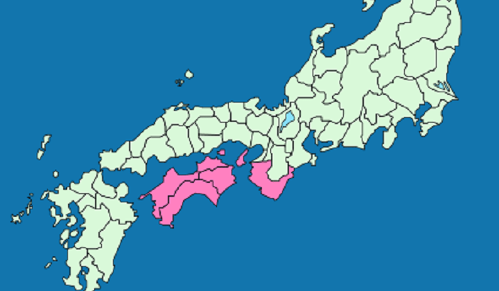
According to general estimates, the earthquake that shook the islands in the southeast of Japan had a magnitude of at least 8.4. A seismic event led to a tsunami that hit the Japanese provinces of Kii, Awaji and the coast of the island of Shikoku. The waves were strong enough to demolish the isthmus that previously separated Lake Hamana from the ocean. Flooding was observed throughout the historical region of Nankaido, and the death toll reached, presumably, from 26,000 to 31,000 people.
6. Nankaido (Japan), October 28, 1707

Another devastating tsunami, caused by an earthquake of magnitude 8.4, hit Japan's Nankaido in 1707. The wave height was 25 meters. The settlements on the coast of Kyushu, Shikoku and Honshu were damaged, and the large Japanese city of Osaka was also damaged. The disaster resulted in the destruction of over 30,000 homes and the death of about 30,000 people. It is estimated that about a dozen tsunamis hit Japan that day in just 1 hour, some of them traveled several kilometers inland.
7. Sanriku (Japan), June 15, 1896

The tsunami in the northeastern part of the island of Honshu was caused by an earthquake of magnitude 7.2, caused by a shift in the lithospheric plates in the area of the Japan Trench. After the earthquake, the Sanriku region was hit by two waves one after the other, rising to a height of up to 38 meters. Since the arrival of the water coincided with the tide, the damage from the disaster was incredibly high. More than 22,00 people died and over 9,000 buildings were destroyed. The tsunami has reached Hawaiian Islands, but here their height was much less - about 9 meters.
8. Northern Chile, August 13, 1868

The tsunami in northern Chile (at that time off the coast of Arica in Peru) was caused by a series of two large-scale earthquakes of magnitude 8.5. Waves up to 21 meters high flooded the entire Asia-Pacific region and reached the Australian Sydney. The waters crashed onto the banks for 2 or 3 days, eventually resulting in 25,000 deaths and $300 million worth of damage.
9. Ryukyu (Japan), April 24, 1771

Boulders thrown by the tsunami
An earthquake of magnitude 7.4 caused a tsunami that flooded many Japanese islands. Ishigaki and Miyako suffered the most, where the wave height reached 11 to 15 meters. The disaster resulted in the destruction of 3,137 houses and the death of about 12,000 people.
10. Ise Bay (Japan), January 18, 1586

Ise Bay today
The earthquake that caused the tsunami in Ise Bay on the island of Honshu received a magnitude of 8.2. Waves rose to a height of 6 meters, causing damage settlements on the coast. The city of Nagahama suffered not only from water, but also from fires that broke out after the earthquake and destroyed half of the buildings. The tsunami in the bay killed more than 8,000 people.
Causes of a tsunami
The distribution of tsunamis is associated, as a rule, with areas of strong earthquakes. It is subject to a clear geographical pattern, determined by the connection of seismic regions with areas of recent and modern mountain building processes.
It is known that most earthquakes are confined to those belts of the Earth, within which the formation of mountain systems, especially young ones belonging to the modern geological epoch. Earthquakes are most pure in the areas of close proximity of large mountain systems with depressions of the seas and oceans.
On fig. 1 shows a diagram of folded mountain systems and areas of concentration of earthquake epicenters. This diagram clearly shows two zones. the globe most prone to earthquakes. One of them occupies a latitudinal position and includes the Apennines, the Alps, the Carpathians, the Caucasus, the Kopet-Dag, the Tien Shan, the Pamirs and the Himalayas. Within this zone, tsunamis are observed on the coasts of the Mediterranean, Adriatic, Aegean, Black and Caspian Seas and the northern part of the Indian Ocean. Another zone is located in the meridional direction and runs along the shores of the Pacific Ocean. The latter is, as it were, bordered by underwater mountain ranges, whose peaks rise in the form of islands (Aleutian, Kuril, Japanese islands other). Tsunami waves are formed here as a result of gaps between rising mountain ranges and sinking deep-sea troughs parallel to the ridges, separating island chains from a sedentary region of the Pacific Ocean floor.
The immediate cause of tsunami waves is most often the changes in the relief of the ocean floor that occur during earthquakes, leading to the formation of large faults, sinkholes, etc.
The scale of such changes can be judged from the following example. During an earthquake in the Adriatic Sea off the coast of Greece on October 26, 1873, ruptures of a telegraph cable laid at the bottom of the sea at a depth of four hundred meters were noted. After the earthquake, one of the ends of the broken cable was found at a depth of more than 600 m. Consequently, the earthquake caused a sharp subsidence of the seabed to a depth of about 200 m. were at a depth different from the previous one by several hundred meters. Finally, a year after the new shocks, the sea depth at the place of the break increased by 400 m.
Still greater disturbances of the bottom topography occur during earthquakes in the Pacific Ocean. So, during an underwater earthquake in the Sagami Bay (Japan), with a sudden rise in a section of the ocean floor, about 22.5 cubic meters were displaced. km of water, which hit the shore in the form of tsunami waves.
On fig. Figure 2a shows the mechanism of tsunami generation as a result of an earthquake. At the moment of a sharp subsidence of a section of the ocean floor and the appearance of a depression on the sea bottom, the hearth rushes to the center, overflows the depression and forms a huge bulge on the surface. With a sharp rise in a section of the ocean floor, significant masses of water are revealed. At the same time, tsunami waves arise on the surface of the ocean, quickly diverging in all directions. Usually they form a series of 3–9 waves, the distance between crests of which is 100–300 km, and the height when the waves approach the shore reaches 30 m or more.
Another cause of tsunamis is volcanic eruptions rising above the sea surface in the form of islands or located on the ocean floor (Fig. 2b). The most striking example in this regard is the formation of a tsunami during the eruption of Krakatoa volcano in the Sunda Strait in August 1883. The eruption was accompanied by the release of volcanic ash to a height of 30 km. The menacing voice of the volcano was heard simultaneously in Australia and on the nearest islands of Southeast Asia. August 27 at 10 o'clock in the morning, a gigantic explosion destroyed volcanic island. At that moment, tsunami waves arose that spread throughout the oceans and devastated many islands of the Malay Archipelago. In the narrowest part of the Sunda Strait, the wave height reached 30–35 m. In some places, the waters penetrated deep into Indonesia and caused terrible destruction. Four villages were destroyed on Sebezi Island. The cities of Angers, Merak and Bentham were destroyed, forests and railways washed away, and fishing boats are abandoned on land at a distance of several kilometers from the ocean coast. The shores of Sumatra and Java became unrecognizable - everything was covered with mud, ash, corpses of people and animals. This catastrophe brought the death of 36,000 inhabitants of the archipelago. Tsunami waves spread throughout Indian Ocean from the coast of India in the north to the Cape of Good Hope in the south. In the Atlantic Ocean they reached the Isthmus of Panama, and in the Pacific Ocean they reached Alaska and San Francisco.
Tsunami cases at volcanic eruptions known in Japan. So, on September 23 and 24, 1952, there was a strong eruption of an underwater volcano on the Meijin reef, several hundred kilometers from Tokyo. The resulting waves reached the island of Khotidze to the northeast of the volcano. During this disaster, the Japanese hydrographic vessel Kaie-Maru-5, from which observations were carried out, perished.
The third reason for the occurrence of a tsunami is the fall of huge rock fragments into the sea, caused by the destruction of rocks by groundwater. The height of such waves depends on the mass of the material that fell into the sea and on the height of its fall. So, in 1930, on the island of Madeira, a block fell off from a height of 200 m, which caused the emergence of a single wave 15 m high.
Tsunami off the coast South America
The Pacific coast within Peru and Chile is prone to frequent earthquakes. Changes in the topography of the bottom of the coastal part of the Pacific Ocean lead to the formation of large tsunamis. highest height(27 m) tsunami waves reached the Callao region during the Lima earthquake in 1746.
If usually the lowering of the sea level, which precedes the onset of tsunami waves on the coast, lasts from 5 to 35 minutes, then during the earthquake in Pisco (Peru), the receding sea waters returned only after three hours, and at Santa even after a day.
Often, the advance and retreat of tsunami waves occur here several times in a row. So, in Iquique (Peru) on May 9, 1877, the first wave hit the coast half an hour after the main shock of the earthquake, and then within four hours the waves attacked five more times. During this earthquake, the epicenter of which was located 90 km from the Peruvian coast, tsunami waves reached the coasts of New Zealand and Japan.
On August 13, 1868, on the coast of Peru in Arica, 20 minutes after the start of the earthquake, a wave of several meters high surged, but soon receded. With an interval of a quarter of an hour, it was followed by several more waves, smaller in size. After 12.5 hours, the first wave reached the Hawaiian Islands, and after 19 hours - the coast of New Zealand, where 25,000 people became its victims. The average tsunami wave speed between Arica and Valdivia at a depth of 2200 m was 145 m/s, between Arica and Hawaii at a depth of 5200 m - 170-220 m/s, and between Arica and the Chatam Islands at a depth of 2700 m - 160 m/s.
The most frequent and strongest earthquakes characterize the area of the Chilean coast from Cape Concepcion to the island of Chiloe. It is known that since the catastrophe of 1562, the city of Concepción suffered 12 strong earthquakes, and the city of Valdivia suffered 7 earthquakes during the period from 1575 to 1907. During the earthquake on January 24, 1939, 1,000 people died in and around Concepción and 70,000 people were left homeless.
The destruction caused by the 1960 tsunami waves in the city of Puerto Monte
On May 21, 1960, a new earthquake shook the Chilean coast near Cape Concepción, and then for 10 days shook the entire southern part countries for 1500 km. During this time, about a thousand people died and about 350,000 people were left homeless. In the cities of Concepcion, Puerto Monte, Temuco and the island of Chiloe, 65,000 buildings were completely destroyed and 80,000 seriously damaged. The strongest shock was on May 22, when the maximum amplitude of soil vibration in Moscow was 1500 microns. This is three times the amplitude of the oscillations caused by the 1948 Ashgabat earthquake, whose epicenter was located six times closer to Moscow.
The catastrophic shaking on May 22 gave rise to tsunami waves that propagated across the Pacific Ocean and beyond at a speed of 650-700 km/h. On the Chilean coast, fishing villages and port facilities were destroyed; hundreds of people were swept away by the waves. On the island of Chiloe, waves destroyed four-fifths of all buildings.
Tsunami(as they were called in Japan) occur during underwater earthquakes and volcanic eruptions, when large masses of water come into motion, forming very long waves, almost imperceptible in the open ocean. With great speed - up to 800 km / h (the speed of a jet airliner) - they scatter in all directions from their place of origin. Near the coast, the speed and length of the waves decrease sharply, however the height is multiplied. But even this reduced speed is enough to cause a lot of trouble. Tsunamis are a formidable natural phenomenon, they claim thousands of human lives and cause great damage to coastal areas. Severely affected by the tsunami and shipping.
Tsunami. Chronicle of the most destructive cases.
So, in 1737, 20 thousand people died in the Bay of Bengal. sailing ships and boats and about 300 thousand people. There was no war here. There was a wave 30 meters high. It was she who sank a whole armada of ships, claimed so many human lives.
In November 1755, the Portuguese capital of Lisbon was almost completely destroyed by a tsunami: First, the Atlantic Ocean receded from the coast. On the bare bottom of the waters of the Lisbon harbor, in many cases overturned on board, were 300 large warships and merchant ships. Suddenly, a rumble came from the ocean. He was growing fast. A moment later, a giant wave burst into the bay, destroying everything in its path. Vessels and ships, picked up by the tsunami, like matchboxes, were thrown far ashore.
The largest tsunamis occur earthquakes in the Pacific. Thirty-eight times giant waves devastated Hawaii, fourteen times they raided the Kuriles and Kamchatka. In the summer of 1780, during an earthquake in the northern part of Kuril Islands and southern Kamchatka, the ship St. Natalia was torn off the anchors and thrown onto the island of Iturup at a distance of 350 m from the coast.
In 1889, during the eruption of the Krakatau volcano in the Sunda Strait of the Indonesian archipelago, a giant tsunami 35 m high hit the coast and killed tens of thousands of people. And how many ships were broken! Waves lifted the Danish gunboat to a height of ten meters and threw it four kilometers from the shore.
A few years after this terrible event in the Gulf of Mexico, a tsunami was thrown onto Chandler Island. big ship Ebenger. He stood on land for 12 years. A new tsunami removed the ship from the island and returned it to the sea.
Perhaps the most "distinguished" tsunami in May 1960 during the Chilean earthquake. The catastrophe caused huge human casualties, and the material damage caused is estimated at a billion dollars. Characteristic Chilean tsunamis - their wide advance in the Pacific Ocean while maintaining great destructive power. They covered the distance to Petropavlovsk - over 16,000 km in 20 hours 30 minutes at an average speed of 750-800 km / h.
The Chilean tsunamis are especially memorable in terms of the height of the waves, which reached 25 m, and the length of the coastline, which was devastated. Newspapers in those days were full of headlines: “Thousands of dead”, “ Dead cities and settlements”, “Many destroyed ships”.
The first manifestation of a tsunami was sea retreat. Here is how this phenomenon is described in Chilean newspapers:
“In the next moment, they suddenly noticed that the water began to move away from the coast, leaving the ocean floor open more than at the highest low tide ... After a short period of time - from 15 to 30 minutes - the sea returned, moving ashore in a giant wave ... "
According to the newspaper "Liberation", the tsunami waves that flooded the city of Corral carried away two large-capacity ships: Sant-Yago and Karl Gaserbeck. The ships were carried through the streets of the city. The first of them reached the harbor of Valparaiso. Only chance can explain the fact that during this "voyage" the ship did not crash. As for Karl Haverbeck, his fate was sad: it soon sank.
The tsunami that broke into the Australian port of Sydney formed a whirlpool that caused great damage to ships in the harbor. Small ships were particularly affected. Whirlpools in the bays, accidents and shipwrecks were also caused by the Chilean tsunami in the ports of Mexico and on the California coast of the United States. Dozens sea vessels found a grave here.
Off the coast of New Zealand, several large-capacity steamers were capsized by the wave, including a large passenger ferry that was in Auckland harbor.
Japan is one of the most tsunami-affected countries. The echoes of the Chilean earthquake also affected her. The Chilean tsunami devastated much of Hokkaido south of Kushiro and the northern coast of Honshu. The island of Okinawa was especially affected - it was the worst disaster of its kind in its entire history. In the area of Shogama in northern Japan, the entire coast was littered with the remains of ships, barges, boats and fishing sailboats.
Tsunamis also took place in subsequent years: in October 1963 they captured the region of the Kuril Islands. Then a three-meter wave approached the shore. The inhabitants were warned and took refuge in elevated places, the ships weighed anchors and went to the open sea, where the tsunami no longer poses a serious danger to ships.
In June 1964, a massive earthquake and the waves it caused caused massive damage to the Japanese city of Ningata. Ships in the harbor were thrown ashore.
In October 1966, powerful ocean waves that arose in the southern hemisphere as a result of an earthquake off the coast of Peru again crossed the entire Pacific Ocean, crossed into the northern hemisphere and reached the Kuril Islands on the night of October 13. And again houses collapsed, ships perished.
5 / 5 ( 2 votes)
A wave 300 meters high literally washed away one of the Cape Verde Islands - Santiago Island, located in the Atlantic Ocean about 620 kilometers from west coast Africa. It happened a very long time ago - 73 thousand years ago. But traces are still preserved. They were found by scientists from the UK, USA, Portugal and Japan, as reported in the scientific journal Science Advances. According to the head of the research team, Ricardo Ramalho from the Columbia University Observatory, a monstrous wave surged as a result of a volcanic eruption on Fogo Island, located 55 kilometers from Santiago Island. Part of the crater wall collapsed into the ocean - a block with a volume of several cubic kilometers fell into the water. The resulting water shaft reached almost 300 m in height - more precisely, 266 m. And rolled across the ocean. And the piece that fell off sank to the bottom - it is still there.
Scientists determined the height of the wave by finding traces of sea water, sea sand and giant boulders high in the mountains of Santiago Island - 49 pieces weighing from 50 to 200 tons. These blocks, thrown into the mountains, testify to the monstrous power of the wave.
Scientists warn: a kilometer-high wave - the so-called megatsunami - can surge in the Atlantic Ocean. It can be created by rocky rock, which will collapse into the water as a result of volcanic eruptions on canary islands. The most dangerous in this sense are the active vents of the Cumbre Vieja volcanic ridge on the island of La Palma. According to the calculations of Simon Day of University College London, in an hour the wave will reach the west coast of Africa. And spreading in the opposite direction, it will rush to America. Off the coast of Africa, the wave height will be 100 m, off the coast of the United States - 50 m.
By the way, megatsunamis were formed in our time. In 1958, as a result of an earthquake in Alaska, a glacier weighing 90 million tons came down from the mountain and collapsed into the water. The collapse created a 525 m high wave in the Lituya Bay - just below the Ostankino TV tower, whose height is 540 m. This wave was the highest of all officially registered.
SAVE WHO CAN!
A killer wave in the Mediterranean could affect 130 million people
It would seem that people vacationing in the resorts of the Mediterranean - in fact, the inland - sea, have nothing to fear. As well as local residents inhabiting coastal areas. Unless a storm hits sometimes. So it's not scary - even beautiful. It won't wash away. You can serenely suck on a mojito while continuing to admire the turquoise trees…
The ocean is another matter - tsunamis of destructive power occur there. In 2004, huge waves hit Indonesia and Thailand, and in 2011, Japan. However, as Italian scientists have found out, walls of water can also rise in the Mediterranean.
Simulations by Dr. Achilles Samaras of the University of Bologna have shown that earthquakes of magnitude 7 to 8 in Sicily and Crete are bound to trigger tsunamis. Waves will go all over the sea at a speed of about 600 kilometers per hour. Their height near the coast will reach 20 meters. That will allow water in some places to penetrate deep into the coast for several kilometers. That is, the danger of being washed off the beach really exists. Estimates show that 130 million people in coastal areas could be affected.
Scientists claim that tsunamis in the Mediterranean occur about once every hundred years. It is hinted that the time for another cataclysm is approaching. After all, the previous one took place in 1908. Then the earthquake in Sicily generated waves that killed thousands of people in the Messina region.
There have been worse: in 365 AD, an earthquake in Crete caused waves to rise that reached Greece, Italy, and Egypt. And in Alexandria alone, 5,000 people were drowned.
Samaras is echoed by German researchers - Rainer Kind and Dieter Kelletat from the University of Duisburg-Essen, who also do not exclude the possibility of a strong tsunami in the Mediterranean.
So far, no one can predict the cataclysm - there are no reliable means in the world for predicting earthquakes - the source of the tsunami. But there is an opportunity to insure. Scientists propose to equip the Mediterranean Sea with a tsunami early warning system, similar to the one that operates, for example, in Southeast Asia. Of course, it will not prevent destruction, but it will give people a chance to escape or go to a higher place.


