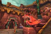
The legend of the path of the giants. Giants road in northern ireland
Once again, nature is showing us one of its phenomenal tricks. On the coast of the northern part of Northern Ireland (forgive the tautology, but that's the way it is) is the Giant's Causeway. This unique phenomenon of nature looks like unusual pillars, the section of which is very similar to a honeycomb.
The pillars (or columns) are so tightly pressed against each other that even a knife cannot be stuck between them. Large stones in the walls of the ancient city of Sacsayhuaman are fitted in approximately the same way, with the only difference being that people did it there, and nature here.
Road of the Giants on the map
- Geographic coordinates 55.240684, -6.511417
- The distance from the capital of Northern Ireland, the city of Belfast, is approximately 80 km.
- Distance to the nearest airport Derry about 50 km
It should be noted that Northern Ireland is an administrative part of the UK, and not a separate state.
The Giant's Road is located 3 kilometers north of the town of Bushmills.
This attraction has about 40,000 basalt columns interconnected. Most of the pillars are hexagonal, but there are also four, five, seven and octagonal specimens. Their height reaches 12 meters. The diameter of the pillars is from 30 to 50 cm.

Considering this unusual natural structure, it is hard to believe that it appeared by chance. According to the official version of scientists, such extraordinary columns arose after a volcanic eruption in antiquity. Active volcanic phenomena took place here 50-60 million years ago. Molten basalt flows formed huge lava fields. With rapid cooling, the volume of the substance was reduced, and horizontal compression contributed to the appearance of such geometrically regular structures.
There is another hypothesis according to which the Road of the Giants was formed as a result of convection of a viscous substance under conditions of cooling of the upper layers.
Local residents, of course, associate the appearance of this structure with an ancient legend.
It says that the hero of the Celtic myths, warrior, sage and seer Finn McKumal decided to measure his strength with a huge one-eyed monster named Goll, who lived in Scotland. But by some absurd accident or random absurdity, the heroic hero… was afraid to get his feet wet. Finn had to drive a whole lot of columns into the bottom of the sea - it turned out to be a kind of bridge on neighboring island. He was very tired and decided to sleep before the battle. While our hero was peacefully dreaming, Goll, without waiting for his opponent, himself came to visit him along the already built bridge. He was met by Uma, Finn's wife. Judging by the name, the lady was not stupid. She cheated a little: pointing to her sleeping husband, she said that he was her child. As you understand, this comrade did not at all resemble a child in size. Uma sat the giant at the table and began to treat him with cakes, in which she had previously baked iron pans. Other cakes (already without pans inside) she set aside for her husband. When Goll began to break his teeth, eating his treat, the awakened Finn calmly ate his cakes "on both cheeks." Realizing that if the baby is like that !!!, then his dad will be completely invincible, Goll runs away in a panic and destroys the bridge along the way, cutting off the path for persecution.
Whether the Road of the Giants appeared as it is said in myth or as scientists suggest is no longer so important. The main thing is that now we have one more unsolved and therefore very attractive natural attraction.

The Road of the Giants runs for more than 270 meters along the coast and about 150 meters along the bottom of the sea. All columns are very hard and have a dark color. This is due to the high content of magnesium and iron in their composition. Such a mixture of substances is practically not subject to the destructive action of sea waves and wind.
Close to the Giant's Road are cliffs with original titles. Harp Rock - its columns are curved and descend to the shore. The cliff of the Organ, whose pillars are straight and very similar to this huge musical instrument.
There are also cliffs Giant's Loom, Coffin and Giant's Eyes. Here you can still see the Giant's Shoe. This is a huge cobblestone in the form of shoes and 2 meters high.

- in 1986, UNESCO declared Giant's Causeway and the Causeway Coast, where it is located, a World Heritage Site, and only a year later, the Department of Environmental Protection awarded this place the status of a National Wildlife Refuge
- despite the fact that the Giant's Road has been here for thousands, and possibly millions of years, it was widely known only in the 17th century from the stories of the Bishop of Derry. And only at the beginning of the 19th century the first tourists came here.
- access for tourists here is nowhere and is not limited in any way
- in Scotland, on the island of Staffa, there is a unique one, the walls of which (like the coast of the island itself) consist of the same hexagonal basalt columns. Perhaps this is also part of the Road of the Giants
Road of the Giants photo


Antiquity + Modernity = Northern Ireland
Northern Ireland is one of the four parts of the UK, and quite an interesting part of it. It was founded in 1921, and before that, there were wars and powerful conflicts over the territory for many years.
On an area of \u200b\u200balmost 14 square km, there are 6 counties at once, the capital of this area is beautiful city Belfast. In this country, ancient buildings are combined in an original way with modern buildings, as well as with unique nature– Ireland is rich in forests, water bodies, among which is its own sea, and objects world heritage.
The population of Ireland is very interesting, here you can meet both native Irish Catholics and British Protestants, there are also Anglo-Irish and Scotch-Irish. Accordingly, they speak two languages here - English and Irish.
The climate of this country is temperate, there is quite warm winter and not very hot summer season. At the same time, a lot of precipitation falls throughout the country, the air is almost always humid. In summer, the average temperature is about +15 degrees, and in winter +5. July is the hottest month when Ireland traditionally has the most tourists.
The public holiday in Northern Ireland is St. Patrick's Day, the patron saint of the country, who expelled snakes from the island and brought Christianity. Once on this holiday, one is surprised by the huge number of people on the streets dressed in national green. Everyone on this day walks, attends beer parties and indulges in the world-famous dark Guinness beer.
Northern Ireland
In terms of food, Northern Ireland is famous for its Ulster breakfast - scrambled eggs with sausages, soda cakes and potato bread. Also here you can taste the amazing taste of meat and oysters, delicious food here as in expensive restaurants, there and in small cafes.
What else is remarkable about Northern Ireland is its numerous legends and myths. Tourists visiting Ireland should definitely visit the "Giant's Road" - this is the main attraction, which is included in the list of UNESCO sites. The unusual embankment consists of countless columns, the largest reaching up to six meters in height. The locals believe in the legend, according to which one hero specially drove large columns into the bottom of the sea to fight the monster and built a bridge out of them. But the giant monster tricked himself into the city over this bridge, and subsequently, being frightened by cunning deceit, he fled back from the city in horror and broke the bridge. As a result, only bizarre columns resembling fragments remained of it.
What else is worth visiting? Shipyard Harland & Wolff Shipyards - it was here that the Titanic, famous for its sad fate, was built at one time. lovers quiet rest you can advise to see the ruins of Dunluce Castle, and for connoisseurs of alcohol, an excursion to the Old Bushmills Distillery is suitable. Here you can see with your own eyes how the best whiskey is made. Since Ireland is famous for its natural beauty, visiting Ratlin Island, you can admire the many different species of birds that live in natural conditions. But extreme people will appreciate the Carrick Red Rope suspension bridge between two rocks: walking along the 24-meter long bridge, you will see only the endless sea below you.
Northern Ireland is very rich in vibrant places and pleasant experiences. It is quite colorful and constantly attracts tourists from all over the world. Looking here, you can appreciate all the attractiveness and singularity of this place, as well as feel the true Irish culture.
Road of the Giants in Northern Ireland
Giant's Road is the most popular tourist attraction in Northern Ireland. This unique coast appeared due to volcanic intervention. Thanks to an eruption that occurred many centuries ago, about 40,000 basalt columns were formed here, going into the sea, like steps for a real giant.
Once here, it will also be interesting for you to climb up and survey the picturesque panorama. In this area, it is possible to rent (or come on an already rented) bike and ride along an equipped route around the area.

The road of giants is a real miracle of nature
The Giant's Causeway (Giant's Path or Giant's Causeway) is a unique coastal area that consists of several tens of thousands of interconnected basalt columns formed as a result of an ancient volcanic eruption.
It is located in the north-east of Northern Ireland, about 3 km north of the Irish whiskey town of Bushmills. The road, as well as the Causeway Coast on which it lies, was declared a UNESCO World Heritage Site in 1986, and a National Wildlife Refuge in 1987 by the Northern Ireland Department of the Environment. The tops of the columns form a springboard, which starts at the foot of the cliff and disappears under the surface of the sea. Most of the columns are hexagonal, although some have four, five, seven or eight corners. The highest is about 12 meters.
The Road of the Giants impresses not only with its size, but also with mysterious legends of origin. This impressive place rightfully deserves popularity and admiration.
60 million years ago, powerful volcanoes shook the island.
About 60 million years ago, powerful volcanoes shook the area. They raised columns of ash into the sky, and threw them on the surface of the earth. a large number of magma. This event left the Irish a legacy of the mysterious Road of the Giants. According to another legend, the giants themselves actually walked along it.

Once upon a time, a warrior from Irish mythology, Finn Mac Kumalo, was going to compete with a one-eyed giant named Hall. The latter lived across the sea. Finn decided to build a bridge to the other side so as not to get his feet wet. With his sword, he carved and drove into the bottom of the sea a whole series of stone columns. When tired, the warrior lay down to rest and fell asleep.
At this time, a formidable opponent himself came to him precisely along this bridge. But they still couldn't compete. It turned out that Finn had a very cunning wife. She gave her sleeping husband as a little son. Pretending to be waiting for her husband, she began to treat Hall with cakes with iron pans baked in them.
When Finn woke up, his wife gave him the same cakes, only without pans. Hall was very frightened when he saw how quickly the child was eating loaves. He imagined what the father of such a child should be like. Hall started to run. And the bridge from his terrible blows could not stand it and broke.

Giants trail in Ireland
In ancient times, the good giant Fin McCool lived in Ireland with his wife Una, and across the strait from him, in Scotland, lived the evil giant Benadonna. The Scot constantly hurt and offended the Irish. One day, Fin Mak Cool shouted to Benadonna: “If I could swim, I would swim across the strait in a couple of minutes and would pile on you for the most not indulge!”
But the Irishman did not know how to swim. Then he decided to build a bridge across the strait. For seven days and seven nights he did not close his eyes, dragged huge stone rods into the sea and built a bridge across the strait.
In the end, he was very tired and thought: “Before I fight Benadonna, I must have a good rest” and went to bed. At this time, the Scottish giant saw the bridge and ran across it to Ireland.
He began knocking on the giant's door, but Fin MacCool was fast asleep. His wife Una was frightened and came up with a trick: she swaddled him like a baby. Opening the door, she said to Benadonna, “Shhh! My baby is sleeping!”
The Scot looked at the “baby” and thought: “If Fin McCool has a child that big, then what is he like?” Frightened, Benadonna fled back to Scotland, breaking the entire bridge behind him.
The Giants' Trail - a UNESCO World Heritage Site

Only the very beginning of the Bridge of the Giants, consisting of hexagonal basalt columns, which is included in the UNESCO World Heritage List and is one of the wonders of nature, has survived to this day.

Carrickfergus Castle.
One of the few examples of medieval fortifications in Northern Ireland, which has survived to this day in almost its original form. The castle is the main and only attraction of the city of the same name, located nearby. Today, Carrickfergus Castle is one of the country's largest centers for the study of the Middle Ages.
The castle appeared in the XII century, its appearance became a certain stage in the development of the British Isles. The castle was built by the Anglo-Norman tribes, hence the very unusual name for the fort and the city that arose years later. According to the hypotheses of historians, the founders of the castle were faced with the task of making it as impregnable as possible, which was embodied during the years of construction. The castle was built on a sheer cliff, which at that time completely excluded capture from the sea, and Belfast Lough became the most defensive bay in the country. All the towers of the castle were built from the strongest basalt and sandstone mined nearby, relatively high for that time walls of 20 meters reached a thickness of up to four meters, which made the castle invulnerable even to cannon fire. A kind of pride of the castle was a unique defense against ground attacks, nicknamed by the enemies "death hole". The hole is a gateway above the main gate of the castle, disguised as the color of the wall.
At the moment of breaking through the gates or deliberately deceiving the enemy, unsuspecting infantrymen received a stream of boiling resin, oil or a pile of sharp stones on their heads. The path to retreat was cut off by a slamming secret grate. The principle of operation of the "hole of death" is shown to all sightseers, which causes regular applause. In addition to a sightseeing visit to the castle, you can book a walk along the bay, which allows you to view the walls of the fortress from different angles. Also inside the castle, costumed performances on the theme of life in the Middle Ages are very often held. Anyone can take part in them, as well as be in the role of a spectator. City of Carrickfergus this moment completely focused on the tourism business, the flow of tourists from all over the world cannot be called colossal, but due to inexpensive prices for local infrastructure, there is a certain demand. There are many Russians among the visitors of the city and the castle, which forced local entrepreneurs to create printed materials in Russian in souvenir shops - guides, booklets, memorable books about the city and the history of the castle.

Enniskillen Castle is one of the Northern Irish castles that has survived almost in its original form. The castle is located in the county of Fermanagh, which is on the border with Ireland, and is the main sightseeing attraction of this region. Despite enough rich history, Enniskillen Castle does not have an exact date of its foundation - all ancient documents were destroyed during numerous military operations in the county. Nevertheless, it is officially accepted that the castle was founded at the very beginning of the 15th century by the Scottish Maguire clan.
The erection of the castle ensured the protection of the whole county from the attacks of hostile neighbors, and for this purpose strong walls and high observation towers were doing great. In the 16th century, the territory of the castle became the epicenter of political intrigues that resulted in the so-called Nine Years' War, when the confrontation between Elizabeth I and the Spanish crown reached its climax precisely on the territory of Ireland, which was used by Spain as a military base. Since that moment, the strategic importance of the castle has increased, and it was rebuilt several times, expanding the arsenal and the number of barracks for military personnel.
Starting from the 17th century, the castle became completely owned by the British crown, and it was already used against numerous skirmishes with the French, the stables and barracks built during that period can be seen today. Now Enniskillen Castle is a huge museum complex dedicated to the centuries-old history of County Fermanagh. Among several dozen exhibition halls, you can see exhibitions dedicated to both the military affairs of Ireland, starting from the 15th century, and the private life of people who lived in the castle and its environs. In addition to weapons, uniforms and armor, you can see household items, furniture, clothes and much more.

Dunluce Castle is one of the oldest castles in the UK, located five kilometers from small town Portrush. At present, the territory of the castle is a relatively safe state for visitors, which, in turn, are included in the list of historical monuments specially protected by the state. Founded in the 13th century, this castle served as an impregnable frontier for many centuries, protecting the coast from attacks from Atlantic Ocean. According to the meager data that have survived to this day, this castle belonged to several of the richest families, but the last recorded owners are the Scottish McDonalds clan. The castle belonged to this clan until 1690. Shortly before this, very tragic pages began in his history.
In 1639, the owners of the castle hosted a dinner party with guests and musicians. At the height of the fun, the kitchen yard could not withstand the mass of the gathered guests and fell right into the sea, not everyone managed to escape. The remaining part of the kitchen yard is now fenced off from visits for security purposes, but it can be seen from several points of the castle. Half a century after this tragic incident, the MacDonalds clan completely went bankrupt, and the castle was taken as a repayment of debts. The majestic medieval building was not restored, it was decided to gradually dismantle it in order to obtain high-quality building materials, from which some other buildings in the vicinity were later created.
Included in the list of historical and architectural monuments There was a castle in Northern Ireland only at the end of the 19th century, since that time it has become a popular sightseeing object. Currently, tours of the castle are held regardless of the time of year, but you can get here only with a guide, whose services can be ordered in the city of Portrush. A sightseeing minibus will take you to the castle in a matter of minutes, and after the overview lectures, guests can go on a free walk around the surrounding areas.

Viaduct Craigmore
This is an old railway bridge, which is located near the village of Bessbrook, in County Armagh. Locals call their bridge "18 arches", it was built in 1852. As tall as a 14-story building, the Craymore Viaduct provides an excellent vantage point for taking in the surroundings. And by themselves, its granite arches are very beautiful.

Marble Arch Caverns
These caves were opened to tourists relatively recently - in 1985. There are many caves in Northern Ireland and usually they do not arouse much interest among travelers. However, the Marble Arch Caverns are a completely different matter! Under their arches you can sail on a boat, which is much more interesting than just walking.

Lough Neagh is the largest lake in the UK, one of the largest in area. fresh lakes in Europe. In fact, Northern Ireland owns only 90% of the lake area, its southern part is already on Irish territory. Lough Neagh is called the main freshwater area near Belfast, although the city is remote at a fairly decent distance of 30 kilometers. Despite the shallow depth - a maximum of 31 meters - there are a lot of wells for sampling drinking water used, including for industrial purposes. As for tourism, trips to the lake are consistently popular among guests from other countries.
For a walk along the shore, it is advised to choose a clear day, because during the period of rains and strong winds, the smooth surface of the lake can become the site of a real storm. Regardless of the choice of the vantage point to start the tour, this place will be distinguished by stunning views of both austere and in its own way unique Irish nature. In spring, on the shores of the lake, you can see white swans that have arrived from wintering. local legend about the origin of the lake again refers us to the national hero of Ireland - Finn, also known as Fingal.
The action of the legend refers to the period of regular battles between the Irish and Scottish tribes. Finn, as in most legends, appears here as a powerful hero, able to control nature. According to an old legend, Loch Neagh appeared on the spot where Finn took a piece of land to bring it to Scotland. The earth did not fly to Scotland, but fell in the place where the famous Isle of Man is now located, and this explains its occurrence. In addition to national legends, Lough Neagh is famous for much darker stories.
Over decades of study, archaeologists from all over the world have found confirmation that there were several dozen pagan altars around the lake, where the ancient inhabitants of this land worshiped a variety of deities. In addition, it is documented that in the Middle Ages, priests executed heretics on the shore of the lake, which could not but affect the reputation of this place. Paranormal enthusiasts from all over the world come here to capture something unusual.
Residents of the surrounding towns and villages are not too fond of such a reputation for the lake and try not to give rise to stories in dubious magazines.

The Road of the Giants is about 40,000 closely spaced basalt pillars on the northeast coast of Northern Ireland. Their tops, like cobblestones of the pavement, lead in ledges from the foot of the coastal cliffs and gradually disappear into the sea. Most of the pillars are in some incomprehensible way shaped like almost perfect hexagons. They, like parts of a giant stone puzzle, stretch along the seashore for three kilometers.
For a decade and a half, the Giant's Road has resisted unbridled storms here. North Atlantic. For many centuries, the strange regularity of its stone columns forced local shepherds and fishermen to write legends about it. They came up with own history its origin long before this secret was truly revealed by science.
Giant ethnic conflict
According to legend, the pillars that go into the sea are the remains of a road built by the Irish giant Finn McCool. He decided to build it after he was challenged to battle by a giant from Scotland named Benandonner.
To get to the rival who lived overseas, McCool began to tear off huge stones from the coastal rocks and throw them into the sea. So there was a 25-mile road leading to the lair of Benandonner - a cave on the Scottish island of Staffa. Now Fin could cross the Northern Strait along it and teach the insolent a lesson.
However, the construction of the road tired him so much that he decided to rest first - he returned home and went to bed.
The next morning, while Fin McCool was still fast asleep, his giantess wife was awakened by the sound of menacing footsteps. It was the huge and terrible Benandonner who had managed to use the new road first. Seeing him, she thought: “My husband will never be able to cope with this,” and quickly threw a blanket and a baby cap over the sleeping man.
Where is Fin? bellowed Benandonner as he approached their house. Where is this coward hiding?
"Be quiet, you'll wake up our baby!" - answered the wife, pointing to the sleeping spouse.
Benandonner glanced at the "child" and immediately panicked. If the son of Fin was so big, what then would his father be? The Scot decided not to find out, and hastily retreated to his cave. Along the way, he destroyed the road built by Fin so that he could not catch up with him.
Legendary riddles and scientific clues
The legendary Fin McCool built his road to the small island of Staffa for a reason. Folk lore chose this tiny piece of land because it is made up of the same basalt pillars as the Northern Irish Giant's Causeway. The external similarity of the two places gave rise to a single explanatory myth.
Interestingly, from a scientific point of view, the basalt columns of Staffa and the Road of the Giants do have a common origin. It, of course, has nothing to do with "disassembly" legendary giants, and is due to the unity of their geological history.
Basalt pillars Giants' roads descend from the foot of the coastal hills and disappear into the sea.
The scientific world first learned about the Giant's Causeway in 1693, when Sir Richard Bulkley of Trinity College Dublin reported it to the Royal Society of London. The news caused considerable confusion in the educated circles of that time. This was the first time that science had dealt with basalt pillars, and heated debate began to be waged over the reasons for their appearance. Some considered the Giant's Road to be the creation of human hands, others - the result of unknown natural processes, and some even seriously leaned towards the "giant" theory.
The first correct idea about the origin of the Road appeared on the pages of the scientific press in 1768 in one of the volumes of illustrations for the landmark French Encyclopedia. As a commentary on the engraving depicting her, the French geologist Nicolas Desmarets (1725 - 1815) suggested a volcanic reason for her appearance. More recent research has proven him right.
The real story of the Road of the Giants
Today it is known that the Road of the Giants originated about 60 million years ago, when the separation of Europe and North America began.
At that time, as a result of the divergence of the Eurasian and North American lithospheric plates, ruptures began to form in the earth's crust, through which basalt lava repeatedly poured onto the surface. Freezing, it formed a huge lava Tulean plateau, the area of \u200b\u200bwhich scientists estimate at least 1.3 million km2.
Subsequently, it was torn apart and hidden by the waters of the North Atlantic Ocean. Today, its remains are scattered over vast expanses from Norway, Scotland and Ireland to Faroe Islands, Iceland and eastern Greenland. The Causeway of the Giants and the basalt pillars of Staffa Island are the most famous results of its formation.
In total, three phases of volcanic activity were noted in the area of the Giant's Road during the emergence of the Tulean Plateau. They are known as the lower, middle, and upper basalts and are separated by two long periods of relative calm, when the surface of the erupted and solidified lava was eroded. The erosion of the oldest, lower basalt layer created the conditions for the formation of the Road.
During the first of these "erosive" periods, water flows cut through numerous valleys in the lower basalts. Later, when the lava of the middle basalts erupted, its huge masses accumulated in these valleys and began to cool very slowly there. It was the low cooling rate that became the key factor in the appearance of the stone pillars of the Giant's Road.
 The road of giants going into the sea. The same basalt pillars are located on the Scottish island of Staffa on the other side of the North Channel.
 As scientists have found out, shrinking during slow cooling, basalt begins to crack. In most cases, cracks form at an angle of 120°, since this releases the largest amount of excess surface energy at the interfaces. This is how hexagonal horizontal sections of future basalt pillars are formed.
As it cools, the cracks move from the surface deep into the massif. Their length depends on the thickness of the basalt layer: the thicker it is, the longer the pillars form. The highest height of the columns of the Giant's Road is 12 meters, and this is far from a record. In exceptional cases, as, for example, in the US state of Wyoming, they can reach a hundred or even more meters in height.
The thickness of the columns is also mainly determined by the cooling rate: the lower it is, the larger the diameter of the columns appear. The average thickness of the pillars of the Giant's Road is 30 cm.
Approximately two million years after the formation of the pillars, new eruptions occurred in the area of the future Giant's Road. Their result - a layer of upper basalts - was not massive enough to give rise to their own stone columns, but it was quite enough to hide the existing ones for a long time.
 The hexagon is the most common sectional shape of basalt pillars, since the angle between its adjacent sides is exactly 120°. Columns with a different number of faces are formed less frequently.
 Glaciers helped to see the light of the future Road of the Giants again. During the last glacial maximum, they "scraped off" the later geological layers that covered it and exposed the basalt pillars. Then, when the glacier began to recede about 15,000 years ago, the ocean level rose, and the Giant's Road took on its present form.
world heritage site
Since the Giant's Road is an exemplary example of processes related to the geological evolution of the Earth, and at the same time is also associated with the cultural heritage of Northern Ireland, it is protected by numerous protected statuses.
The most significant of these is the UNESCO World Heritage status awarded to the Giant's Causeway and adjacent Causeway Coast in November 1986. In addition, the Road, along with the coast, is a state reserve, and is also part of one of the so-called "areas of special scientific interest."
On the Road to the Road
Over the past 300 years, the Giant's Road has become one of the symbols of Northern Ireland and its most popular tourist attraction. The first tourists began to appear here almost immediately after the "discovery" of Sir Bulkley. In the 19th century, their flow became massive, especially after the construction in the 1880s of a hydroelectric tram line that connected the Road with the resort town of Portrush.
Today, on the Road of the Giants, a huge number of tourists click the shutters of their cameras every year. In 2014 alone, 788 thousand visitors from all over the world visited here.
Getting to the famous basalt pillars is not difficult. Giants Road is located in County Antrim, 3.2 km from the village of Bushmills. A trip here by private car from Belfast takes 1 hour 25 minutes, from Derry - 1 hour 10 minutes, from Dublin - 3 hours 45 minutes.
You can use public transport: take the train in Belfast or Derry and get to the city of Coleraine. Further - 17.7 km by bus.
 Another close-up of the basalt pillars of the Giant's Road.
 The Causeway Coast is open all year round with no time limit. Four convenient hiking trails lead to the faceted pillars from the official entrance. A walk along them, as well as along the coast itself, is free. If desired, you can pay for a triple additional service: visiting a new tourist center(opened in July 2012), an audio guide in 9 languages (including Russian) and a booklet diagram.
For many centuries, the rough symmetry of the basalt pillars of the Giant's Road has never ceased to intrigue and inspire visitors. Walking along it is like traveling back in time. Its steps lead simultaneously to the creative cataclysms of a million-year past, and to the foggy legends of Irish antiquity. Without a visit here, no trip to Northern Ireland can be considered complete.
River bent in an arc
At first glance at this sharp bend in the Colorado River in northern Arizona, USA, it becomes clear where its name comes from - the Horseshoe. With its almost perfectly symmetrical 270 degrees of turn, this river meander really looks like a horse's "shoes". The unusual shape, picturesque cliffs over 300 meters high and comparative accessibility have made the Horseshoe an extremely popular tourist attraction. Today, it is one of the most recognizable and frequently photographed natural landmarks in the Southwest United States of America.
How to bend an entire river into an arc
Geologists believe that the Arizona Horseshoe arose about 5 million years ago, when, as a result of the tectonic uplift of the Colorado Plateau, the ancient Colorado River on the border of the future states of Arizona and Utah was forced to adapt to the new terrain. Following faults in local sandstone massifs, she gradually carved a whole canyon into them. Today it is known as the Glen, and the Horseshoe is its most intricately curved section.
 The color of the rocks and water at the Horseshoe changes throughout the day. Some of the best shots are taken at sunset.
 In 1963, the canyon was almost completely flooded by the huge Powell Reservoir. It retained its original appearance only in the southernmost part, about 24 km long (where, in fact, the Horseshoe is located).
By the way, Glen is the northern neighbor of the famous Grand Canyon, which has a very similar geological history.
Easily accessible beauty
Horseshoe is one of those few phenomenally beautiful places that travelers with almost any physical ability can reach. It is located just 6.5 km southwest of the Arizona town of Page, from which the 89th highway leads to the bend. A dirt road turns from it between milestones No. 544 and No. 545, and then almost immediately there is a special parking lot and the beginning of a hiking trail. A short ascent to a small pavilion on a hill, then a gentle descent - and a mighty bend of the Horseshoe opens before your eyes.
In general, a walk there and back, a distance of about a couple of kilometers, takes about 45 minutes.
You can go to the Horseshoe all year round, permits and separate tickets to visit it are not required. You will only have to pay for access to the Glen Canyon National Recreation Area, on whose territory the Horseshoe is located. Access costs $25 from a private car and is valid for up to seven days.
In the National Recreation Area it is forbidden to litter, as well as in any way violate wildlife and leave notes. You can walk dogs on a short leash (no longer than 1.8 m).
Going to the Horseshoe, it is recommended to take plenty of water with you (at least 1 liter per person), as well as sunglasses and a hat, because there is no shade on the trail except for the gazebo halfway. For those who are fond of photography, a wide-angle lens is mandatory - without it, the scale of the Horseshoe simply cannot be covered. Of course, you should be careful on the observation deck - there are no railings and fences on it.
 The height above sea level at the observation deck of the Horseshoe is 1285 m. The height above the Colorado River is just over 300 m. There are no fences, so you need to be careful. In July 2010, a Greek tourist fell and died here.
 In terms of the beauty of the landscape the best time to visit the Horseshoe - from about 9:30 in the morning (when the river gets rid of a thick shadow) until noon. At noon itself, due to the lack of shadows, the view of the famous bend will be somewhat flat. Evening until sunset, inclusive, is also a good option, but in this case the sun will shine in the eyes.
In relative proximity to the Horseshoe, there are several other first-class attractions at once. So, directly north of Page is the imposing wall of the Glen Canyon Dam, 220 meters high, beyond which the Powell Reservoir begins. 45 km west of the Horseshoe lies the famous Arizona Wave - a sandstone rock formation of absolutely incredible beauty. And 12 km to reverse side(that is, to the east) is the equally famous Antelope Canyon.
And finally, southwest of the bend downstream of the Colorado River begins the Grand Canyon - one of the most unusual and impressive geological features of the globe.
Remarkable freshman
At the top of one of the taiga-covered mountain ranges of the Gremyachinsky district of the Perm Territory, there is a powerful rock mass cut up by deep cracks. Crossing it crosswise, large and not very clefts form a bizarre labyrinth, reminiscent of the streets, alleys and squares of some long abandoned settlement. This is the so-called Stone Town, one of the most popular tourist destinations of the modern Prikamye.
Three names for one place
Today Stone Town is widely known not only to Permians, but also to many guests of the region. Here, despite the remoteness, a constant flow of travelers stretches all year round. However, this was not always the case: a couple of decades ago, only a few local residents knew about Stone Town, and even then under completely different names.
 Cracks in the rock mass of the Stone Town form a network of large and small "streets".
 The fact is that modern tourists have already called this place Stone Town, and earlier for half a century it was called "Turtles". This name was given to it in the middle of the 20th century due to the characteristic shape of the two highest remnant rocks by residents of the neighboring mining villages of Shumikhinsky and Yubileiny, founded in 1953 and 1957, respectively. However, this name was not the original: the old-timers of the most "age" locality local places - the village of Usva - have long known these rocky outcrops as the Devil's settlement.
Such a name is not uncommon for the Ural toponymy. Not far from Yekaterinburg, for example, there is a spectacular mountain of the same name, very popular with tourists and rock climbers. In addition, objects with a similar name are also found in other regions of Russia, since rock massifs and stone ridges were usually called devilish settlements. unusual shape. Obviously, people, not knowing the true geological reasons, attributed their construction to evil spirits.
History of appearance
How did the Permian Stone Town actually arise?
Scientists have established that 350 - 300 million years ago there was a large river delta in this place. Its mighty streams brought with them large masses of sand, which eventually turned into powerful sandstone deposits. Later, as a result of the movement of tectonic plates that caused the formation Ural mountains, the territory of the future Stone Town turned out to be raised high above sea level and began to undergo weathering.
 Quartz sandstone of the Stone Town. The brown color is due to the admixture of iron hydroxides.
 Over long millions of years, water, wind, temperature changes and chemical processes have deepened and expanded the cracks in the rock that appeared during the tectonic uplift. This led to the emergence of the current "streets" and "lanes", which at the moment can be up to eight meters wide and twelve meters deep. In other words, from a scientific point of view, the Permian Stone City is an accumulation of weathering remnants composed of fine-grained quartz sandstones.
Road to Stone Town
Given today's great popularity of the Stone Town, it is hard to believe that it is not even mentioned in the old guidebooks around the Kama region. Nevertheless, this is true - the rush demand for the Gremyachinsky remnants appeared among Perm travel lovers only in the last one and a half to two decades, and before that, due to poor transport accessibility were practically unknown to the mass tourist.
Fortunately, the situation has changed since then, and today Stone Town can be easily reached by car. The general route is as follows: first, the road to Usva (188 kilometers from Perm, 383 from Yekaterinburg), then about two more kilometers along the highway towards Kizel. Then turn right to the villages of Shumikhinsky and Yubileiny and five kilometers along the forest dirt road to the car park. Further, turning left from the road, about a kilometer and a half march along a well-marked path and among the trees the first remnants of the Stone Town will begin to be seen.
At the top of the Rudyansky spoy
Since the Stone Town is located near the main peak of the Rudyansky spoy mountain range (526 meters above sea level), the path from the dirt road to the remains goes up a small slope. The ridge begins on the outskirts of the village of Usva and stretches 19 kilometers north to the city of Gubakha. It was named Rudyansky because of the Rudyanka river flowing in its southern part, in the basin of which iron ore was mined at the beginning of the 19th century. Spoils in the Perm Territory used to be called forest-covered long mountain ranges without pronounced peaks.
 The rocky outlier Turtle is the main symbol of the Permian Stone Town.
 The stone city (not counting the numerous single stones scattered around it) is divided into two unequal parts. The first rock outcrops visited by tourists belong to the so-called big city. It is in it that the two largest local remnants rise - the Big and Small Turtles, because of which the Devil's Settlement changed its name in the 1950s.
The smaller of these remnants, due to its similarity in shape to a perched bird, is today better known to tourists as the Feathered Guardian. The larger one, accordingly, is now more commonly referred to simply as the Turtle. Between him and the Feathered Guard there is a vast and almost horizontal platform - the so-called Square. Tourists get to it along the Prospekt - the widest (up to four meters) and the longest crack in the Stone Town. The almost sheer walls of the Prospect in places reach eight meters in height.
 The feathered guard, as well as the Turtle seen behind it, often becomes the object of annual rock climbing competitions held in Stone Town between rescuers of the Ministry of Emergency Situations, mountain tourists and speleologists of the Perm Territory.
 To the right and to the left of the Prospect narrow cracks-streets depart. One of them (the one that goes around the Turtle) has the highest - up to 12 meters - walls in the city. On the other two, you can climb above the rock massif and from there, in all its glory, see in front of you and stone guard, and Turtle.
About 150 meters north of the Bolshoy is the Small Town. Despite a much smaller area compared to its neighbor, it is also very interesting and picturesque. Its main "street", for example, is even more spectacular than the Prospect described above. In addition, there is a curious stone ridge with a through hole in the base. The only problem is that there is no clear path to the Small Town, and it is not always easy to find.
You can come to Stone Town at any time of the year, but it is especially beautiful here on sunny autumn days. At this time, you can wander endlessly through its streets immersed in bright colors. That is why at the end of August and at the beginning of autumn in the Stone Town there is the largest influx of visitors.
However, many tourists come here in winter, when both the remnants themselves and the trees growing right on them are effectively covered with snow-white caps of snowdrifts. Therefore, going to the Stone Town in the winter months, you should not be afraid that the local paths will be impassable due to deep snow. They will certainly be well trodden by groups of previous visitors.
 Stone Town is located immediately to the west of the main peak of the Rudyansky spoy ridge. From here, unforgettable views of the boundless ocean of the Ural taiga open up.
 Before visiting the Stone Town, you need to stock up on water, as there are no large water sources in it. Also, since since 2008 this landscape monument nature of regional importance received the status of a specially protected natural area, certain rules of conduct should be followed.
Firstly, it is possible to make fires in the Stone Town only in specially equipped places, using only dead wood and deadwood for this (it is forbidden to cut down living trees and shrubs). Secondly, you can not litter and leave unextinguished fires behind. Thirdly, it is forbidden to disturb animals and make inscriptions on rocks, stones and trees. Violation of these rules threatens with a fine of up to 500 thousand rubles.
Stone Town is not the only natural attraction in the vicinity of Usva village. Not far from it is, for example, such a "flagship" of the tourism industry in the Perm Territory as the Usva Pillars - a huge and extremely photogenic stone ridge with a picturesque remnant of the Devil's Finger. Rafting on the Usva River is also very popular among Permians.
In general, the remnants of weathering, similar to the Stone City, associated with the selective destruction of mountain ranges, are one of the most spectacular geomorphological objects of the Kama region. There are especially many of them on the flat peaks of the Northern Urals, such as the Chuvalsky stone, Kuryksar, Larch ridges and on the Kvarkush plateau.
At the exhibition, where you can see in the photo the most Beautiful places Europe or even the most beautiful places in the world, a photo of the Giants' Trail in Ireland will be a must.
Any collection of photos of beautiful places on the planet cannot do without the sight of this mystical, stretching into the sea, an unknown road made of basalt polygons.


Road of the Giants Giant's Causeway- this is also called this natural phenomenon, located near the city of Bushmills on. The British Causeway Coast, where the Road of the Giants is located, was declared a World Heritage Site by UNESCO (along with the Road, of course) at the end of the last century, in 1986.


One of the most beautiful places in Europe is a set (about forty thousand) of mostly hexagonal basalt pillars up to twelve meters high standing close to each other. However, some of these natural columns have fewer - from four or more - up to eight corners, and the columns can also be made of andesite.


Scientists believe that this form of education arose during a volcanic eruption fifty to sixty million years ago. Hot basalt then broke through to the surface through the waters of the river, so the outer layers of lava instantly solidified as if multifaceted majestic columns were driven into the ground.


But the ancient Celtic legend explains this natural phenomenon, of course, differently. The coast of huge stone slabs and the stone pavement leading into the sea are the most unusual and most beautiful places in Europe, according to many, this is the work of the ancient giants. Or rather, one of them, the warrior Finn McKumal, who lived on the Irish coast. Across the strait from him, on the Scottish coast, the one-eyed giant Goll Mac Morna settled, constantly insulting the Irish hero. The Irishman decided to take revenge on the giant and began to build a bridge across the strait, driving into the seabed tightly to each other stone pillars. He spent seven days and nights building this bridge. Tired after hard work, Finn McKumal decided to rest and gain strength for the decisive battle with the giant.


The giant, finding this bridge at his side, ran to the Irish coast and began to break into Finn's house. The warrior's wife, frightened by the giant, conceived a trick: she swaddled her husband like a baby and gave him a soft, freshly baked cake. And she also treated the one-eyed giant Goll with fresh cakes, but only baked flat iron pans inside. The giant, who had broken his teeth on iron, looked with amazement at the “baby” Finn, who was eating such a “delicacy” and with horror imagined the father of this child. Realizing that he could not cope with such a giant, the giant Goll fled back to his home, destroying part of the stone bridge along the way.


Therefore, only the beginning of the Road of the Giants has survived to this day ...
Giant's Causeway in Northern Ireland - unique a natural phenomenon: interconnected basalt hexagonal columns create amazing landscapes, reminiscent of a natural pavement. The trail is the result of the activity of an ancient volcano; the ledges were formed during the cooling of the lava flow. There is another version of the appearance of a bizarre path: the road was built by the hero of Celtic myths Finn McKumal.
The pavement of giants really could serve as a road: columns of different heights (from 6 to 12 meters) seem like a ladder, and cracks are the result of a sloppy layout of a nature trail.
In 1986, the Bridge of the Giants was inscribed on the UNESCO World Heritage List.
To visit the Path of the Giants, you should choose comfortable clothes and shoes, best of all - with rubber soles.
It is better to plan a trip to the Bridge of Giants for the period from late spring to autumn. There are no tours of the Giant's Path during winter. Be careful: the weather in the north of Ireland is quite changeable. In strong winds and rain, approaching a cliff can be dangerous.
Tourist office where you can get detailed information about the Causeway of the Giants and buy souvenirs, located at 44 Causeway Road. When buying a ticket, tourists receive an audio guide in Russian (English, French, German, Spanish, Italian, Polish, Japanese and Mandarin are also available).
How to get there
The bridge of the giants is located in the north-east of Northern Ireland, 100 km from Belfast. bus service connects the Giant's Trail and Belfast: tourist buses run (mainly in the summer), and can also be reached by bus 252, a circular route which runs along the picturesque Antrim coast.
From late spring to early autumn, you can get to the Bridge of the Giants by tourist buses from Bushmills, as well as from another attraction in Northern Ireland -. In summer, minibuses also run from the Tourist Office.
From Belfast and Londonderry you can also take the Translink trains (www.translink.co.uk). Closest to the Bridge of the Giants railway stations- Portrush (Portrush) and Coleraine (Coleraine), from where regular buses follow to the coast.
Steam Railway connects Bushmills and Giant's Trail; the station is located 200 meters from the main entrance to the natural park.
Travel time from Belfast by car is about an hour and a half. Follow the M2 to the junction with the A26. Turning right, follow until the turn onto the M2. After passing the town of Ballymena, continue on the A26 to the town of Ballymoney. Turning right, follow Ballybogy Road to the junction with Priestland Road. Turn right again and continue to Causeway Road.
Location
The Causeway of the Giants is located in County Antrim at .