The most ancient mountains on earth. Ural Mountains Name of the territory of the Ural Mountains
The ancients called the Urals the Riphean or Hyperborean mountains, medieval geographers - the Belt, the Stone, the Stone Belt, the Earth Belt, and the Russian pioneers, as a rule, called the Stone. This name, which until the 17th - 18th centuries was also used in official documents, is a translation from local languages: the Nenets call the Ural Igarka Pe (“Big Stones”), the Khanty - Kev (“Stone”), the Mansi — Nyor (“Stone”) , Komi - Iz (“Stone”).
The name Ural was first mentioned in Russian documents of the late 17th century, but it was only in the 18th century that it became firmly established in both business and colloquial language.
Many works have been written about the toponym Ural, but the issue has not been fully resolved. Two versions of the origin of this name have been seriously discussed for a long time - Finno-Ugric (Mansi) and Turkic.
The creators of the Finno-Ugric (Mansi) version were famous researchers of the Northern Urals E.K. Hoffman and M.A. Kovalsky. They compared the name Ural with the Mansi word ur - “mountain”. Already in our days, the Hungarian scientists B. Kalman and J. Guya developed the Mansi version and compared the word “Ural” with the Mansi ur ala - “top of the mountain.” Despite all the external convincingness of this version, it does not stand up to criticism, since the Mansi themselves call the Urals only Nyor - “Stone” and never use the expression ur ala - “top of the mountain” both in relation to the Urals as a whole and to individual mountains.
Supporters of the second version argue that the name Ural is associated in origin with the Turkic languages - Bashkir, Tatar, Kazakh. There is a lot for this version: the external signs of the word “Ural”, characteristic of Turkic languages, for example, the emphasis on the last syllable, and the name of the Ural-Tau watershed ridge, which stretched across the entire Bashkiria from the northeast, recorded by P.S. Pallas back in the 18th century to the SSW for almost 300 km, and, finally, the ancient forms of Aral(b)tova and Oral(b)tova mountain, recorded in the “Book of the Big Drawing” of 1627 and clearly related to the Southern Urals.
But there is no unity in the interpretation of the word. A number of researchers, starting with V.N. Tatishchev, believe that this oronym has the meaning “Belt” and connects it with the Turkic verb uralu, oralu - “to be girded.” This path agrees well with the data of physical geography, but does not fully correspond to the facts of Turkic vocabulary and grammar.
Other scientists compare the Bashkir name Aral Dingeze - Aral Sea ("Island Sea") and the already mentioned Aral Mountain, allowing for transfer by contiguity: after all, the southern part of the Ural ridge - the Mugodzhary mountain range - ends not far from the Aral Sea. Recently, I. G. Dobrodomov showed that the transition of the Aral to the Urals can be explained on the basis of the ancient Chuvash-Bulgar dialects, but another assumption has been made: the forms Aral(b)tova, Oral(b)tova mountain in the “Book of the Big Drawing” are erroneous, in fact must be the Ural Mountain.
Finally, geographer E.V. Yastrebov believes that the name Ural goes back to Bashkir folklore. Bashkir legends tell about Ural-batyr (“the hero of the Urals”), who bravely fought with the enemies of the Bashkir people - various spirits and monsters. But it is very likely that this beautiful legend is secondary and that it is not the name of the ridge that owes its origin to the name of the hero, but, on the contrary, the name of the hero was given by the name of the ridge.
One way or another, the assumption about the Turkic origin of the name Ural is more plausible than the Mansi version, although there is no complete clarity yet. That is why new explanations of this mysterious word are appearing.
Several years ago, Perm local historian E.N. Shumilov expressed the opinion that the toponym Ural is of Mongolian origin (see the Bolshaya Kama newspaper, 1978, No. 28). The original form of the name Ural, according to E. N. Shumilov, is Khural uul, that is, “Collection of mountains.” The Turks, who assimilated the Ural Mongols over time, adopted the name Khural uul from them and replaced the Mongolian uul with the identical Turkic tau - “mountain”. Later, the initial x dropped out and the Turkic name Ural-Tau arose.
It can be assumed that some Mongolian tribes lived in the Urals and that there may also be Mongolian elements in the Ural toponymy. But the “Gathering of Mountains” will not be Khural uul, but Uulyn khural, since in the Mongolian language the definition always comes before the defined (cf. uulyn nuruu - “mountain range”, literally “ridge of the mountain, mountains”). Therefore, Shumilov’s hypothesis faces a strong counterargument from the grammar of the Mongolian language.
And another assumption was made quite recently - about the Tungus-Manchu origin of the word “Ural”. It is based on the sound proximity of the oronym Ural and the Evenki geographical term ure - “mountain”. Since l in the Evenki language is a plural suffix, then, therefore, the word “Ural” should be interpreted simply as “Mountains”. The weakness of the Tungus-Manchu version lies primarily in the fact that it remains unclear how the Russians, moving from west to east, could have borrowed the name Ural from the Evenki, the inhabitants of Eastern Siberia.
It is difficult to predict what new hypotheses will emerge and what historical documents will be discovered. But most likely the name of the Ural range came from the south - from the Turkic languages.
If you believe the encyclopedia, then it is a mountain system between the East European and West Siberian plains. Its length is more than two thousand kilometers, and according to some sources more than two and a half thousand (if we count together the Pai-Khoi ridges in the north and Mugodzhary in the south). The width of the system ranges from 40 to 200 kilometers.
Some of the most ancient mountains on our planet (only the mountains of New Zealand are more ancient). That is why they are not as high as Tibet or the Andes. The age of the Ural Mountains is more than 600 million years, and during this long time the mountains managed to be thoroughly destroyed under the influence of winds, rains and landslides. It has already become commonplace to say that the Ural Mountains are very rich in fossils. Indeed, in the Urals you can find deposits of copper, magnesium, titanium, coal, oil, bauxite, etc. In total, experts estimate more than fifty-five important minerals and ores.
History of the discovery of the Ural Mountains
The history of the discovery of the Ural Mountains begins in antiquity. It would be more accurate to say that this is a history of discovery specifically for our civilization, but in general people settled the Urals at much earlier times. We find the first written mentions of the Ural Mountains among the Greeks. They talked about the Imaus Mountains, the Riphean Mountains and the Hyperborean Mountains. Now it is very difficult to establish which part of the Ural Mountains the pundits of ancient Greece and Rome were talking about, because their narratives are very richly supplied with legends, fairy tales and outright fables. It is clear that they themselves had never been to the Urals and heard about the Ural Mountains from third or even fourth and fifth lips. Somewhat later, more detailed information about the Ural Mountains could be gleaned from Arab sources. The Arabs talked about the country of Yugra, where the Yura people lived. In addition, descriptions of such countries as Visa, the country of Yajuja and Majuja, Bulgaria, etc. probably refer specifically to the Urals. All Arab sources agree on one thing: the territory of the Ural Mountains was inhabited by ferocious people and therefore was closed to travelers. Also, they all unanimously speak about harsh climatic conditions, which actually allows us to say that they mean the Urals. But, despite these facts, their attention was still focused on the Ural Mountains, because it was here that there was the source of the two most important currencies of the Middle Ages - furs and salt, which were quoted no less than gold and precious stones. Starting from the 13th-14th centuries (according to some data even from the 12th century) Ural and Ural Mountains began to be mastered by Russian pioneers. At first the Ural Mountains were known as Stone. So they said, “Go for the Stone,” i.e. to the Urals and Siberia. Already since the 17th century, largely thanks to Vasily Tatishchev, the territory of the Ural Mountains received the name of the Urals. The Ural, in fact, is translated as a mountain or a stone belt from Mansi (sometimes they talk about the Turkic, namely Bashkir origin of this word).
Water resources of the Ural Mountains
There are simply a huge number of lakes, rivers and streams in the Urals. There are 3327 (!) mountain lakes. The total length of the rivers is more than 90,000(!) kilometers. Such rich water resources are associated with a large catchment area, which, in turn, is determined by the characteristics of the landscape. Most rivers are mountainous in nature, which means they are very fast, relatively shallow and transparent. The rivers are home to Siberian and European grayling, taimen, pike, pike perch, burbot, perch and other fish. Thanks to all this, they are simply ideal for water tourism and sport fishing for grayling, taimen and whitefish.

The main peaks of the Ural Mountains.
The highest peak in the Urals is Mount Narodnaya (1894.5 meters). By the way, you need to pronounce it with emphasis on the first syllable, because... the name comes from the word “to give birth” and is associated with Mansi legends, which say that this is where they came from, i.e. were born, Komi-Permyaks. In addition to Narodnaya, there are several more “branded” and significant peaks in the Urals. In the Southern Urals these are the mountains Yamantau (1640 m), Bolshoi Iremel (1582 m), Bolshoi Shelom (1427 m), Nurgush (1406 m), Kruglitsa (1168 m) and Greben Otkliknaya (1155 m).

Responsive Comb. Photo by Maxim Tatarinov
In the Middle Urals, it is worth noting the mountains Oslyanka (1119 m), Kachkanar (878 m), Starik-Kamen (755 m), Shunut-Kamen (726 m) and Mount Belaya (712 m). In the Northern Urals, the highest peaks are at the Konzhakovsky Stone (1569 m), Denezhkina Stone (1492 m), Mount Chistop (1292 m), Mount Otorten (1182 m; famous for being located near the Dyatlov Pass), Kozhim-Iz (1195 m ) and Telposis (1617 m). Speaking about the mountains of the Northern Urals, one cannot ignore the famous Man-Pupu-Ner - these are outlier stones near Mount Koip.

Manpupuner. Photo by Sergei Ishchenko
The most significant peaks of the Subpolar Urals: the already mentioned Mount Narodnaya, Mount Manaraga (1820 m), Mount Kolokolnya (1724 m), Mount Protection (1808 m), Mount Mansi-Nyer or Mount Didkovsky (1778 m), etc. As is easy to see It is the mountains of the Subpolar Urals that are the highest.
Well, in the Polar Urals we should highlight the mountains Payer (1499 m) and Ngetenape (1338 m).

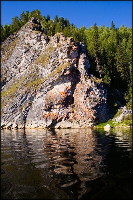
Manaraga
Such a large number of mountains of different heights, caves (which naturally exist in the mountains), rivers and lakes has become the main reason for the development of active tourism in the Urals. The arsenal of Ural (and not only Ural) tourists includes hiking routes, mountain trekking, river rafting, combined tours, ethnographic tours, as well as sport fishing and hunting.
Ecology of the Ural Mountains
The environmental issue in the Urals is very acute. initially served as a kind of storehouse for the state. Industry has always been developed here and anthropogenic pressure on nature has always been felt. Today, the most pressing problems include deforestation, the consequences of the extraction of underground minerals, dams on rivers (hydroelectric power plants), and the operation of hazardous chemical, pulp and metallurgical industries. So that readers do not get the impression of the Ural Mountains as a kind of industrial colony, we note that work is underway to improve the environment in the Urals. There are already a large number of nature reserves, parks and wildlife sanctuaries on the territory. The largest of them are: Vishera Nature Reserve, Yugyd Va National Park, Denezhkin Stone Nature Reserve, etc. In addition, with the development of the tourism business in the Urals, private fishing farms, recreation centers and recreational areas with ecological routes and trails are increasingly appearing. All this taken together allows us to hope that the ecology of the Urals will not be disturbed and will allow many, many more tourists to relax and even improve their health in the Ural Mountains.
What were the Ural Mountains called in the old days?
The correct answer to the question is STONE. To be more precise, the Big Stone. We first encounter this name in the Tale of Bygone Years. They are also called the stone belt - a literary synonym for the Ural Mountains. For example, in Evgeny Fedorov’s book Stone Belt about Ural miners.
The Ural Mountains have stood for many years and during this time they have changed several names. The Hyperborean mountains used to be called the mountains on the northern side of the Urals, the middle part had the name Rimnus, and the mountains on the southern side were called Noros. And in Rus' these beautiful places were called Stone.
Correct answer: stone
The Ural mountains stretch from north to south for more than two thousand kilometers. These mountains are quite old and already dilapidated by natural elements. In the fifteenth century, in the description of the campaign of the Muscovites under the leadership of the governor Vasily Kurbsky, mountains with the name Kamen are mentioned. In the old days, the Ural mountains were called the Stone Belt, the Belt, and simply the word Stone. This name lasted until the end of the eighteenth century.
The word stone is suitable as an answer to the question asked.
Before their conquest by people, the Russians called the Ural Mountains themselves the Stone Belt or simply the Belt or simply the Stone itself. Gradually, with the development of these mountains, a new name from the language of the Mansi people was assigned to them - Ur-ala mountain peak - initially this was the name of the northern segment of the mountain range (Polar Urals), which was studied earlier.
Answer - Stone
I remember watching a film about Yarmak. Partly, in fits and starts. But I still remember the story there, how one of the Cossacks asks permission from Tsar Ivan IV to go beyond the Stone. This is what the Ural Mountains were called back then. Another name is Stone Belt. So the answer is probably Stone.
The Urals and the Ural Mountains have more than one name, but even several; you can choose the right option only based on the number of letters. For example,
From the proposed list you can choose STONE, this will be the answer we need.
Sorry citizens, I know that the Ural Mountains were previously called Riphean(Rifean), aka Ripea, Riphean- there, according to Hippocrates, the country of Scythia is located and there is also the dwelling of the north wind Boreas:
Aristotle mentions the Rhipaean Mountains, Strabo considers them mythical (as well as the Hyperboreans), and Ptolemy - in the 2nd century AD. uh (! - by the way, much earlier!) marks them in his maps.
The word ripe is translated from Greek. flight, pressure, gust of wind, most likely due to the dwelling behind them of the wind Boreas.
But since all the words I have given contain 5 letters, take all this simply for information.)
Whatever our ancestors called the Ural Mountains, separating the European part of our country from the distant Siberian lands. In the chronicles there are the names Belt, or Belt Mountains, Earth Belt, and also Big Stone. The answer is here STONE.
Despite the fact that the crossword puzzle contains 6 letters (and this, of course, leads to the idea that the desired name is Stone), but alas, the Ural River in ancient times, before the time of the Pugachev uprising, was called Yaik, and the Ural Mountains were called Riphean. The confusion occurs because the Ural Mountains are also called the Stone Belt. But this is rather a poetic and fictional name; it relates to real toponymy very, very indirectly.
Many scientists believe that Ural Mountains one of the first to rise on our planet. Since ancient times, they were called differently, and ancient geographers divided the mountains into separate sections. So, they called the northern Urals Hyperborean mountains, southern - Noros, and the middle Urals were called Rimnus.
In ancient Rus', judging by the descriptions in the first chronicle The Tale of Bygone Years, the Ural Mountains were called the Belt Mountains, the Earth Belt and the Big Stone. In addition, the mountain ranges of the Urals were simply called: Stone.
Answer: Stone.
The Ural Mountains are a mountain system located between the West Siberian and East European plains, and represent a kind of border separating Europe from Asia. They were formed by the collision of the African and Eurasian lithospheric plates, as a result of which one of them literally crushed the other. From the point of view of geologists, these mountains arose in a complex way, as they consist of rocks of different ages and types.
With a length of more than 2000 km, the Ural Mountains form the Southern, Northern, Subpolar, Polar and Middle Urals. Because of their length, they were called the Earth Belt in the first mentions of the 11th century. Everywhere you can see crystal clear mountain streams and rivers, which then flow into larger bodies of water. The following large rivers flow there: Kama, Ural, Belaya, Chusovaya and Pechora.
The height of the Ural Mountains does not exceed 1895 meters. Thus, it is medium in level (600-800 m) and the narrowest in width of the ridge. This part is characterized by peaked and sharp shapes with steep slopes and deep valleys. The peak of Pai-Er has the greatest rise (1500 m).
The subpolar zone expands slightly and is considered the highest part of the ridge. The following peaks are located here: Mount Narodnaya (1894 m), which is the highest, Karpinsky (1795 m), Sablya (1425 m) and many other Ural mountains, the average rise of which ranges from 1300 to 1400 meters.
They are also characterized by sharp landforms and large valleys. This part is also notable for the fact that there are several glaciers here, the largest of which stretches almost 1 km in length.
In the northern part, the Ural Mountains, whose height does not exceed 600 meters, are characterized by smoothed and rounded shapes. Some of them, made of crystalline rocks, take on funny shapes under the influence of rain and wind. Closer to the south they become even lower, and in the middle part they take the form of a gentle arc, where the most significant mark (886 m) is occupied by the Kachkanar peak. The relief here is smoothed and more flat.
In the southern zone, the Ural Mountains rise noticeably, forming many parallel ridges. Among the highest points we can note (1638 m) Yamantau and (1586 m) Iremel, the rest are slightly lower (Big Sholom, Nurgush, etc.).

In addition to beautiful mountains and caves, the Urals has a very picturesque, diverse nature, as well as many other attractions. And that is why it is so attractive to many tourists. Here you can choose routes for people of different levels of training - both for beginners and for lovers of extreme travel. In addition to all other advantages, the Ural Mountains are a storehouse of minerals, which include the following: ores of copper, chromium, nickel, titanium; placers of gold, platinum, silver; deposits of coal, gas, oil; precious malachite, diamonds, yam, crystal, amethyst, etc.).
As they say, the only things better than mountains are mountains. And this is true, because their indescribable atmosphere, beauty, harmony, grandeur and clean air inspire and charge with positive, energy and vivid impressions for a long time.
To the history of the name Ural
About 600 million years ago, the Urals appeared as a tectonically calm country. Land prevailed. Shallow warm seas occupied small areas. The inhabitants of these seas were sponges, archaeoceates, and other now extinct organisms, the remains of which were preserved in sedimentary rocks.
In the Paleozoic era, active tectonic movements covered the eastern areas of the Paleo-Ural. Extended valleys (rifts), accompanied by deep faults, alternately form in different parts of this territory, as if pushing and expanding it. Volcanic activity is resuming. Volcanic belts cover vast areas. Most of the volcanoes were marine, so the products of volcanic activity (lavas, tuffs, bombs) were often mixed with sediments that accumulated in the same basins. The vast Ural paleoocean extended to the east for no less than 1500 km.
About 400 million years ago, volcanic islands were formed in this paleoocean, almost the same as today’s Kuril and Japanese islands. The remains of such an “island arc” can be observed today in the area of Magnitogorsk.
The toponymy of the Urals has long attracted the attention of scientists. Back in the 18th century. V.N. Tatishchev and P.S. Pallas tried to penetrate the secrets of the origin of the names of our region, sometimes with success, sometimes naively and helplessly.
The toponymic zoning of the Urals basically coincides with its traditional division into Northern, Middle and Southern. On the western slope of the Northern Urals the Komi toponymy dominates, on the eastern slope Mansi geographical names predominateIn the process of this work, significant differences were established between Komi and Mansi toponymy.
The Komi adopted Christianity in the 14th century, their toponymy went through many years of religious, cultural and linguistic filter, losing mainly pagan features and ancient imagery.
On the contrary, the Mansi became Christians relatively recently (18th century), while remaining pagans at heart. Hence the amazing brightness and imagery of Mansi toponyms, which contain valuable information about Mansi religion, mythology and history.
Thus, in the toponymy of various peoples of the world, mountains are named with the meaning “Old Man”. The sign of old age, antiquity, eternity of mountains in comparison with man is a semantic universal, which is also represented in Mansi toponymy, but in Mansi it has two ways of implementation.
In the first case, the semantic model “Old Man” undergoes a significant metamorphosis. The Ural range is divided into a kind of district. Each such district has its own Ner-Oika, i.e. "Old Man Ural" or "Master of the Urals", who must guard the Ural ridge and help the Mansi. Of course, he needs to make sacrifices. Moreover, one of these stone gods - at the top of Northern Sosva - was the main one, the rest obeyed him.
In another version, the antiquity of the mountains is emphasized by comparison with the events of the time of the Flood. At the same time, it turns out that the mountains are older, since the high peaks, according to beliefs, remained dry, and people and animals were saved there. During the flood, nine Mansi sought refuge on Mount Kholat-Syakhyl (“Mountain of the Dead”), but they died of hunger, hence the name.
Currently, the Mansi are reindeer herders who graze their herds on mountain pastures. It is clear that each mountain, pass, and rock received its own special designation. But what is striking: the main economic character - the deer - is almost not mentioned in toponymy, but names like Luv-Ner “Horse-Stone” and other similar oronyms are repeatedly noted. These names are associated with the horse cult characteristic of the Mansi, which reflects their former horse-breeding life, and in the past was also expressed in the sacrifice of a white or pinto horse, described in detail in pre-revolutionary ethnographic sources.
Hence the conclusion is that the Mansi, like their closest relatives the Hungarians, once lived to the south and were engaged in horse breeding, but then, under pressure from more powerful nomadic tribes, they moved north and eventually became reindeer herders. Another interesting point: many names of the rivers of the Northern Urals (Vishera, Lozva, etc.), and sometimes even the mountains, do not have Mansi etymologies. They clearly belong to some more ancient population, perhaps relatives of the modern Nenets living in the polar tundra. This also indicates that the Mansi are not aborigines, but came to the Northern Urals from other places.
In the Southern Urals we see a completely different picture. Turkic (Bashkir and Tatar) toponymy dominates here, which forms the top layer of names
The problem is created by quite numerous pre-Turkic names, approaches to “deciphering” which are seriously hampered by their processing in the Turkic environment. Meanwhile, the interpretation of pre-Turkic names can have radical consequences for the reconstruction of the linguo-ethnic map of the Southern Urals in antiquity. At one time, there is an active development and discussion of two difficult issues related to the origin of the substrate toponymy of the Southern Urals, namely the search for ancient Hungarian and Iranian toponymic relics in these places. A number of etymologies of substrate toponyms have been proposed, but in general the problem turned out to be very complex and there are no “breakthrough” studies in this area yet. However, there are quite a lot of facts, and one must hope that sooner or later the key to them will be found.
More significant are the results of studying the toponymy of the Middle Urals, which is characterized by an upper Russian-speaking layer and a fairly numerous, but very variegated and unevenly distributed pre-Russian substrate.
The Middle Urals, where the mountains are very low and the passes are sometimes, for example, near Yekaterinburg, completely invisible, did not present any obstacle for the nomads. In ancient times and in the Middle Ages it was a real passage yard. For this reason, in some places, especially in the middle part of the Trans-Urals between Tura and Iset, literally “fragments” of former toponymic systems have survived. Toponymy here is extremely difficult to research. The further north you go, the more homogeneous and transparent it is, since Russification occurred here recently.
1. Evidence has been obtained that in the northern part of the Middle Urals the Mansi replaced the ancient Khanty population. The name of the largest lake in our region - Indra - in the Tavdinsky region and such rivers as Lyalya and Ous are convincingly explained from the Khanty language. Moreover, there is reason to think that the ancient Ob-Ugric population, perhaps of the Khanty type, once (before the Turks) lived further to the south - between Tura and Pyshma. In any case, such names as Neiva, Pyshma, Tagil and some others are best explained from the Khanty language.
2. A powerful wedge of Komi names has been identified, running from the Ural Range to the east. Its base is a conditional line that connects the sources of the South Sosva and Neiva, and the tip is directed to the confluence of Nitsa and Tura. These names (Kosva, Lobva, Sosva, Yasva, etc.) are distributed mainly in the same territory as Russian toponyms, formed from the name of the Zyryan people, as the Russians used to call the Komi (Zyryanka, Zyryansky, etc.) .
Initially, it was believed that both of them, starting from the time of Ermak, were spread by the Komi-Zyryan guides of the Russian warriors, but, more likely, this remarkable wedge was formed as a result of the resettlement of various Komi groups along with the Russians during the development of the Urals.
At the same time, it turned out that some names derived from the ethnonym Zyrjainen (from the Finnish syrjainen - “extreme”) may be associated not with the Komi, but with another people who lived along the Ustya River in the Northern Dvina basin - the mysterious Zyrya, whose name was moved to the 16th - 17th centuries. on the northern Komi (Permyaks or Permians of Russian chronicles). Who these Dvina Zyryans were has not yet been definitively established, perhaps they were relatives of the Volga Meryans or some branch of Chudi Zavolochskaya. One way or another, over time they were captured by the Russian resettlement movement, ended up in the Trans-Urals and became Russified.
Therefore, even today in the Russian North the river is called Ustya, the inhabitants of now Russian villages on the banks are called Zyr, a dense swampy forest is Lagmas, and in the Pyshminsky district of the Sverdlovsk region the village is called Ustyanka, another is Zyrany, there is also the Lagmas tract, although no one is knows what this word means.
It follows that the migration flow of the 17th - 18th centuries. captured not only Russians, but also some Finno-Ugric peoples who were at one or another stage of Russification. This allows us to understand how, among the purely Russian names of settlements like Ivanovka or Lipovka, names like Karely or Cheremisskoye appeared.
3. At present, it is possible to quite accurately designate the area of Turkic substrate toponymy in the territory of the Middle Urals, primarily Tatar, the northern border of distribution of which goes approximately from Shamar to Nizhny Tagil, then to Kushva, Verkhoturye and further along Tura, i.e. in some places it intersects with the southern border of the former Mansi area. There are many Turkic names in the vicinity of Yekaterinburg (Shartash, Bilimbay, etc.). But not all of them are actually Tatar. In the east of the Sverdlovsk region, the West Siberian-Tatar toponymy with its characteristic clatter certainly prevails (the ancient name of the village of Chubarovskoye in the Irbitsky region was Tsubartura in the Kazan-Tatar Chubartura - “Motley City”).
In the south of the region and in the vicinity of Yekaterinburg, a prominent place belongs to Bashkir names, which, however, are not easy to distinguish from Tatar ones. Finally, traces of the presence of the Volga Bulgarians were discovered in the Cis-Urals - energetic entrepreneurs and traders of their time, whose state was destroyed by the Mongols in the 13th century. The Volga Bulgarians are a special branch of the Turks; the modern Chuvash are considered their relatives. Indicative, in particular, is the nest of river names in the Bisert basin to the west of Druzhinino - Baryshan, Kirgishan, Chikishan, in the repeating part of which the Chuvash sana - “sleeve”, Volga-Bulgarian shan - “sleeve”, “channel”, “tributary” are recognized. .
A. K. Matveev
TOPONYMY OF THE URAL AS A MONUMENT OF LANGUAGE AND HISTORY
(News of the Ural State University.
- Ekaterinburg, 2001. - No. 19.)
In Bashkir mythology, the most powerful hero is the Ural Batyr. Once, in a fierce battle with the azhda dragon, he extracted living water from the spring of immortality. He could drink it himself to gain eternal life. But Ural Batyr sprinkled this water around, granting immortality to nature. And when he died, people built a high mound over his grave, from which the Ural Mountains were formed.
The batyr, the ancient legend continues, had many beautiful sons and daughters. The eldest daughter took after her father - courageous, strong, strong-willed. The Ural Batyr named her Idel and, when the time came, married her to the foreign batyr Valdai.
In the old days, Turkic-speaking peoples called the Volga Idel. Let me ask the reader, what does the Volga have to do with the Urals? Every schoolchild knows where it flows today, where its beginning and end are. But not everyone will believe that once the source of the Volga was really located on the slopes of the Urals, only at the Zhigulevsky Gate the ancient bed of the great river approximately coincided with the current one. The version about the Ural origin of the Volga is confirmed by modern geological research.
Ural-Batyr kept his youngest, most beloved daughter, Agidel, with him. Trusting and simple, a spoiled girl and a minx - the light-eyed Agidel was his joy and consolation. She remained to live in her father’s house, behind the long wall of the Ural-Tau ridge. Living water from the spring of immortality has mixed with her water, and the river runs, flows, splashes, remaining as bright-eyed and young as it was thousands of years ago. And its upper reaches - magnificent royal palaces erected by nature - attract tourists from all over the country. “Ural-batyr” (Bashk. Ural batyr) is a Bashkir folk epic.
The Belaya River was named so for a reason - the water in it is very light, which is especially noticeable when it flows into the Kama. Here it does not immediately mix with the darker, yellowish-brown water of the Kama. At a distance of several hundred meters, two rivers flow in streams of different colors in the same channel.
Previously, on ancient maps, the Volga was drawn not as it is now, but along the bed of the Kama and further along the Belaya. Perhaps there were geographical misconceptions of that time, or perhaps there were some reasons for this.
.

(clickable)
***
The Urals were finally annexed to Muscovite Rus' in the 16th century (but were developed earlier), South Ural Bashkiria even later.
The Turks call the mountains Tau, and the Mansi call them Ner. The Russians who came to the Urals had a tendency to name the mountainous country in their own way; they called the Urals - Stone. Until the 18th century, “to go to Siberia” for Russians sounded like “to go beyond the Stone.” The competition between two toponyms (Kamen and Ural) ended with the victory of the latter.
.