Safe rafting on the Kuban River. Rafting on the Bolshoi Zelenchuk, Kuban, Aksaut rivers
Tour schedule
First day
The route starts in the village of Khurzuk. Tourists get acquainted and set up camp. After a detailed description of the route and instructions - dinner and overnight.
Second day
Start of the rafting. Together with an instructor, tourists practice their technique and learn how to dock correctly. Lunch - on land. Second overnight stay in the Ammonite Canyon area.
Third day
Passing the rapids of the Ammonite Canyon. Here rafters face rapids of the fourth category of difficulty, after which the difficulty of the route decreases. Passing through the Kamennomostsky canyon is the first, second and third difficulty of the route.
After passing Kamennomostsky, the rafts are carried overland through the Zhelob rapid, which has the fifth category of difficulty and is intended to be overcome only by professional rafters. After the rafts are launched again, tourists will find rapids of the second and third categories of difficulty.
In the evening of the third day, the route ends in the village of Zavetnoye, from where the rafters are delivered to their transport.
Advantages of rafting on the Kuban River
- Professional instructors. The rafting is carried out by professional athletes, including the vice-president of the Adygea Rafting Federation. Before the start, a comprehensive briefing is provided. During the entire rafting, the instructor supervises the rafters.
- Issuance of equipment. The price includes the rental price of equipment for rafting and overnight stay: protective helmets with a mount for an action camera, special shoes, life jackets and wetsuits. For overnight stays - pots, tents and sleeping bags.
- Safety. The entire rafting route along the Kuban River has been explored and studied by instructors. During the entire route, they control the rafting, being directly on board the rafts.
- Positive emotions. The rafting route passes through picturesque places; the very process of passing rapids and spending the night in the open air will give you positive emotions and unforgettable impressions.
- Affordable prices. The cost of a three-day rafting trip with the provision of rafts, equipment and the services of professional instructors will pleasantly surprise you.
About the route
The rafting route on the Kuban River is available from mid-May to the end of October. The route passes through a narrow valley covered with mixed forest. The rapids on the route are rocky areas, heaps of boulders and meter-high shafts.
The most serious obstacle on the route is the Aman Hit Canyon. Here in the riverbed there are a lot of rock fragments and large boulders, steep drop-offs and foam pits between the stones. The last section of the canyon will give you the greatest amount of emotion and drive - here the river accelerates and leaves little time for maneuvering between large fragments of rocks. This section of the route is characterized by high waves of water with tilting peaks. Before passing this section, preliminary reconnaissance of the rapids is mandatory.
Following the canyon is a section of the route with rapids of the first, second and third levels of difficulty - the Kamennomostsky rapid. The route in this section consists almost entirely of rocky rifts and steeply sloping sections with overwater rocks. In these places, the shafts in the rifts reach one and a half meters. The Upper Kamennomostsky threshold is a short and steep drop in the riverbed, with a large number of pitfalls. Because of the stones, foam forms, which makes it difficult to see the flow.
At the end of this section is the rapid Zhelob, which is too difficult for tourists to overcome, since it is a narrow passage between rocks and an almost uniform fall of the river from a height of six meters over a distance of seventy meters. This threshold is bypassed by land.
After this, the rafting route along the Kuban River dives into a bare, treeless valley. The riverbed is rocky and replete with long rifts. The river becomes more powerful and full-flowing.
The next section of the path passes through the sharp bends of the riverbed, over which sandstone canopies hang. The rapids in this area are of artificial origin. This is the Pechka threshold - a huge stove demolished into the water, a former dam and the Reinforcing threshold - the remains of a washed away section of the railway track.
The last section of the path is calm, with rapids of the first or second level of difficulty, and rare rifts. The river is divided into several branches, in which there is a mass of demolished trees and rhizomes. Beyond the final point of the route, the Kuban overflows widely, turning into a reservoir blocked by a dam.
Considering that the rafting is carried out under the supervision of experienced rafter instructors, the rafting route along the Kuban River does not pose a danger to tourists.
Tourist rafting on the Kuban River and all its tributaries is possible from March to November. It is not recommended to go at other times of the year. Since Kuban is lower than Krasnodar, the Krasnodar reservoir and the Protoka River are navigable, water tourists traveling along the route must know the Rules of navigation on the inland waters of the Russian Federation and the navigation situation in this area. Good transport accessibility creates favorable conditions for choosing a route. The main dangers during rafting are rubble and snags, sharp stones and industrial waste. The possibility of a coup cannot be ruled out. Therefore, every participant in a water trip must have a life jacket.
We offer brief descriptions of some non-category hikes and 1 c.s. along the Kuban and its tributaries.
100 km - Achuevo, 120 kmIn addition to these routes, we can offer boat or kayak route “Along the Azov Coast” for lovers of water tourism.
(described in the book by K.A. Gorshenev “Travels in the Krasnodar Territory”).Route thread: Temryuk - Achuevo village - Primorsko-Akhtarsk - Kamyshevatskaya station - Dolzhanskaya station - Yeysk.
During the trip, tourists will see active mud volcanoes, reed "jungles", an Indian lotus plantation, Lake Khanskoye with healing mud, hydrogen sulfide springs, and get acquainted with the Azov cities.
The journey from Temryuk to Primorsko-Akhtarsk takes 4-5 days, then to Yeysk another 3-4 days. There are many convenient parking places along the route; the floodplains and estuaries are rich in fish and game. The fauna is represented by migratory ducks, gulls, bitterns, gray herons, pelicans, cormorants, and hoopoes. Due to the lack of firewood, it is better to take with you either a primus or gas burners.
Among the rivers of the Black Sea basin, water athletes give preference to the Mzymta and Shakhe rivers. Some Sochi routes use rafts for commercial rafting - vessels that came from the West and look like our catamarans.
Water sports trip through the Caucasus 3 KS, rafting on the Bolsho Zelenchuk, Kuban and Aksaut rivers. The hike took place in the summer of 2017. The goal of the trip is to ride new rivers, gain experience in passing the technically difficult Caucasian rapids, including slalom skills during difficult maneuvering. During the hike, all three rivers had very high water levels. The trip was not without an emergency, and was marked by an overkill in front of the “Pushka” rapids on the Bolshoy Zelenchuk River, as well as a massive overkill of catamarans in the “Amankhyt” rapids on the Kuban River.
Rafting on the Bolshoi Zelenchuk River
Rafting on the Bolshoy Zelenchuk River is an active and exciting event. The river originates high in the mountains of the North Caucasus, above the village of Arkhyz. The length of the river is more than 100 km, most of which is stormy and rapids. The rapids here are up to 4 KS (the “Cannon” rapid, “The Fourth Explosive”), and they are difficult at any water level. When the water level drops, rocks and boulders appear and tacking becomes more difficult. As the water level rises, huge foam boilers are formed, the height of the shafts increases to 2 meters or more.Rafting on the Bolshoy Zelenchuk River is distinguished by a variety of obstacles, rapids and surrounding views. The situation is constantly and rapidly changing. The river valley expands and then narrows into canyons. Rafting is possible on catamarans, rafts, kayaks, and kayaks. Most rapids can be viewed from the shore and enclosed.
Our group of 10 people took almost two days to reach the river. We arrived at night, set up camp in complete darkness and in the rain, quickly ate and rested. We were sure that we were standing on the threshold of “Cannon”. Due to constant rains, the water in the river rose very high, 1.5-2 meters above normal. For this reason, local Arkhyz guys who take people on raft rides have temporarily suspended their business.
In the morning, for rolling out, we decided to first go through the lower section of the river and only then throw it into the upper reaches. Thinking that we were starting from the “Cannon”, we started in front of the “Fourth Explosive” rapids, which, it should be noted, was also quite difficult. Having entered it like that on the fly, without warming up, I immediately strained my right shoulder, since I had to row very hard there. One kayaker shot back, then brewed a cat-four in a large barrel. The basin was eventually caught only a few kilometers later on the shallows.
Having passed the lower section, many had enough adrenaline and extreme excitement, but the most desperate ones decided immediately after that to rush into the upper reaches and cross the river again from beginning to end. Which was done by two crews of twos. On the way to Arkhyz, we realized that we were not standing on the “Cannon”, and that the most difficult threshold was still ahead. As a result, starting from Arkhyz, we walked the entire upper section to the “Cannon”, understood and experienced to the full what big water is like while rafting on the Bolshoy Zelenchuk River! The shafts are so high that you can’t always reach the water with an oar. punch with such force that the oar bent and the veins cracked. There were several pressures where we had to pull ourselves up a lot, the culmination of which was, of course, the “Cannon”, where several times the oar on the shaft simply did not reach the water. After that, the lower section was passed for the second time. walk. This is what it means - everything is learned by comparison.
Overkill and saved. work on water
After overkilling the catamaran-four at the entrance to the “Pushka” rapid, two participants had to go by self-rafting for more than a kilometer, after which they were carried out to a small island in the shallows, littered with driftwood. One participant had to be rescued from under the rubble, where he was pulled by the current. The severe stress experienced did not allow us to continue the rafting and people had to be transported to shore using a rope.
Rafting on the Kuban River
Rafting on the Kuban River can serve as a good warm-up before rafting on the more difficult rivers of the Caucasus. The rapids on the Kuban River are local; between them, on the fast current, there are places that require attention, but in general there is nothing serious that would require inspection and would not be taken from the water. One of the most interesting and natural obstacles on the river is the Amankhyt rapids 3-4 KS. The rapid is characterized by the need to maneuver between boulders in the riverbed, contains high drains, several strong barrels, high shafts, especially difficult in deep water.
Rafting on the Aksaut River
Having moved to the Aksaut River, we had a day out. The previous few days of rafting, eventful and adrenaline-filled, had left their mark on both the internal state and the equipment, and everything had to be put in order before the rafting along Aksaut. During the day, everyone minded their own business, but I tried to catch fish with a fishing rod. It is worth saying that before this I had never fished in the Caucasus. Before the trip, I tried to find out the preferences of the local trout, they mostly write that they catch on insects, but I took the usual spinning rod with medium-sized baits, spinners and spinners with a narrow blade. I walked along the river for an hour and a half, but without success. Afterwards there was a walking excursion to one of the waterfalls, hidden deep in a gorge overgrown with all kinds of vegetation. In the evening there was lamb pilaf and a bathhouse.Rafting on the Aksaut River is particularly difficult. The river as a whole is not wide, with a large number of pitfalls, sloughs in the riverbed, and boulders along the banks. At the same time, Aksaut has a sharp drop, up to a 10 m drop in height per 100 m of the river, the current here is very strong. In addition to stones, in the riverbed there are pressure points, combs of overhanging trees, tree trunks fallen into the water, rubble in narrow places - all these obstacles need to be seen and avoided. You must not let go of the oar even for a moment, constantly monitoring the stroke. Tacking is very difficult; in an instant you can run into a stone and turn over. Going by self-rafting Aksaut is extremely undesirable. You can crawl out onto the shore blue from head to toe from hitting the rocks.
We rafted along Aksaut from the village of Krasny Karachay, above the bridge. The water level was high due to rains, which made the speed and power of the water even greater than usual. We had to maneuver left and right, constantly turning around rocks. We tried to pass the river carefully, avoiding, if possible, those obstacles that could have been jumped. Rafting along the Aksaut is an invaluable experience, here you have to use the entire arsenal of the waterman, all possible running and control strokes, pins, braces, and you have to actively work with your body. That is why I choose experienced teams for rafting on the Aksaut River to train before going on the most difficult and dangerous rivers of the Caucasus.
Fin. help the channel
Photos


When rafting along the route and passing obstacles, a navigation guide was used (clause 11 of the report), the water level corresponded to the navigation guide. Detailed description of thresholds in paragraph 1.3.
Days 1-2 (30.04-01.05). Cunt.
On Friday evening we boarded the train and went; the journey took a long time, more than a day. On Saturday afternoon, minor equipment repairs, beer, etc.
Day 3 (02.05). Casting, slipway.
02:00. We got off the train in Nevinnomysk. A pre-ordered bus and a truck for backpacks were already waiting for us (the delivery was joint with other departments of the school, 39 people). In theory, it was necessary to stop by Cherkessk and put a stamp on the list of the group at the local border detachment. However, after listening to the stories of neighboring groups and analyzing the situation, we decided not to go there and not to put a seal. The stories boiled down to the fact that we would have to wait until 2-3 o’clock in the afternoon, and then we would have to drive another 5 hours. All this could have resulted in a loss of time per day, and we decided not to go to the border detachment.
02:30. We left the railway station by bus and truck. We drove without incident, the police did not bother us along the way. On the way (in the morning) we looked through some sections of the river.
07:30. We arrived at the slipway site, 1 km below the confluence of the Uchkulan and Ullu-Kam rivers (just below the village of Uchkulan), between the 46th and 45th km. We stopped 1 km below.
08:50. Breakfast, then the slipway.
13:00. Lunch. A local police officer (with his colleagues) arrived, greeted us and said that we should have stopped in Uchkulan and checked in with him, but he didn’t need the seal of the Cherkessk border post (we didn’t have one) at all. We didn’t go to the local police officer. It worked out.
14:00. After lunch, part of the group (those who had left the group by this time) went to the radial trail to Mount El-Bashi. The goal is to reach the snowfield.
16:50. Only two continued the path to the snowfield (Mulach and Kochetkov), the rest turned back.
19:15. The guys returned from the snowfield and brought a bottle of snow.
19:30. Dinner. A bottle of snow (cold and clean water) came in handy.
23:00. We started to disperse to the tents.
Day 4 (03.05). Alloy.
07:30. Wake up, breakfast.
08:30. Start of getting ready.
10:00 - 11:00. Classes according to the school plan: practicing crossing the river (seriously, with a safety net with two carrots, etc.)
12:00. Lunch and end of preparations.
13:30. We swam.
13:45 “Scout” dived into a small threshold. Caught, move on
14:30. We passed the bridge. We stood at the bridge for 5 minutes.
15:00 Passed the suspension bridge.
15:13. We started in front of the bridge in a. Kart-Dzhurt. We looked through the shaver.
15:35. It went well.
15:50. Suspension bridge.
16:00 - 16:10. Smoke break with a hook on the shallows on the right.
16:15 - 16:20. Pouring stones between concrete walls in front of the bridge. Just below Elbrus. We walked along the LB.
16:35. We stopped on the right bank, below a mine or mines (such dilapidated houses) for the night.
20:00. Dinner. After dinner, two local guys came to visit. In general, the guys turned out to be normal, talked until 2 am, then stayed on duty.
Day 5 (04.05). Slav.
08:00. Wake up, breakfast.
11:00. We left.
11:40 We passed the bridge.
11:45. We started. They were mistaken, they thought the Dautskaya shevera, but it turned out they were not.
12:15. We approached the Dautskaya shever. We stood on the PB, on a rocky shallow in front of the bridge. We looked through the shever.
12:55 We started our passage: catamarans, scouts, kayaks. We took pictures.
13:45. We stood on the left bank on the “shelf”. On the opposite bank, 2 kilometers away, there are Narzan springs. The weather is deteriorating and it has started to rain. There's plenty of firewood. Some particularly violent ones went for narzan, then changed their minds and returned. The people from the neighboring department decided to go to victory. We observed the return of these people at half past seven in the evening. We understood that the “man exhausted by Narzan” is a man who walked for 4 hours in the rain and through mud to the Narzan spring.
Day 6 (05.05). Alloy.
07:40. Wake up, breakfast.
10:05. We left.
10:15. We got up to view the 2nd explosive rapids on the right bank. The threshold has been washed away! Well, not exactly, but the passage has become easier.
10:45. We passed what was left of the threshold and took a couple of pictures.
11:25. Halt.
12:00. We approached Amankhit. A landmark that was not referred to by any of the studied directions: in front of the threshold at the top of the ridge on the left bank, a support for the main power line is visible. If it occurs, it is better to moor on the right bank and go look for a place to portage
12:00 - 13:30. View the threshold.
13:30. We got up for lunch.
15:00. We started passing the rapids. The canoe decided not to go. Tactics for passing the 1st and 3rd stages: 2 catamarans pass on mutual belay and get on the belay after the stage, then the 3rd catamaran passes and also gets on the belay, then the scout and kayaks pass. Tactics for passing the 2nd stage: the crews of the scout, kayaks and canoes organize belaying with carrots from the shore and photography, pass the catamarans and get into active belaying, then the scout and kayaks go. Life made its own adjustments: at the second stage, the third cat with Alexei Dugin and Andrei Ragozin. got hit by a “comb” on the PB behind the second stage. As a result: Andrey floated down on a self-rafting vessel, followed by two catamarans (one from ours and one from a neighboring department), and Alexey remained with the catamaran on the rock behind the “comb”. However, Andrey himself quickly got ashore and returned to his boat. The left katas stood up for belay before the third stage. There were no more emergencies at this threshold.
17:05 We stopped for the night right outside the door, on the LB shelf.
24:00. Calmed down and fell asleep.
Day 7 (06.05). Day, classes...
08:15. Wake up, breakfast.
09:35. Classes according to the school plan: organizing belay and passing obstacles at the base of the Amankhit threshold. We crossed to the right bank and walked around the threshold along the highway.
10:40. We started re-passing the Amankhit rapids.
11:50. Everything went well.
12:00 - 13:20. Kayaking near the camp
13:50 Lunch. After lunch, one part of the group slept, and the other went into a small radial to the peak under which we stood. There is a good path leading there, so the climb did not take long, about 45 minutes. From the top there is a beautiful view of almost the entire Amankhit rapids.
18:00. Everyone gathered in the camp. Global idleness has begun... well...
19:30. Dinner.
24:00. Fall asleep.
Day 8 (07.05). Alloy.
07:00. Wake up, breakfast.
09:10. We left.
10:10. We approached the “1st Kamenomostsky” threshold. Viewed. We decided to change the passage tactics and the composition of the ships’ crews. Carry all the things, the canoe and the 1st catamaran, from which 2 knits flew after Amankhit. The kayakers decided to start from the middle of the rapid with a PB. As a result, the reinforced crews of the 2nd (Fedorov and Kharkov) and 3rd (Dugin and Medvedev) catamarans and a regular scout passed the threshold.
12:00. Started the walkthrough. The 1st catamaran and carrots are on belay. The rolls were successful, the Scout capsized almost at the exit of the rapids, and was quickly rescued.
12:30. We approached the Trench (2nd Kamennomostsky). We looked. They decided to go through the rapids with reinforced crews: 2nd (Fedorov and Kharkov) and 3rd (Dugin and Medvedev) catamarans. Moreover, they decided to go without unloading the catamarans. We insured from below the threshold with all the surrounded ships.
13:40. We've passed the "Gutter". The threshold looks scary, but in fact it's special effects. Technically, the passage is not difficult, you just need to constantly keep the ship in the center of the rapid. We stopped for lunch under the “Trench”.
15:10. We left. Special mention must be made about the next section of the path. It seemed that all the nominal obstacles were over, and we had to swim 30 km. section to the village of Krasnogorskaya, where transport was ordered the next day. In general, this section did not particularly allow one to relax: there were clamps, shafts, and sometimes barrels on the turns. We saw how one of the four from the neighboring, Ryazan, group was held in a pin for about 2 minutes. Plus, the population was not very friendly: a couple of times they threw stones of quite good size from the cliffs.
18:30. We arrived at the anti-slip site, on the LB immediately behind the bridge in Krasnogorskaya, and began to anti-slip.
20:20. A local police officer arrived and said that all sorts of scumbags might come to visit and, just in case, he left his mobile number. We decided to take turns on duty until the morning.
Day 9 (08.05). Throwaway.
07:00. Wake up, (who slept), breakfast. Let's get ready and pack.
11:15. Our transport arrived, we loaded up and drove off.
14:30. We are in Nevinnomyssk, at the station. 6 hours to train. We went to the bathhouse, to the market, etc.
20:15. We boarded the train and went home.
Days 10-11 (09.05-10.05). Train.
We traveled on the train for more than a day and arrived in Moscow on May 10 at 5:30 am. This is where the hike ended.
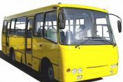
Attention! We provide transportation services for the organization of water trips and rafting along the Kuban, Aksaut, and Teberda rivers in Karachay-Cherkessia. You can order our transport - one or two Gazelle buses for multi-day river trips.
The Gazelle bus is a transport that is well suited for transporting inflatable rafts or kayaks.
Remember! How your entire journey will go depends on how transport support is prepared!
Water hikes and rafting are often held on the mountain rivers Kuban, Aksaut, and Teberda. This is another series of river arteries of the Republic of Karachay-Cherkessia, which have long been chosen by lovers of water tourism. If you are still wondering how best to get to them, then think about...
You can order minibuses from us to accompany and transport groups along rivers from Armavir, Krasnodar, Nevinnomyssk:
Or maybe you should order a Gazelle bus from us for pick-up or transfer directly from the station to them? After all, for this you may need to get to the mountain villages of Krasny Karachay, Khurzuk, Uchkulan in the Karachaevsk area. We also use some of these destinations to provide transport services to mountain tourism lovers:
Drop off, transfers to Uchkulan, Khurzuk from Armavir, (Nevinnomyssk).
Please, regarding transportation to the rivers of Karachay-Cherkessia: Kuban, Aksaut, Teberda, please contact us in advance if possible!
A brief description of the routes of water trips, rafting on the rivers Kuban, Aksaut, Teberda.
The Republic of Karachay-Cherkessia is one of the places in our country where nature has remained the same as it was created over thousands of years. The high mountain river valleys of local mountain rivers have preserved an amazing diversity of flora and fauna. Water hikes and rafting along local mountain rivers on rafts, kayaks, (kayaks) are a great way to see the local nature and get a dose of adrenaline.
Water trips, rafting on the Teberda River in Karachay-Cherkessia. When organizing and conducting a water trip or rafting trip, it is difficult to do without additional transport services. You can contact us and arrange a transfer to the rivers of Karachay-Cherkessia: Kuban, Teberda, Aksaut! Along the route, starting from the right tributary of the Shumka River and to the city of Teberda, there are many shallow rocky areas. Then the river breaks up into small components. Therefore, from this place to the bridge on which cars drive in front of the mouth of the Jamagat River, it is better to inspect the area before rafting. It is approximately about 2 km. About 1 km downstream of the Teberda from the mouth of the Dzhamagat you will encounter the Morenny rapids. In the process of rafting to it, you will have to overcome a number of water areas with pitfalls and large boulders. Along the entire route of the water trip along Teberda, including further, you will encounter shivers. Attention! 3 km below the village of Verkhnyaya Teberda, the rafting or hike will need to be interrupted and the means of transportation on the water must be transferred on foot. You will come across a low suspension bridge. (The distance to the water is about half a meter). Below the village of Nizhnyaya Teberda we continue rafting. The next 2 km the river again spreads over a large area and varies around the trees felled in its bed. A more complex and interesting segment begins. The Teberda River here has a small width and high speed. This means that you need to be prepared for quick maneuvers. Next to the village of Novaya Teberda you will come across a suspension bridge. (Distance from water 1 meter). Further 1 km there is a series of channels, even further there is a threshold with sharp overflows through pitfalls. Then a bridge, behind which is a dam. In this place on the river there is a drain 2-5 m high. It is recommended to view this entire section before rafting. In general, the last 7 km of rafting are characterized by various obstacles. Downstream there will be a couple more bridges, after which we will exit to clean Teberda. The Teberda River beyond Karachaevsk flows into the Kuban River.
Water trips, rafting on the Aksaut River often they start with a drop off to the village of Krasny Karachay, sometimes Aksaut. The length of the route by water is about 75 km; the rafting time can take up to 5 days. The distance from the village of Zelenchukskaya to the village of Krasny Karachay is 54 km. The Aksaut River originates on the Aksaut glacier. Near the village the river flows in a wide channel, where it is divided into small branches. After a couple of kilometers they will unite into one. At the same time, the width of Aksaut will be around 10 to 15 meters. Here there is a rapid of up to 400 meters, which will end with a one and a half meter drain. A little further on the bridge, beyond which Aksaut will widen again for several kilometers. Next, after the narrowing, there will be a 2nd threshold. A hundred meters downstream you will pass a canyon for 2 km. From here it is about 700 meters to a sharply falling river. Now, for 1 km and up to the bridge across the river, the main thing is a series of difficult rapids. It is better to study the last eight-kilometer section of the hike on site in advance. Here, from the mouth of the Khalega River, the difference in height is approximately 18 meters per kilometer. From the bridge, calmer water will begin, along which you can raft almost to the dairy farm, which is 3-4 km further than the village of Krasny Karachay. Then the slope on Aksaut increases and during the rafting process you will encounter a number of difficult rapids. 7 km downstream from Krasny Karachay, Aksaut from the road will cross to the opposite side, where you can expect quite difficult rapids. A couple of hundred meters below the bridge there is one up to 2 km long, followed by a second. There are large boulders at this place. At this point the river narrows greatly and enters a narrow canyon up to 300 meters long. After leaving the canyon, raft along long stretches of rapids. in this area of the river there is a good opportunity to moor to the shore. On the approach to the village of Khasaut-Grecheskoe, water tourists will be greeted by the next “steep” threshold. Now Aksaut is blocked by boulders along almost its entire width. Beyond the forestry area, the river splits into smaller channels and further passage is only possible through large waters. In this regard, rafting or water trips on the Aksaut River often end in Khasaut-Grechesky.
Water trips, rafting on the Kuban River. The route most often begins with a stop at 49 km of the Karachaevsk-Uchkulan highway. at this place the rivers Uchkulan and Ullu-Kam join together. Starting from the village of Uchkulan, rafting along the Kuban River will take place through a narrow gorge. There are a lot of suspension bridges in this place, so you need to be more careful. Beyond the village of Elbrus, Kuban is even narrower, and in addition, rapids will begin. Beyond the place where the Khudee River flows into the Kuban, the water will encounter rapids with meter-high stones. There is a difficult roll on the way to the Red Bridge. A couple of kilometers further, at the suspension bridge, you will encounter a threshold that needs to be approached with the greatest attention. And not reaching 14 km to the city of Karachaevsk, the Aman-Hit canyon (Aman-Nykhyt) will await you. Its length is about 1500 meters. Perhaps this is the most dangerous section of the route during the entire water trip (rafting) on the Kuban River. Large stones and rock fragments in the water create foam pits and sharp drains in Kuban. Then follows an equally difficult section from road pillar 36/13 of the Uchkulan-Karachaevsk highway. There are many stone boulders in the riverbed here, which requires careful study of the area. Then to the village of Kamennomostsky there is an alternation of shivers with encountered stones for more than a meter. Further, on the approach to Kamennomostsky, the river decreases in width. The next obstacle during the rafting is the so-called “Verkhne Kamennomostsky”. As you approach, you will see a building with a pipe on the right half a kilometer before the object. Be sure to stop and look around. A twenty-five meter rapid with a sharp drop of water, under which there are many stones. We raft for another kilometer and on our way we reach the Zhelob rapids. The threshold represents a 6 meter difference in height over a length of 70 meters. It is better not to go on kayaks and kayaks here, the only way to pass on rafts is on the left side, there are metal structures in the water on the right! After 2 km we pass the Pechka rapids, not swimming 1 km to the station. Krasnogorskaya. The Pechka Rapid is a large stove in the river that you need to dodge. Next, normal rafting to the village of Vazhnoe Kuban, where a reservoir is formed in front of the power plant on the approach to the city of Ust-Dzheguta. Then, all the way downstream to Cherkessk there are shallow areas.
The water trip along the Kuban River can be extended by 10 km due to a section on the Ullu-Kam River. Ullu-Kam belongs to the source of the Kuban and up to the tributary of Ullu-Khurzuk it has a uniform and fast flow; along the way there are only riffles below 1 km from the mouth of Ullu-Kam. The only exception is a twenty-meter drop with a large number of pitfalls. Its length is up to 7 km. Before rafting, preliminary study is required!
- Back
- Forward
They called the other day. Minibus services Gazelle from Nevinnomyssk and Armavir on average from 4 thousand rubles per day. There is no point in looking for something cheaper - drivers without any experience are also not interested. The discussion was about servicing rafting on the Aksaut, Teberda and Kuban rivers. There was an idea to shout out to the local UAZs in Arkhyz, the village of Zelenchukskaya, and so on. But later my friend came to his senses. There they have 1 - 2 hour excursions around the local area from 3 thousand rubles for a minibus starts. In addition, there is a lot of tension between them and the Gazelles. And the UAZ “Loaf” is both smaller in capacity and worse in terms of amenities.